Jack Mountain Topo Map Maine
To zoom in, hover over the map of Jack Mountain
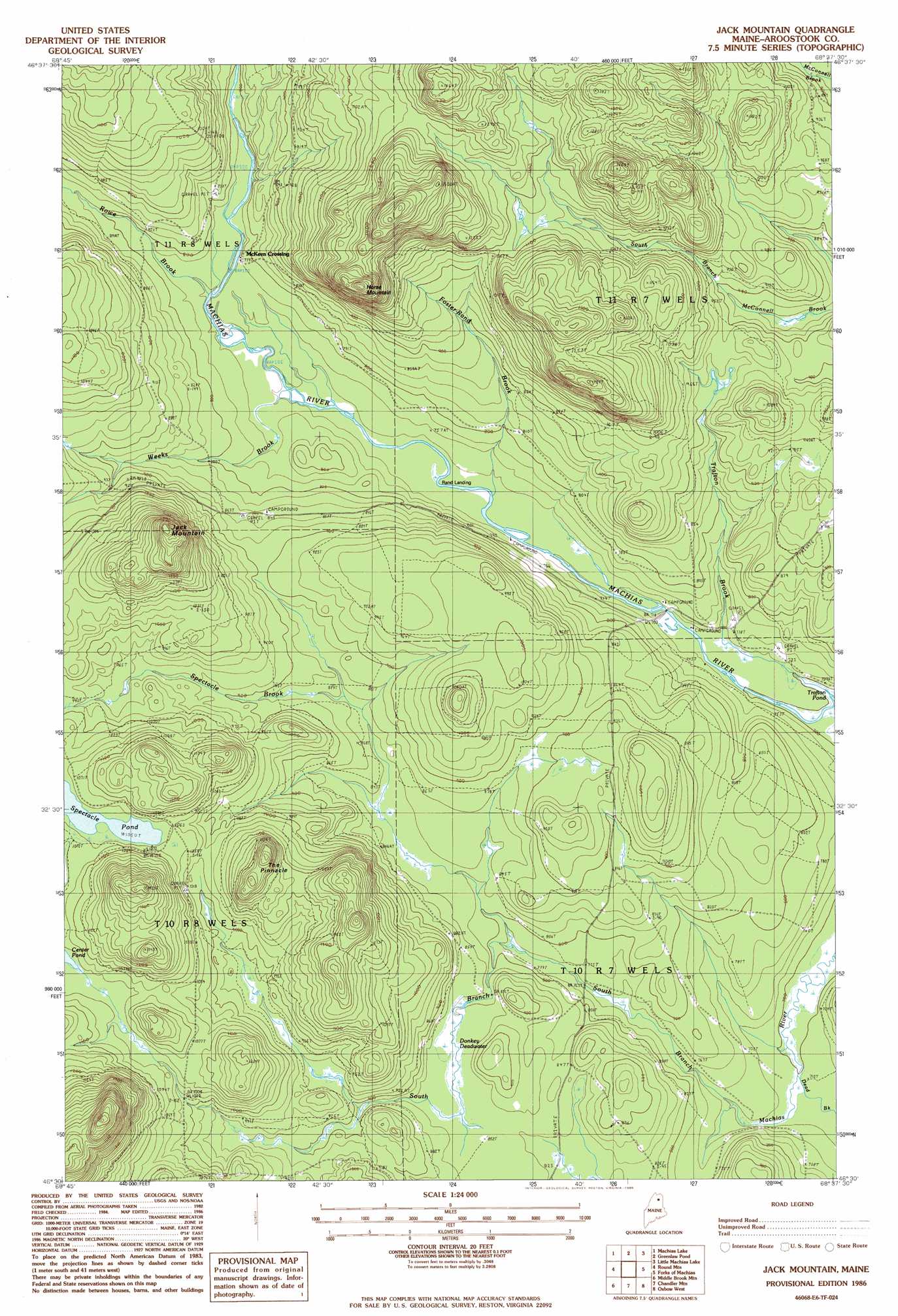
USGS Topo Quad 46068e6 - 1:24,000 scale
| Topo Map Name: | Jack Mountain |
| USGS Topo Quad ID: | 46068e6 |
| Print Size: | ca. 21 1/4" wide x 27" high |
| Southeast Coordinates: | 46.5° N latitude / 68.625° W longitude |
| Map Center Coordinates: | 46.5625° N latitude / 68.6875° W longitude |
| U.S. State: | ME |
| Filename: | o46068e6.jpg |
| Download Map JPG Image: | Jack Mountain topo map 1:24,000 scale |
| Map Type: | Topographic |
| Topo Series: | 7.5´ |
| Map Scale: | 1:24,000 |
| Source of Map Images: | United States Geological Survey (USGS) |
| Alternate Map Versions: |
Greenlaw SW ME 1975, updated 1981 Download PDF Buy paper map Jack Mountain ME 1986, updated 1986 Download PDF Buy paper map Jack Mountain ME 2011 Download PDF Buy paper map Jack Mountain ME 2014 Download PDF Buy paper map |
1:24,000 Topo Quads surrounding Jack Mountain
Fish River Lake Sw |
Fish River Lake |
Carr Pond |
Portage Lake West |
Portage Lake East |
Farrar Pond |
Big Machias Lake |
Greenlaw Pond |
Little Machias Lake |
Ashland |
Mooseleuk Lake |
Round Mountain |
Jack Mountain |
Forks Of Machias |
Squa Pan |
Mooseleuk Mountain |
Middle Brook Mountain |
Chandler Mountain |
Oxbow West |
Oxbow East |
Millinocket Lake West |
Millinocket Lake East |
Grand Lake Seboeis |
La Pomkeag Lake |
Umcolcus Lake |
> Back to 46068e1 at 1:100,000 scale
> Back to 46068a1 at 1:250,000 scale
> Back to U.S. Topo Maps home
Jack Mountain topo map: Gazetteer
Jack Mountain: Areas
Donkey Deadwater elevation 258m 846′Jack Mountain: Lakes
Spectacle Pond elevation 321m 1053′Trafton Pond elevation 213m 698′
Jack Mountain: Pillars
The Pinnacle elevation 392m 1286′Jack Mountain: Populated Places
McKeen Crossing elevation 231m 757′Rand Landing elevation 225m 738′
Jack Mountain: Streams
Dead Brook elevation 217m 711′Foster-Rand Brook elevation 225m 738′
Rowe Brook elevation 231m 757′
Spectacle Brook elevation 237m 777′
Weeks Brook elevation 225m 738′
Jack Mountain: Summits
Horse Mountain elevation 438m 1437′Jack Mountain elevation 421m 1381′
Jack Mountain: Trails
Round Trail elevation 252m 826′Jack Mountain digital topo map on disk
Buy this Jack Mountain topo map showing relief, roads, GPS coordinates and other geographical features, as a high-resolution digital map file on DVD:
Maine, New Hampshire, Rhode Island & Eastern Massachusetts
Buy digital topo maps: Maine, New Hampshire, Rhode Island & Eastern Massachusetts