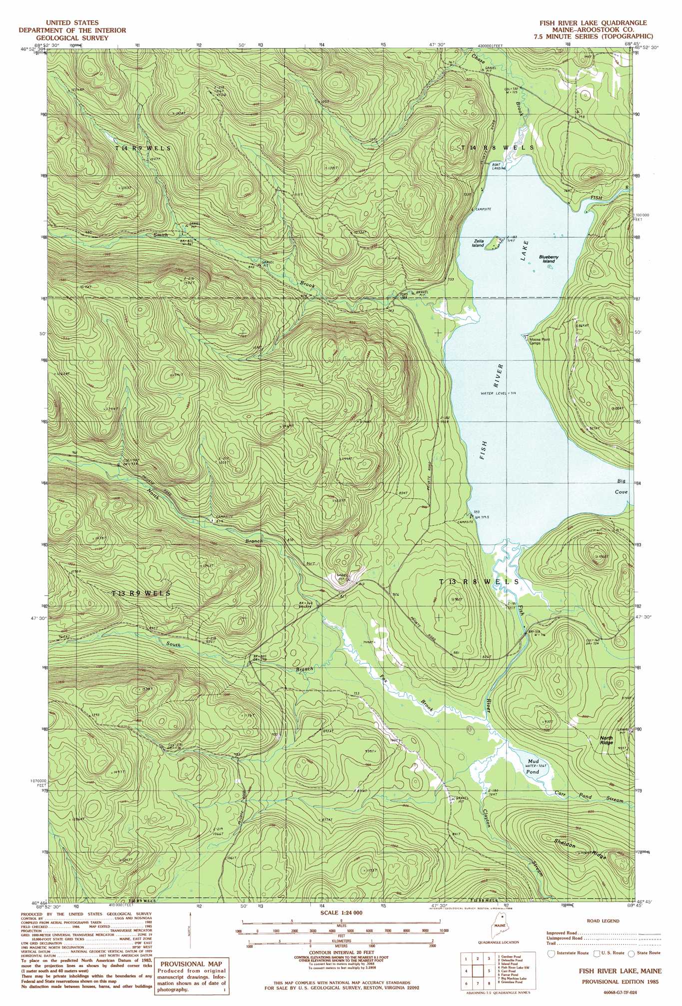
Fish River Lake Topo Map Maine
To zoom in, hover over the map of Fish River Lake
USGS Topo Quad 46068g7 - 1:24,000 scale
| Topo Map Name: | Fish River Lake |
| USGS Topo Quad ID: | 46068g7 |
| Print Size: | ca. 21 1/4" wide x 27" high |
| Southeast Coordinates: | 46.75° N latitude / 68.75° W longitude |
| Map Center Coordinates: | 46.8125° N latitude / 68.8125° W longitude |
| U.S. State: | ME |
| Filename: | o46068g7.jpg |
| Download Map JPG Image: | Fish River Lake topo map 1:24,000 scale |
| Map Type: | Topographic |
| Topo Series: | 7.5´ |
| Map Scale: | 1:24,000 |
| Source of Map Images: | United States Geological Survey (USGS) |
| Alternate Map Versions: |
Fish River Lake SE ME 1975, updated 1981 Download PDF Buy paper map Fish River Lake ME 1985, updated 1986 Download PDF Buy paper map Fish River Lake ME 2011 Download PDF Buy paper map Fish River Lake ME 2014 Download PDF Buy paper map |
1:24,000 Topo Quads surrounding Fish River Lake
Allagash |
Second Lake |
Mclean Mountain |
Wallacrass Lakes |
Eagle Lake |
Mckeen Lake |
Gardner Pond |
Deboullie Pond |
Island Pond |
Winterville |
Big Brook Lake |
Fish River Lake Sw |
Fish River Lake |
Carr Pond |
Portage Lake West |
Upper Mcnally Pond |
Farrar Pond |
Big Machias Lake |
Greenlaw Pond |
Little Machias Lake |
Fifth Musquacook Lake |
Mooseleuk Lake |
Round Mountain |
Jack Mountain |
Forks Of Machias |
> Back to 46068e1 at 1:100,000 scale
> Back to 46068a1 at 1:250,000 scale
> Back to U.S. Topo Maps home
Fish River Lake topo map: Gazetteer
Fish River Lake: Bays
Big Cove elevation 217m 711′Fish River Lake: Islands
Blueberry Island elevation 218m 715′Zella Island elevation 222m 728′
Fish River Lake: Lakes
Fish River Lake elevation 217m 711′Mud Pond elevation 221m 725′
Fish River Lake: Ridges
Sheldon Ridge elevation 321m 1053′Fish River Lake: Streams
Carr Pond Stream elevation 220m 721′Chase Brook elevation 218m 715′
Clayton Stream elevation 221m 725′
Fivemile Brook elevation 225m 738′
Fox Brook elevation 221m 725′
North Branch Fox Brook elevation 225m 738′
Smith Brook elevation 218m 715′
South Branch Fox Brook elevation 225m 738′
Fish River Lake: Trails
Fox Brook Trail elevation 269m 882′Fish River Lake digital topo map on disk
Buy this Fish River Lake topo map showing relief, roads, GPS coordinates and other geographical features, as a high-resolution digital map file on DVD:
Maine, New Hampshire, Rhode Island & Eastern Massachusetts
Buy digital topo maps: Maine, New Hampshire, Rhode Island & Eastern Massachusetts