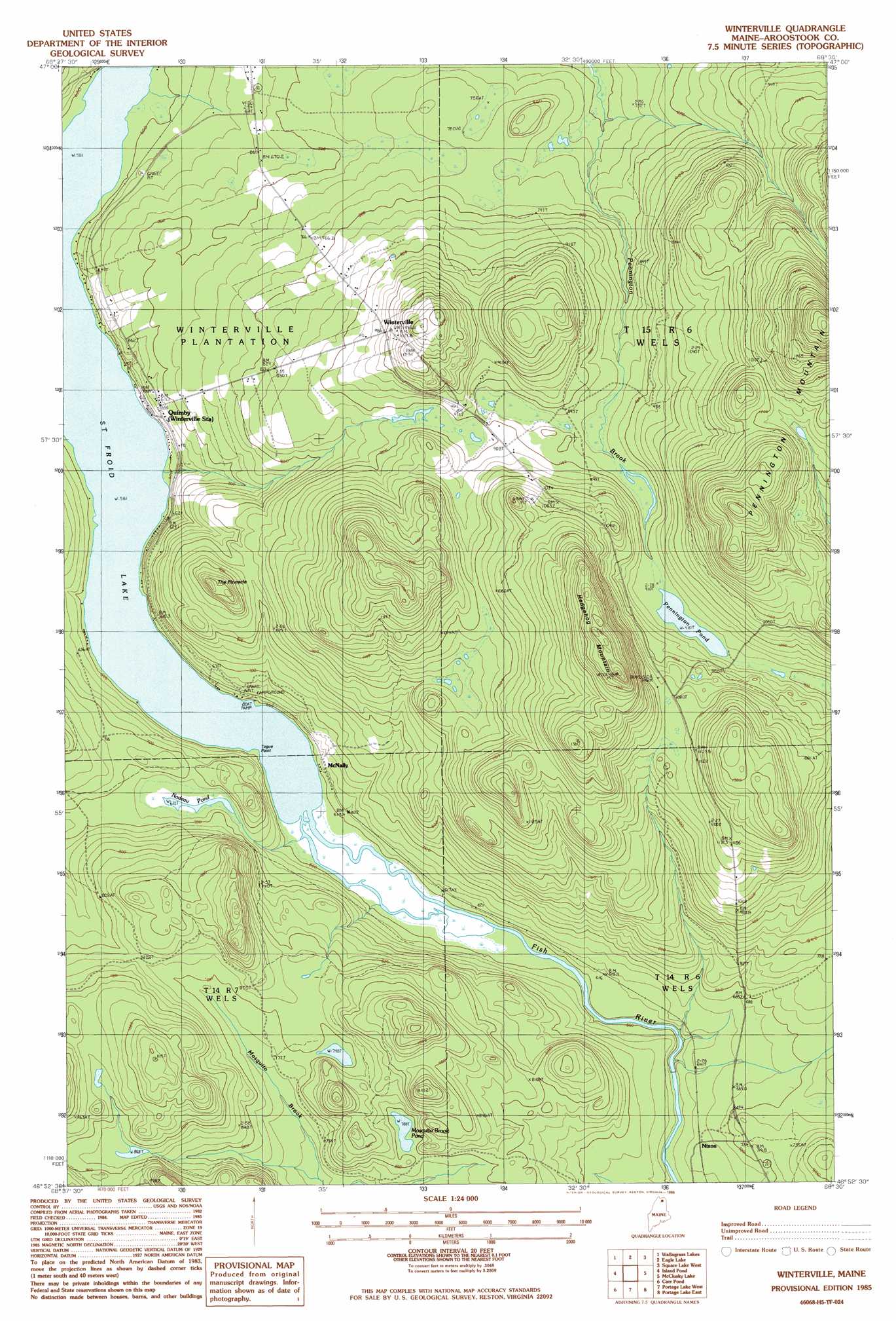
Winterville Topo Map Maine
To zoom in, hover over the map of Winterville
USGS Topo Quad 46068h5 - 1:24,000 scale
| Topo Map Name: | Winterville |
| USGS Topo Quad ID: | 46068h5 |
| Print Size: | ca. 21 1/4" wide x 27" high |
| Southeast Coordinates: | 46.875° N latitude / 68.5° W longitude |
| Map Center Coordinates: | 46.9375° N latitude / 68.5625° W longitude |
| U.S. State: | ME |
| Filename: | o46068h5.jpg |
| Download Map JPG Image: | Winterville topo map 1:24,000 scale |
| Map Type: | Topographic |
| Topo Series: | 7.5´ |
| Map Scale: | 1:24,000 |
| Source of Map Images: | United States Geological Survey (USGS) |
| Alternate Map Versions: |
Winterville NE ME 1975, updated 1981 Download PDF Buy paper map Winterville ME 1985, updated 1986 Download PDF Buy paper map Winterville ME 2011 Download PDF Buy paper map Winterville ME 2014 Download PDF Buy paper map |
1:24,000 Topo Quads surrounding Winterville
Saint John |
Wheelock |
Fort Kent South |
Daigle |
Saint Agatha |
Mclean Mountain |
Wallacrass Lakes |
Eagle Lake |
Square Lake West |
Square Lake East |
Deboullie Pond |
Island Pond |
Winterville |
Mcclusky Lake |
Hanford |
Fish River Lake |
Carr Pond |
Portage Lake West |
Portage Lake East |
Bull Brook |
Big Machias Lake |
Greenlaw Pond |
Little Machias Lake |
Ashland |
York Ridge |
> Back to 46068e1 at 1:100,000 scale
> Back to 46068a1 at 1:250,000 scale
> Back to U.S. Topo Maps home
Winterville topo map: Gazetteer
Winterville: Capes
Togue Point elevation 177m 580′Winterville: Lakes
Mosquito Brook Pond elevation 243m 797′Nadeau Pond elevation 205m 672′
Pennington Pond elevation 278m 912′
Saint Froid Lake elevation 177m 580′
Winterville: Pillars
The Pinnacle elevation 289m 948′Winterville: Populated Places
McNally elevation 187m 613′Nixon elevation 196m 643′
Quimby elevation 206m 675′
Winterville elevation 311m 1020′
Winterville: Post Offices
Quimby Post Office elevation 197m 646′Winterville Post Office (historical) elevation 283m 928′
Winterville: Summits
Hedgehog Mountain elevation 457m 1499′Pennington Mountain elevation 526m 1725′
Winterville digital topo map on disk
Buy this Winterville topo map showing relief, roads, GPS coordinates and other geographical features, as a high-resolution digital map file on DVD:
Maine, New Hampshire, Rhode Island & Eastern Massachusetts
Buy digital topo maps: Maine, New Hampshire, Rhode Island & Eastern Massachusetts