Doucie Brook Topo Map Maine
To zoom in, hover over the map of Doucie Brook
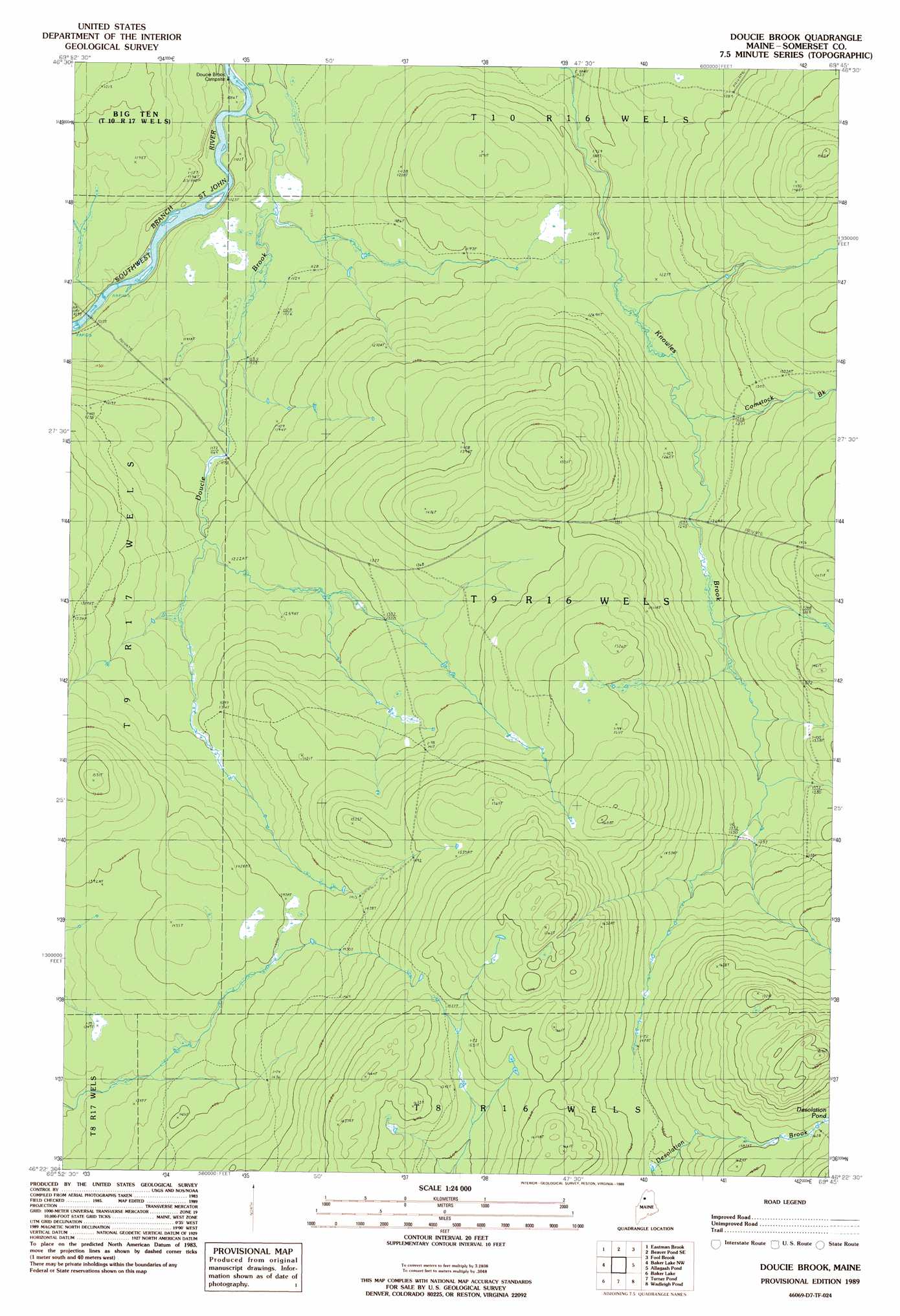
USGS Topo Quad 46069d7 - 1:24,000 scale
| Topo Map Name: | Doucie Brook |
| USGS Topo Quad ID: | 46069d7 |
| Print Size: | ca. 21 1/4" wide x 27" high |
| Southeast Coordinates: | 46.375° N latitude / 69.75° W longitude |
| Map Center Coordinates: | 46.4375° N latitude / 69.8125° W longitude |
| U.S. State: | ME |
| Filename: | o46069d7.jpg |
| Download Map JPG Image: | Doucie Brook topo map 1:24,000 scale |
| Map Type: | Topographic |
| Topo Series: | 7.5´ |
| Map Scale: | 1:24,000 |
| Source of Map Images: | United States Geological Survey (USGS) |
| Alternate Map Versions: |
Doucie Brook ME 1989, updated 1989 Download PDF Buy paper map Doucie Brook ME 2011 Download PDF Buy paper map Doucie Brook ME 2014 Download PDF Buy paper map |
1:24,000 Topo Quads surrounding Doucie Brook
Burntland Pond |
Maryl Pond |
Ninemile Bridge |
Ugh Lake |
|
Daaquam |
Eastman Brook |
Beaver Pond Se |
Fool Brook |
Clayton Lake |
Hardwood Mountain |
Baker Lake Nw |
Doucie Brook |
Allagash Pond |
Upper Russell Pond |
Hardwood Mountain Se |
Baker Lake |
Turner Pond |
Wadleigh Pond |
Allagash Lake |
Hinckley Hill |
Saint John Pond Depot |
Spruce Brook |
Caucomgomoc Lake West |
Caucomgomoc Lake East |
> Back to 46069a1 at 1:100,000 scale
> Back to 46068a1 at 1:250,000 scale
> Back to U.S. Topo Maps home
Doucie Brook topo map: Gazetteer
Doucie Brook: Streams
Comstock Brook elevation 372m 1220′Doucie Brook elevation 328m 1076′
Doucie Brook digital topo map on disk
Buy this Doucie Brook topo map showing relief, roads, GPS coordinates and other geographical features, as a high-resolution digital map file on DVD:
Maine, New Hampshire, Rhode Island & Eastern Massachusetts
Buy digital topo maps: Maine, New Hampshire, Rhode Island & Eastern Massachusetts