Saint Zacharie South Topo Map Maine
To zoom in, hover over the map of Saint Zacharie South
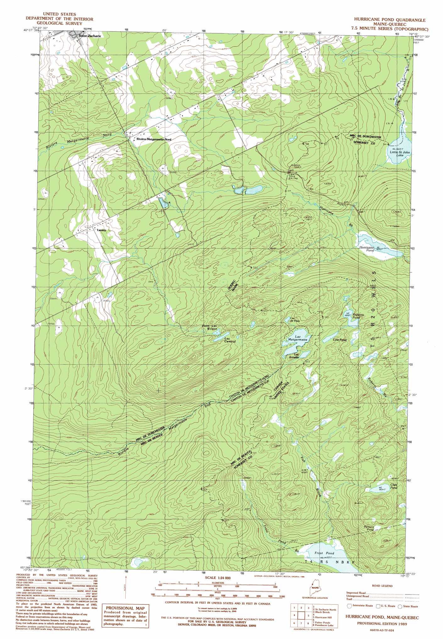
USGS Topo Quad 46070a3 - 1:24,000 scale
| Topo Map Name: | Saint Zacharie South |
| USGS Topo Quad ID: | 46070a3 |
| Print Size: | ca. 21 1/4" wide x 27" high |
| Southeast Coordinates: | 46° N latitude / 70.25° W longitude |
| Map Center Coordinates: | 46.0625° N latitude / 70.3125° W longitude |
| U.S. State: | ME |
| Filename: | o46070a3.jpg |
| Download Map JPG Image: | Saint Zacharie South topo map 1:24,000 scale |
| Map Type: | Topographic |
| Topo Series: | 7.5´ |
| Map Scale: | 1:24,000 |
| Source of Map Images: | United States Geological Survey (USGS) |
| Alternate Map Versions: |
Hurricane Pond ME 1989, updated 1989 Download PDF Buy paper map Hurricane Pond ME 2011 Download PDF Buy paper map Hurricane Pond ME 2014 Download PDF Buy paper map |
1:24,000 Topo Quads surrounding Saint Zacharie South
Hardwood Mountain Sw |
Hardwood Mountain Se |
|||
Saint Zacharie North |
Black Brook |
Hinckley Hill |
||
Saint Zacharie South |
Hurricane Hill |
Norris Brook |
||
Lac Portage |
Penobscot Lake |
Foley Pond |
||
Sandy Bay Mountain |
Campbell Brook |
Boundary Bald Mountain |
Canada Falls Lake |
> Back to 46070a1 at 1:100,000 scale
> Back to 46070a1 at 1:250,000 scale
> Back to U.S. Topo Maps home
Saint Zacharie South topo map: Gazetteer
Saint Zacharie South: Dams
Hurricane Pond Dam elevation 495m 1624′Saint Zacharie South: Lakes
Clish Pond elevation 550m 1804′Frost Pond elevation 434m 1423′
Line Pond elevation 586m 1922′
Little Saint John Lake elevation 489m 1604′
Parkers Pond elevation 540m 1771′
Roberts Pond elevation 574m 1883′
Saint Zacharie South: Populated Places
La Croix Depot elevation 513m 1683′Saint Zacharie South: Reservoirs
Hurricane Pond elevation 495m 1624′Saint Zacharie South: Streams
Fish Brook elevation 434m 1423′Frost Pond Brook elevation 434m 1423′
Saint Zacharie South digital topo map on disk
Buy this Saint Zacharie South topo map showing relief, roads, GPS coordinates and other geographical features, as a high-resolution digital map file on DVD:
Maine, New Hampshire, Rhode Island & Eastern Massachusetts
Buy digital topo maps: Maine, New Hampshire, Rhode Island & Eastern Massachusetts