Hardwood Mountain Se Topo Map Maine
To zoom in, hover over the map of Hardwood Mountain Se
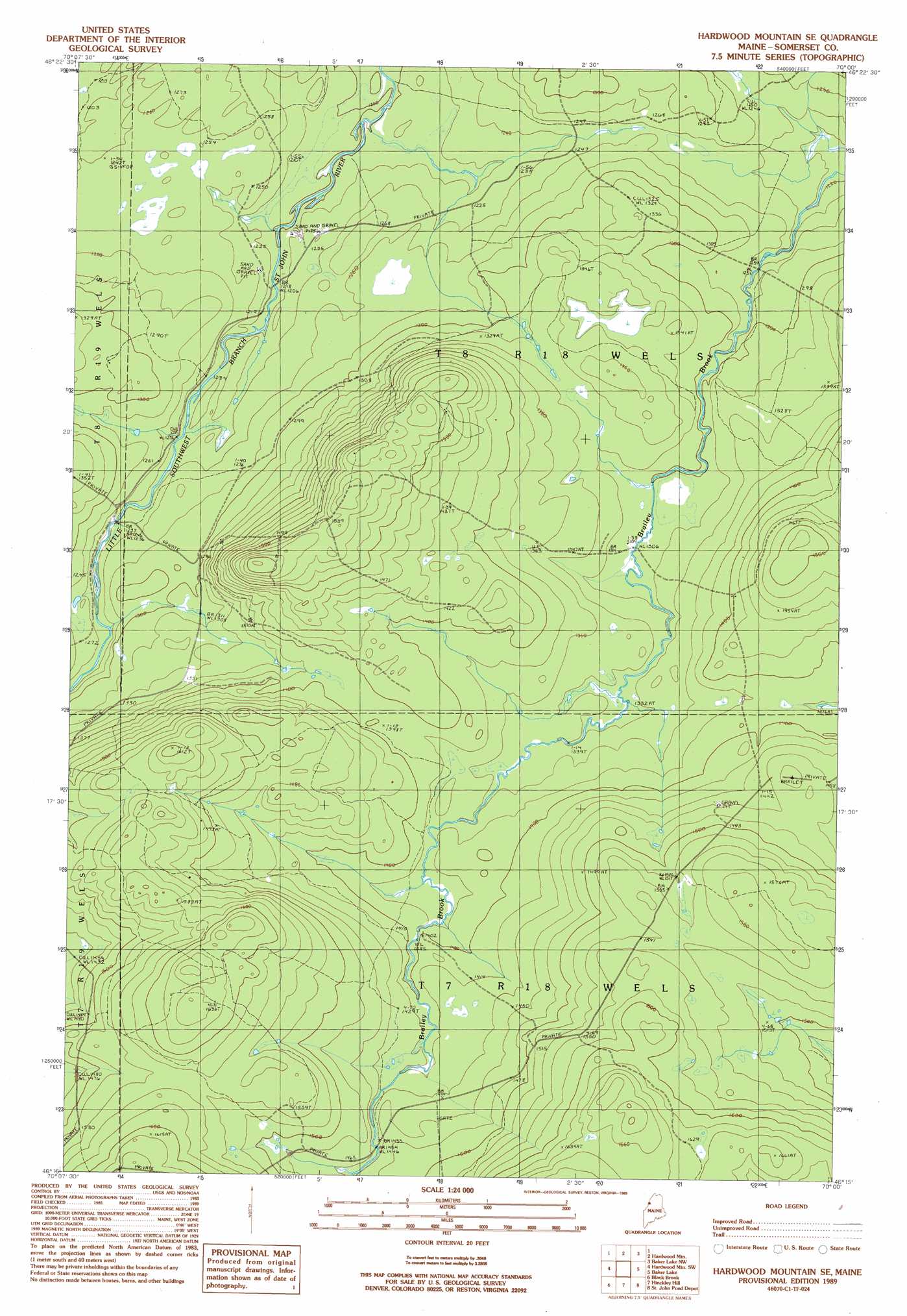
USGS Topo Quad 46070c1 - 1:24,000 scale
| Topo Map Name: | Hardwood Mountain Se |
| USGS Topo Quad ID: | 46070c1 |
| Print Size: | ca. 21 1/4" wide x 27" high |
| Southeast Coordinates: | 46.25° N latitude / 70° W longitude |
| Map Center Coordinates: | 46.3125° N latitude / 70.0625° W longitude |
| U.S. State: | ME |
| Filename: | o46070c1.jpg |
| Download Map JPG Image: | Hardwood Mountain Se topo map 1:24,000 scale |
| Map Type: | Topographic |
| Topo Series: | 7.5´ |
| Map Scale: | 1:24,000 |
| Source of Map Images: | United States Geological Survey (USGS) |
| Alternate Map Versions: |
Hardwood Mountain SE ME 1989, updated 1989 Download PDF Buy paper map Hardwood Mountain SE ME 2011 Download PDF Buy paper map Hardwood Mountain SE ME 2014 Download PDF Buy paper map |
1:24,000 Topo Quads surrounding Hardwood Mountain Se
Daaquam |
Eastman Brook |
Beaver Pond Se |
||
Hardwood Mountain |
Baker Lake Nw |
Doucie Brook |
||
Hardwood Mountain Sw |
Hardwood Mountain Se |
Baker Lake |
Turner Pond |
|
Saint Zacharie North |
Black Brook |
Hinckley Hill |
Saint John Pond Depot |
Spruce Brook |
Saint Zacharie South |
Hurricane Hill |
Norris Brook |
Saint John Ponds |
Russell Mountain |
> Back to 46070a1 at 1:100,000 scale
> Back to 46070a1 at 1:250,000 scale
> Back to U.S. Topo Maps home
No gazetteer data is available for the Hardwood Mountain Se topo map sheet.
Hardwood Mountain Se digital topo map on disk
Buy this Hardwood Mountain Se topo map showing relief, roads, GPS coordinates and other geographical features, as a high-resolution digital map file on DVD:
Maine, New Hampshire, Rhode Island & Eastern Massachusetts
Buy digital topo maps: Maine, New Hampshire, Rhode Island & Eastern Massachusetts