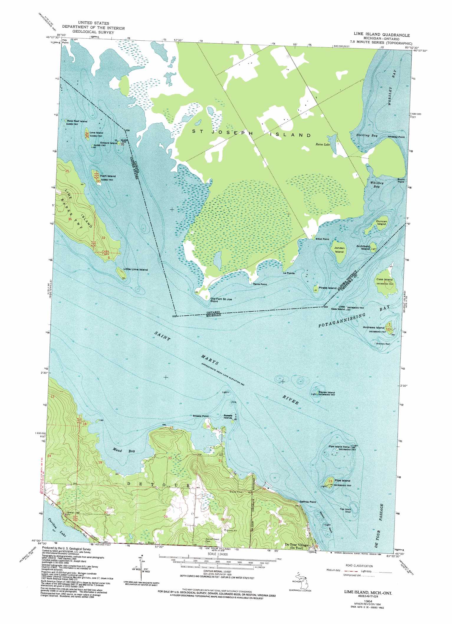
Lime Island Topo Map Michigan
To zoom in, hover over the map of Lime Island
USGS Topo Quad 46083a8 - 1:24,000 scale
| Topo Map Name: | Lime Island |
| USGS Topo Quad ID: | 46083a8 |
| Print Size: | ca. 21 1/4" wide x 27" high |
| Southeast Coordinates: | 46° N latitude / 83.875° W longitude |
| Map Center Coordinates: | 46.0625° N latitude / 83.9375° W longitude |
| U.S. State: | MI |
| Filename: | o46083a8.jpg |
| Download Map JPG Image: | Lime Island topo map 1:24,000 scale |
| Map Type: | Topographic |
| Topo Series: | 7.5´ |
| Map Scale: | 1:24,000 |
| Source of Map Images: | United States Geological Survey (USGS) |
| Alternate Map Versions: |
Lime Island MI 1964, updated 1966 Download PDF Buy paper map Lime Island MI 1964, updated 1994 Download PDF Buy paper map Lime Island MI 2011 Download PDF Buy paper map Lime Island MI 2014 Download PDF Buy paper map Lime Island MI 2017 Download PDF Buy paper map |
1:24,000 Topo Quads surrounding Lime Island
Oak Ridge |
||||
Munuscong |
Munuscong Ne |
|||
Stalwart |
Goetzville |
Lime Island |
Burnt Island |
Drummond |
Prentiss Bay |
Albany Island |
De Tour Village |
Whitney Bay |
Meade Island |
> Back to 46083a1 at 1:100,000 scale
> Back to 46082a1 at 1:250,000 scale
> Back to U.S. Topo Maps home
Lime Island topo map: Gazetteer
Lime Island: Bars
Andrews Reef elevation 179m 587′Pipe Island Shoal elevation 177m 580′
Watson Reefs elevation 177m 580′
Lime Island: Bays
Maud Bay elevation 177m 580′Lime Island: Capes
Gaffney Point elevation 179m 587′Sweets Point elevation 179m 587′
Lime Island: Islands
Andrews Island elevation 180m 590′Bass Reef Island elevation 179m 587′
Cass Island elevation 180m 590′
Edward Island elevation 180m 590′
Hart Island elevation 180m 590′
Lime Island elevation 195m 639′
Little Cass Island elevation 179m 587′
Little Lime Island elevation 180m 590′
Love Island elevation 180m 590′
Pipe Island elevation 180m 590′
Pipe Island Twins elevation 177m 580′
Squaw Island elevation 179m 587′
Sweets Islands elevation 179m 587′
Lime Island digital topo map on disk
Buy this Lime Island topo map showing relief, roads, GPS coordinates and other geographical features, as a high-resolution digital map file on DVD:
 map DVD")