Barbeau Topo Map Michigan
To zoom in, hover over the map of Barbeau
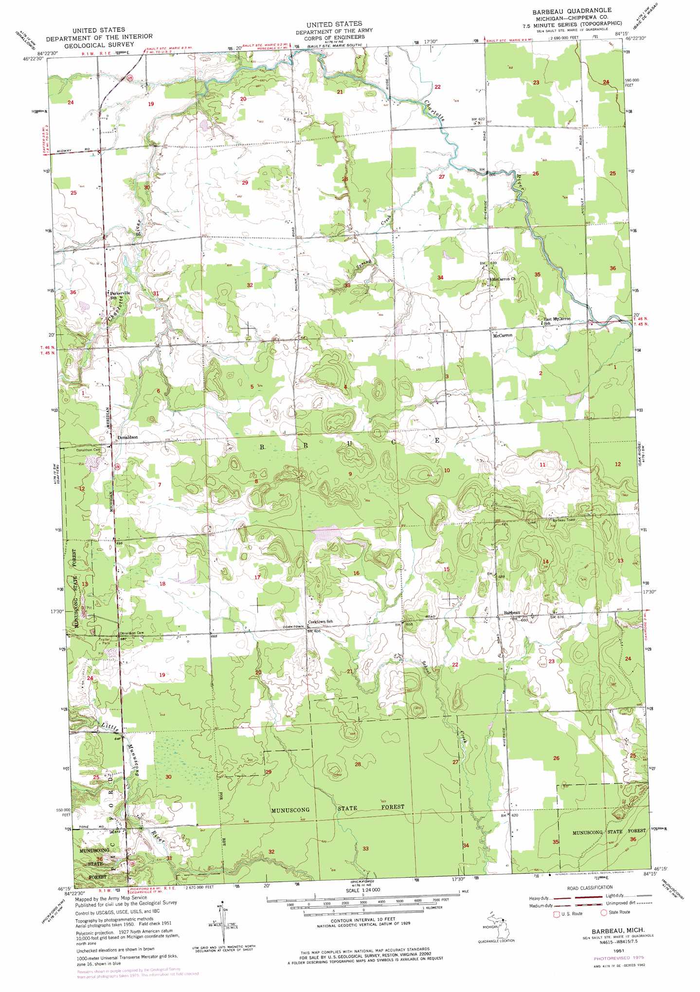
USGS Topo Quad 46084c3 - 1:24,000 scale
| Topo Map Name: | Barbeau |
| USGS Topo Quad ID: | 46084c3 |
| Print Size: | ca. 21 1/4" wide x 27" high |
| Southeast Coordinates: | 46.25° N latitude / 84.25° W longitude |
| Map Center Coordinates: | 46.3125° N latitude / 84.3125° W longitude |
| U.S. State: | MI |
| Filename: | o46084c3.jpg |
| Download Map JPG Image: | Barbeau topo map 1:24,000 scale |
| Map Type: | Topographic |
| Topo Series: | 7.5´ |
| Map Scale: | 1:24,000 |
| Source of Map Images: | United States Geological Survey (USGS) |
| Alternate Map Versions: |
Barbeau MI 1951, updated 1956 Download PDF Buy paper map Barbeau MI 1951, updated 1973 Download PDF Buy paper map Barbeau MI 1951, updated 1977 Download PDF Buy paper map Barbeau MI 2011 Download PDF Buy paper map Barbeau MI 2014 Download PDF Buy paper map Barbeau MI 2017 Download PDF Buy paper map |
1:24,000 Topo Quads surrounding Barbeau
Payment |
||||
Brimley |
Shallows |
Sault Sainte Marie South |
Baie De Wasai |
|
Kinross |
Dafter |
Barbeau |
Oak Ridge |
|
Rudyard |
Pickford Nw |
Pickford |
Munuscong |
Munuscong Ne |
Pontchartrain Shores |
Hessel |
Pickford Se |
Stalwart |
Goetzville |
> Back to 46084a1 at 1:100,000 scale
> Back to 46084a1 at 1:250,000 scale
> Back to U.S. Topo Maps home
Barbeau topo map: Gazetteer
Barbeau: Populated Places
Barbeau elevation 200m 656′Donaldson elevation 211m 692′
McCarron elevation 194m 636′
Barbeau: Post Offices
Barbeau Post Office (historical) elevation 200m 656′Donaldson Post Office (historical) elevation 211m 692′
McCarron Post Office (historical) elevation 194m 636′
Barbeau: Streams
Spring Creek elevation 186m 610′Barbeau digital topo map on disk
Buy this Barbeau topo map showing relief, roads, GPS coordinates and other geographical features, as a high-resolution digital map file on DVD: