Brevort Topo Map Michigan
To zoom in, hover over the map of Brevort
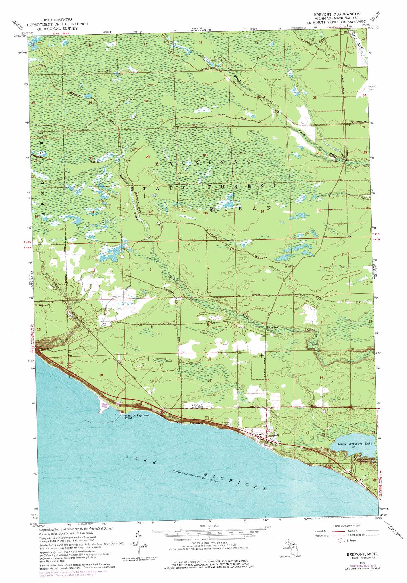
USGS Topo Quad 46085a1 - 1:24,000 scale
| Topo Map Name: | Brevort |
| USGS Topo Quad ID: | 46085a1 |
| Print Size: | ca. 21 1/4" wide x 27" high |
| Southeast Coordinates: | 46° N latitude / 85° W longitude |
| Map Center Coordinates: | 46.0625° N latitude / 85.0625° W longitude |
| U.S. State: | MI |
| Filename: | o46085a1.jpg |
| Download Map JPG Image: | Brevort topo map 1:24,000 scale |
| Map Type: | Topographic |
| Topo Series: | 7.5´ |
| Map Scale: | 1:24,000 |
| Source of Map Images: | United States Geological Survey (USGS) |
| Alternate Map Versions: |
Brevort MI 1964, updated 1965 Download PDF Buy paper map Brevort MI 1964, updated 1977 Download PDF Buy paper map Brevort MI 2011 Download PDF Buy paper map Brevort MI 2014 Download PDF Buy paper map Brevort MI 2017 Download PDF Buy paper map |
1:24,000 Topo Quads surrounding Brevort
Soo Junction |
Hulbert |
Eckerman |
Strongs |
Sullivan Creek |
Garnet |
Rexton |
Trout Lake |
Ozark |
Ozark Ne |
Hog Island Point |
Epoufette |
Brevort |
Kenneth |
Ozark Se |
Pnte Aux Chenes |
Moran |
|||
Hog Island East |
Waugoshance Island |
Big Stone Bay |
Mcgulpin Point |
> Back to 46085a1 at 1:100,000 scale
> Back to 46084a1 at 1:250,000 scale
> Back to U.S. Topo Maps home
Brevort topo map: Gazetteer
Brevort: Airports
Brevort Airport elevation 219m 718′Brevort: Capes
Manitou Payment Point elevation 177m 580′Brevort: Cliffs
Manitou Payment Highbanks elevation 206m 675′Brevort: Lakes
Little Brevoort Lake elevation 191m 626′Brevort: Populated Places
Brevort elevation 182m 597′Brevort: Post Offices
Brevort Post Office (historical) elevation 182m 597′Brevort digital topo map on disk
Buy this Brevort topo map showing relief, roads, GPS coordinates and other geographical features, as a high-resolution digital map file on DVD: