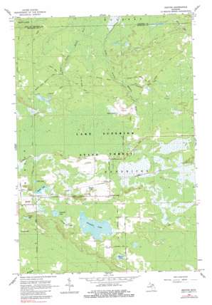
Rexton Topo Map Michigan
To zoom in, hover over the map of Rexton
USGS Topo Quad 46085b2 - 1:24,000 scale
| Topo Map Name: | Rexton |
| USGS Topo Quad ID: | 46085b2 |
| Print Size: | ca. 21 1/4" wide x 27" high |
| Southeast Coordinates: | 46.125° N latitude / 85.125° W longitude |
| Map Center Coordinates: | 46.1875° N latitude / 85.1875° W longitude |
| U.S. State: | MI |
| Filename: | o46085b2.jpg |
| Download Map JPG Image: | Rexton topo map 1:24,000 scale |
| Map Type: | Topographic |
| Topo Series: | 7.5´ |
| Map Scale: | 1:24,000 |
| Source of Map Images: | United States Geological Survey (USGS) |
| Alternate Map Versions: |
Rexton MI 1964, updated 1966 Download PDF Buy paper map Rexton MI 1964, updated 1982 Download PDF Buy paper map Rexton MI 2011 Download PDF Buy paper map Rexton MI 2014 Download PDF Buy paper map Rexton MI 2017 Download PDF Buy paper map |
1:24,000 Topo Quads surrounding Rexton
> Back to 46085a1 at 1:100,000 scale
> Back to 46084a1 at 1:250,000 scale
> Back to U.S. Topo Maps home
Rexton topo map: Gazetteer
Rexton: Lakes
Crossville Lake elevation 260m 853′Fiborn Pond elevation 255m 836′
Little Lake elevation 262m 859′
Rexton Lake elevation 260m 853′
Ryerse Lake elevation 259m 849′
Strouble Lake elevation 260m 853′
Tucker Lake elevation 258m 846′
Rexton: Populated Places
Caffey elevation 262m 859′Caffey Corner elevation 265m 869′
Rexton elevation 262m 859′
Rexton: Post Offices
Caffey Post Office (historical) elevation 262m 859′Fiborn Quarry Post Office (historical) elevation 253m 830′
Rexton Post Office (historical) elevation 262m 859′
Rexton: Streams
Anguilm Creek elevation 241m 790′Nelson Creek elevation 248m 813′
Rexton: Swamps
Reagan Lake elevation 263m 862′Rexton digital topo map on disk
Buy this Rexton topo map showing relief, roads, GPS coordinates and other geographical features, as a high-resolution digital map file on DVD:


