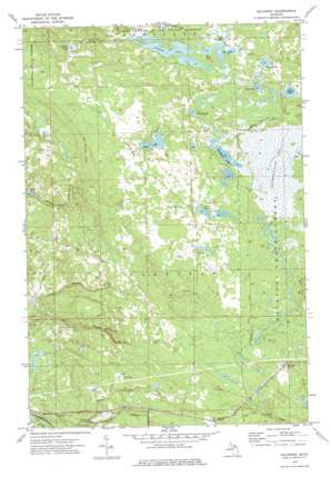
Gilchrist Topo Map Michigan
To zoom in, hover over the map of Gilchrist
USGS Topo Quad 46085b4 - 1:24,000 scale
| Topo Map Name: | Gilchrist |
| USGS Topo Quad ID: | 46085b4 |
| Print Size: | ca. 21 1/4" wide x 27" high |
| Southeast Coordinates: | 46.125° N latitude / 85.375° W longitude |
| Map Center Coordinates: | 46.1875° N latitude / 85.4375° W longitude |
| U.S. State: | MI |
| Filename: | o46085b4.jpg |
| Download Map JPG Image: | Gilchrist topo map 1:24,000 scale |
| Map Type: | Topographic |
| Topo Series: | 7.5´ |
| Map Scale: | 1:24,000 |
| Source of Map Images: | United States Geological Survey (USGS) |
| Alternate Map Versions: |
Gilchrist MI 1973, updated 1977 Download PDF Buy paper map Gilchrist MI 2011 Download PDF Buy paper map Gilchrist MI 2014 Download PDF Buy paper map Gilchrist MI 2017 Download PDF Buy paper map |
1:24,000 Topo Quads surrounding Gilchrist
> Back to 46085a1 at 1:100,000 scale
> Back to 46084a1 at 1:250,000 scale
> Back to U.S. Topo Maps home
Gilchrist topo map: Gazetteer
Gilchrist: Lakes
Cranberry Lake elevation 252m 826′Devine Lake elevation 243m 797′
Dollar Lake elevation 247m 810′
Ear Lake elevation 247m 810′
Goat Lake elevation 250m 820′
Grass Lake elevation 249m 816′
Jocko Pond elevation 196m 643′
Lake Louise elevation 249m 816′
Lucky Lake elevation 251m 823′
Nelson Lake elevation 251m 823′
Pullup Lake elevation 247m 810′
Tee Lake elevation 247m 810′
Gilchrist: Populated Places
Gilchrist elevation 236m 774′Gilchrist: Post Offices
Gilchrist Post Office (historical) elevation 236m 774′Gilchrist: Streams
North Branch Gold Creek elevation 192m 629′South Branch Gold Creek elevation 192m 629′
South Branch Three Mile Creek elevation 195m 639′
Gilchrist: Swamps
Cranberry Lake Bog elevation 253m 830′Gilchrist digital topo map on disk
Buy this Gilchrist topo map showing relief, roads, GPS coordinates and other geographical features, as a high-resolution digital map file on DVD:


