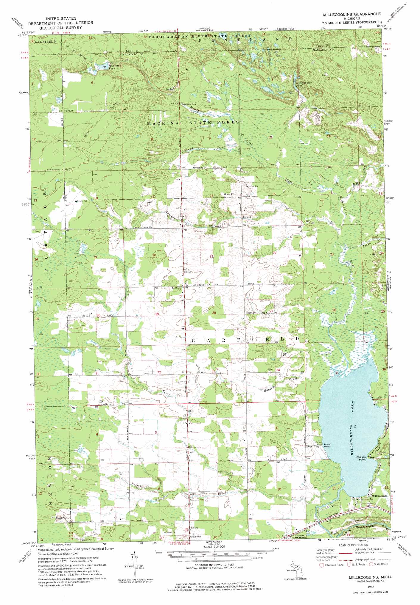
Millecoquins Topo Map Michigan
To zoom in, hover over the map of Millecoquins
USGS Topo Quad 46085b5 - 1:24,000 scale
| Topo Map Name: | Millecoquins |
| USGS Topo Quad ID: | 46085b5 |
| Print Size: | ca. 21 1/4" wide x 27" high |
| Southeast Coordinates: | 46.125° N latitude / 85.5° W longitude |
| Map Center Coordinates: | 46.1875° N latitude / 85.5625° W longitude |
| U.S. State: | MI |
| Filename: | o46085b5.jpg |
| Download Map JPG Image: | Millecoquins topo map 1:24,000 scale |
| Map Type: | Topographic |
| Topo Series: | 7.5´ |
| Map Scale: | 1:24,000 |
| Source of Map Images: | United States Geological Survey (USGS) |
| Alternate Map Versions: |
Millecoquins MI 1973, updated 1977 Download PDF Buy paper map Millecoquins MI 2011 Download PDF Buy paper map Millecoquins MI 2014 Download PDF Buy paper map Millecoquins MI 2017 Download PDF Buy paper map |
1:24,000 Topo Quads surrounding Millecoquins
Tahquamenon Lakes |
Buckeye Lake |
Auger Lake |
Roy Lake |
Gimlet Creek |
Hardwood Island |
Mcmillan |
Newberry |
Roberts Corner |
Soo Junction |
Curtis West |
Curtis East |
Millecoquins |
Gilchrist |
Garnet |
Milakokia Lake |
Gould City |
Engadine |
Naubinway |
Hog Island Point |
Hughes Point |
Point Patterson |
> Back to 46085a1 at 1:100,000 scale
> Back to 46084a1 at 1:250,000 scale
> Back to U.S. Topo Maps home
Millecoquins topo map: Gazetteer
Millecoquins: Capes
Chases Point elevation 189m 620′Millecoquins: Lakes
McAlpine Pond elevation 241m 790′Millecoquins Lake elevation 187m 613′
Millecoquins Pond elevation 213m 698′
Millecoquins: Populated Places
Millecoquins elevation 190m 623′Millecoquins: Streams
Cold Creek elevation 187m 613′Doe Creek elevation 195m 639′
Furlong Creek elevation 187m 613′
Hagler Creek elevation 187m 613′
Harris Creek elevation 189m 620′
Jocko Creek elevation 192m 629′
Maloney Creek elevation 192m 629′
McAlpine Creek elevation 201m 659′
Milk Creek elevation 195m 639′
Skunk Creek elevation 200m 656′
Upper Millecoquins River elevation 187m 613′
Millecoquins digital topo map on disk
Buy this Millecoquins topo map showing relief, roads, GPS coordinates and other geographical features, as a high-resolution digital map file on DVD: