Seney Topo Map Michigan
To zoom in, hover over the map of Seney
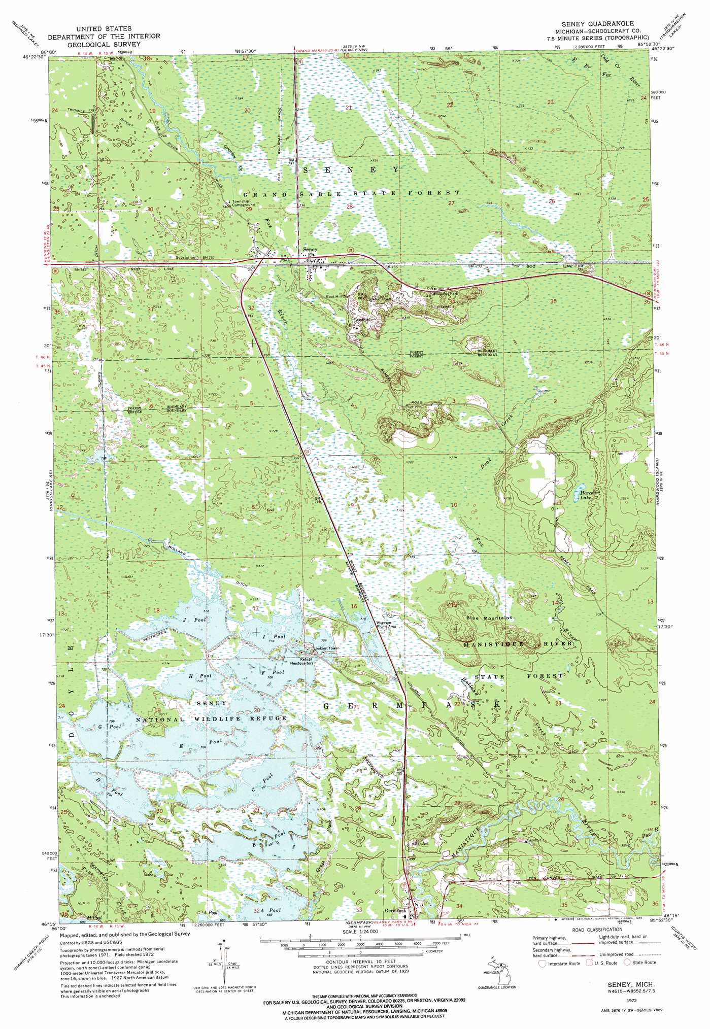
USGS Topo Quad 46085c8 - 1:24,000 scale
| Topo Map Name: | Seney |
| USGS Topo Quad ID: | 46085c8 |
| Print Size: | ca. 21 1/4" wide x 27" high |
| Southeast Coordinates: | 46.25° N latitude / 85.875° W longitude |
| Map Center Coordinates: | 46.3125° N latitude / 85.9375° W longitude |
| U.S. State: | MI |
| Filename: | o46085c8.jpg |
| Download Map JPG Image: | Seney topo map 1:24,000 scale |
| Map Type: | Topographic |
| Topo Series: | 7.5´ |
| Map Scale: | 1:24,000 |
| Source of Map Images: | United States Geological Survey (USGS) |
| Alternate Map Versions: |
Seney MI 1972, updated 1975 Download PDF Buy paper map Seney MI 1972, updated 1975 Download PDF Buy paper map Seney MI 2011 Download PDF Buy paper map Seney MI 2014 Download PDF Buy paper map Seney MI 2017 Download PDF Buy paper map |
1:24,000 Topo Quads surrounding Seney
Au Sable Point Sw |
Au Sable Point Se |
Nawakwa Lake |
Grand Marais Se |
Muskallonge Lake Sw |
Driggs Lake |
Sunken Lake |
Seney Nw |
Tahquamenon Lakes |
Buckeye Lake |
Walsh |
Driggs Lake Se |
Seney |
Hardwood Island |
Mcmillan |
Marsh Creek Pool Nw |
Marsh Creek Pool |
Germfask |
Curtis West |
Curtis East |
Smith Lake |
Merwin Lake |
Blaney Park |
Milakokia Lake |
Gould City |
> Back to 46085a1 at 1:100,000 scale
> Back to 46084a1 at 1:250,000 scale
> Back to U.S. Topo Maps home
Seney topo map: Gazetteer
Seney: Canals
Clarks Ditch elevation 226m 741′Holland Ditch elevation 219m 718′
Seney: Lakes
Harcourt Lake elevation 223m 731′Seney: Populated Places
Seney elevation 224m 734′Seney: Post Offices
Seney Post Office elevation 224m 734′Seney: Reservoirs
B Pool elevation 212m 695′C Pool elevation 214m 702′
D Pool elevation 214m 702′
E Pool elevation 215m 705′
F Pool elevation 218m 715′
G Pool elevation 216m 708′
H Pool elevation 216m 708′
I Pool elevation 217m 711′
J Pool elevation 217m 711′
Seney: Streams
Cold Creek elevation 222m 728′Dead Creek elevation 217m 711′
Fox River elevation 208m 682′
Gronden Creek elevation 225m 738′
Holland Creek elevation 210m 688′
Seney: Summits
Blue Mountains elevation 221m 725′Seney digital topo map on disk
Buy this Seney topo map showing relief, roads, GPS coordinates and other geographical features, as a high-resolution digital map file on DVD: