Timberlost Topo Map Michigan
To zoom in, hover over the map of Timberlost
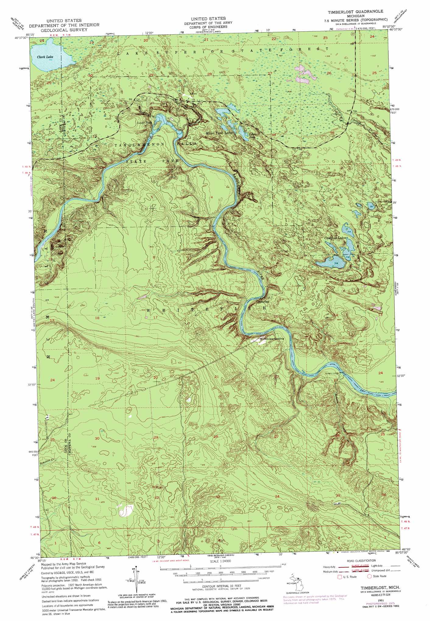
USGS Topo Quad 46085e2 - 1:24,000 scale
| Topo Map Name: | Timberlost |
| USGS Topo Quad ID: | 46085e2 |
| Print Size: | ca. 21 1/4" wide x 27" high |
| Southeast Coordinates: | 46.5° N latitude / 85.125° W longitude |
| Map Center Coordinates: | 46.5625° N latitude / 85.1875° W longitude |
| U.S. State: | MI |
| Filename: | o46085e2.jpg |
| Download Map JPG Image: | Timberlost topo map 1:24,000 scale |
| Map Type: | Topographic |
| Topo Series: | 7.5´ |
| Map Scale: | 1:24,000 |
| Source of Map Images: | United States Geological Survey (USGS) |
| Alternate Map Versions: |
Timberlost MI 1951, updated 1955 Download PDF Buy paper map Timberlost MI 1951, updated 1973 Download PDF Buy paper map Timberlost MI 1951, updated 1977 Download PDF Buy paper map Timberlost MI 1951, updated 1989 Download PDF Buy paper map Timberlost MI 2011 Download PDF Buy paper map Timberlost MI 2014 Download PDF Buy paper map Timberlost MI 2017 Download PDF Buy paper map |
1:24,000 Topo Quads surrounding Timberlost
Vermilion |
Vermilion Se |
|||
Betsy Lake Nw |
Betsy Lake North |
Sheephead Lake |
Shelldrake |
Whitefish Point |
Betsy Lake Sw |
Betsy Lake South |
Timberlost |
Emerson |
|
Roy Lake |
Gimlet Creek |
Big Beaver Creek |
Piatt Lake |
Mcnearney Lake |
Roberts Corner |
Soo Junction |
Hulbert |
Eckerman |
Strongs |
> Back to 46085e1 at 1:100,000 scale
> Back to 46084a1 at 1:250,000 scale
> Back to U.S. Topo Maps home
Timberlost topo map: Gazetteer
Timberlost: Falls
Lower Falls elevation 190m 623′Timberlost: Lakes
Cabin Lake elevation 216m 708′Camp Ten Lakes elevation 218m 715′
Clark Lake elevation 217m 711′
Water Tank Lakes elevation 216m 708′
Timberlost: Parks
Tahquamenon Falls State Park elevation 214m 702′Timberlost: Populated Places
Timberlost elevation 184m 603′Whitehouse Landing elevation 196m 643′
Timberlost: Streams
Bowers Creek elevation 184m 603′Timberlost digital topo map on disk
Buy this Timberlost topo map showing relief, roads, GPS coordinates and other geographical features, as a high-resolution digital map file on DVD: