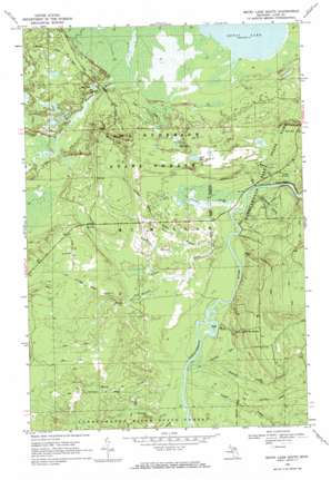
Betsy Lake South Topo Map Michigan
To zoom in, hover over the map of Betsy Lake South
USGS Topo Quad 46085e3 - 1:24,000 scale
| Topo Map Name: | Betsy Lake South |
| USGS Topo Quad ID: | 46085e3 |
| Print Size: | ca. 21 1/4" wide x 27" high |
| Southeast Coordinates: | 46.5° N latitude / 85.25° W longitude |
| Map Center Coordinates: | 46.5625° N latitude / 85.3125° W longitude |
| U.S. State: | MI |
| Filename: | o46085e3.jpg |
| Download Map JPG Image: | Betsy Lake South topo map 1:24,000 scale |
| Map Type: | Topographic |
| Topo Series: | 7.5´ |
| Map Scale: | 1:24,000 |
| Source of Map Images: | United States Geological Survey (USGS) |
| Alternate Map Versions: |
Betsy Lake South MI 1968, updated 1971 Download PDF Buy paper map Betsy Lake South MI 2011 Download PDF Buy paper map Betsy Lake South MI 2014 Download PDF Buy paper map Betsy Lake South MI 2017 Download PDF Buy paper map |
1:24,000 Topo Quads surrounding Betsy Lake South
> Back to 46085e1 at 1:100,000 scale
> Back to 46084a1 at 1:250,000 scale
> Back to U.S. Topo Maps home
Betsy Lake South topo map: Gazetteer
Betsy Lake South: Falls
Upper Falls elevation 211m 692′Betsy Lake South: Islands
Joys Island elevation 215m 705′Betsy Lake South: Lakes
Betsy Lake elevation 217m 711′Loon Lake elevation 231m 757′
Pine Lake elevation 231m 757′
Rat Lake elevation 227m 744′
Betsy Lake South: Springs
The Big Spring elevation 242m 793′Betsy Lake South: Streams
Anchard Creek elevation 215m 705′Baird Creek elevation 216m 708′
Callam Creek elevation 216m 708′
Gage Creek elevation 216m 708′
Linton Creek elevation 215m 705′
Maye Creek elevation 216m 708′
Middle Branch Linton Creek elevation 221m 725′
North Branch Linton Creek elevation 215m 705′
Penny Creek elevation 216m 708′
Popps Creek elevation 216m 708′
Rose Creek elevation 216m 708′
Savage Creek elevation 216m 708′
Schouts Creek elevation 216m 708′
South Branch Linton Creek elevation 225m 738′
Wolf Creek elevation 215m 705′
Betsy Lake South digital topo map on disk
Buy this Betsy Lake South topo map showing relief, roads, GPS coordinates and other geographical features, as a high-resolution digital map file on DVD:


