Smith Lake Topo Map Michigan
To zoom in, hover over the map of Smith Lake
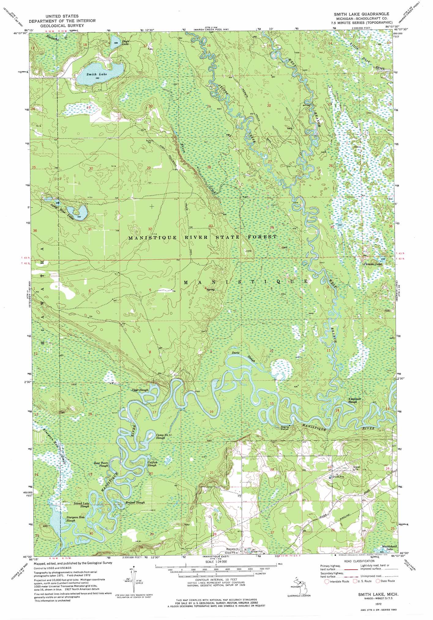
USGS Topo Quad 46086a2 - 1:24,000 scale
| Topo Map Name: | Smith Lake |
| USGS Topo Quad ID: | 46086a2 |
| Print Size: | ca. 21 1/4" wide x 27" high |
| Southeast Coordinates: | 46° N latitude / 86.125° W longitude |
| Map Center Coordinates: | 46.0625° N latitude / 86.1875° W longitude |
| U.S. State: | MI |
| Filename: | o46086a2.jpg |
| Download Map JPG Image: | Smith Lake topo map 1:24,000 scale |
| Map Type: | Topographic |
| Topo Series: | 7.5´ |
| Map Scale: | 1:24,000 |
| Source of Map Images: | United States Geological Survey (USGS) |
| Alternate Map Versions: |
Smith Lake MI 1972, updated 1975 Download PDF Buy paper map Smith Lake MI 2011 Download PDF Buy paper map Smith Lake MI 2014 Download PDF Buy paper map Smith Lake MI 2017 Download PDF Buy paper map |
1:24,000 Topo Quads surrounding Smith Lake
Shingleton |
Creighton |
Walsh |
Driggs Lake Se |
Seney |
Steuben |
Steuben Ne |
Marsh Creek Pool Nw |
Marsh Creek Pool |
Germfask |
Thunder Lake |
Hiawath |
Smith Lake |
Merwin Lake |
Blaney Park |
Cooks |
Manistique West |
Manistique East |
Gulliver |
Seul Choix Point |
Hiram Point |
Point Aux Barques |
> Back to 46086a1 at 1:100,000 scale
> Back to 46086a1 at 1:250,000 scale
> Back to U.S. Topo Maps home
Smith Lake topo map: Gazetteer
Smith Lake: Guts
Bear Town Slough elevation 186m 610′Brassel Slough elevation 184m 603′
Camp Number 11 Slough elevation 184m 603′
Catfish Slough elevation 186m 610′
Clear Slough elevation 184m 603′
Davis Slough elevation 186m 610′
Island Lake Slough elevation 184m 603′
Klegstads Slough elevation 186m 610′
Smith Lake: Lakes
Camp Nine Lakes elevation 211m 692′Clemons Lake elevation 193m 633′
Doyle Lake elevation 208m 682′
Smith Lake elevation 210m 688′
Smith Lake: Streams
Brace Creek elevation 194m 636′Sturgeon Hole Creek elevation 184m 603′
Sturgeon Hole Slough elevation 184m 603′
Stutts Creek elevation 192m 629′
West Branch Manistique River elevation 189m 620′
Smith Lake: Trails
High Rollways Truck Trail elevation 219m 718′Smith Lake digital topo map on disk
Buy this Smith Lake topo map showing relief, roads, GPS coordinates and other geographical features, as a high-resolution digital map file on DVD: