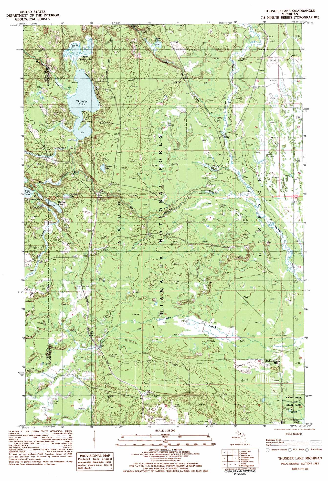
Thunder Lake Topo Map Michigan
To zoom in, hover over the map of Thunder Lake
USGS Topo Quad 46086a4 - 1:25,000 scale
| Topo Map Name: | Thunder Lake |
| USGS Topo Quad ID: | 46086a4 |
| Print Size: | ca. 21 1/4" wide x 27" high |
| Southeast Coordinates: | 46° N latitude / 86.375° W longitude |
| Map Center Coordinates: | 46.0625° N latitude / 86.4375° W longitude |
| U.S. State: | MI |
| Filename: | l46086a4.jpg |
| Download Map JPG Image: | Thunder Lake topo map 1:25,000 scale |
| Map Type: | Topographic |
| Topo Series: | 7.5´ |
| Map Scale: | 1:25,000 |
| Source of Map Images: | United States Geological Survey (USGS) |
| Alternate Map Versions: | |
| FStopo: | US Forest Service topo Thunder Lake is available: Download FStopo PDF Download FStopo TIF |
1:24,000 Topo Quads surrounding Thunder Lake
Powell Lake |
Juniper |
Shingleton |
Creighton |
Walsh |
The Lake |
Corner Lake |
Steuben |
Steuben Ne |
Marsh Creek Pool Nw |
Waco Lake |
Gooseneck Lake |
Thunder Lake |
Hiawath |
Smith Lake |
Saint Jacques |
Garden Corners |
Cooks |
Manistique West |
Manistique East |
Nahma |
Gardner |
Hiram Point |
Point Aux Barques |
> Back to 46086a1 at 1:100,000 scale
> Back to 46086a1 at 1:250,000 scale
> Back to U.S. Topo Maps home
Thunder Lake topo map: Gazetteer
Thunder Lake: Lakes
Banana Lake elevation 211m 692′Bear Lake elevation 205m 672′
Cranberry Lake elevation 211m 692′
Eagle Lake elevation 204m 669′
Frankes Lake elevation 211m 692′
Thunder Lake elevation 202m 662′
Upper Thunder Lake elevation 204m 669′
Thunder Lake: Populated Places
Richardsons Mill elevation 189m 620′Thunder Lake: Springs
Big Spring elevation 189m 620′Thunder Lake: Streams
Bear Creek elevation 201m 659′Big Murphy Creek elevation 192m 629′
Carr Creek elevation 203m 666′
Kilpecker Creek elevation 203m 666′
Little Murphy Creek elevation 193m 633′
Little Star Creek elevation 190m 623′
Thunder Lake digital topo map on disk
Buy this Thunder Lake topo map showing relief, roads, GPS coordinates and other geographical features, as a high-resolution digital map file on DVD: