Baker Creek Topo Map Michigan
To zoom in, hover over the map of Baker Creek
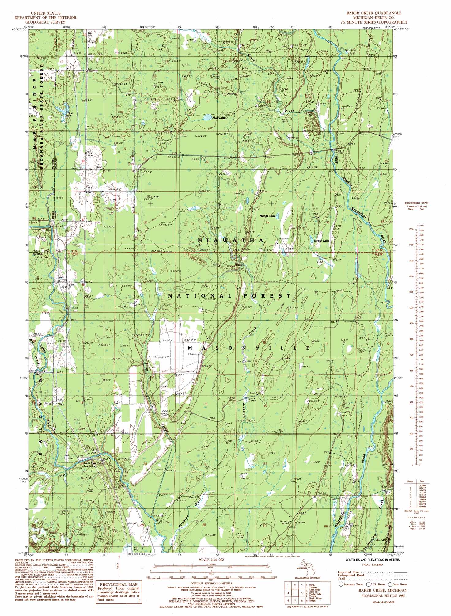
USGS Topo Quad 46086a8 - 1:24,000 scale
| Topo Map Name: | Baker Creek |
| USGS Topo Quad ID: | 46086a8 |
| Print Size: | ca. 21 1/4" wide x 27" high |
| Southeast Coordinates: | 46° N latitude / 86.875° W longitude |
| Map Center Coordinates: | 46.0625° N latitude / 86.9375° W longitude |
| U.S. State: | MI |
| Filename: | o46086a8.jpg |
| Download Map JPG Image: | Baker Creek topo map 1:24,000 scale |
| Map Type: | Topographic |
| Topo Series: | 7.5´ |
| Map Scale: | 1:24,000 |
| Source of Map Images: | United States Geological Survey (USGS) |
| Alternate Map Versions: |
Baker Creek MI 1985, updated 1985 Download PDF Buy paper map Baker Creek MI 2011 Download PDF Buy paper map Baker Creek MI 2014 Download PDF Buy paper map Baker Creek MI 2017 Download PDF Buy paper map |
| FStopo: | US Forest Service topo Baker Creek is available: Download FStopo PDF Download FStopo TIF |
1:24,000 Topo Quads surrounding Baker Creek
Carlshend |
Ladoga |
Chatham |
Forest Lake |
Powell Lake |
Mcfarland |
Diffin |
Trenary |
Lake Stella |
The Lake |
Rock |
Rock Se |
Baker Creek |
Poplar Lake |
Waco Lake |
Cornell |
Perkins |
Rapid River |
Ensign |
Saint Jacques |
Chandler |
Gladstone |
Maywood |
Ogontz |
Nahma |
> Back to 46086a1 at 1:100,000 scale
> Back to 46086a1 at 1:250,000 scale
> Back to U.S. Topo Maps home
Baker Creek topo map: Gazetteer
Baker Creek: Falls
Rapid River Falls elevation 214m 702′Baker Creek: Lakes
Merles Lake elevation 218m 715′Mud Lake elevation 238m 780′
Spring Lake elevation 213m 698′
Baker Creek: Parks
Rapid River Falls County Park elevation 216m 708′Baker Creek: Streams
Baker Creek elevation 200m 656′Casey Creek elevation 215m 705′
Elm Creek elevation 225m 738′
Little West Branch Whitefish River elevation 191m 626′
Baker Creek digital topo map on disk
Buy this Baker Creek topo map showing relief, roads, GPS coordinates and other geographical features, as a high-resolution digital map file on DVD: