Grand Sable Lake Topo Map Michigan
To zoom in, hover over the map of Grand Sable Lake
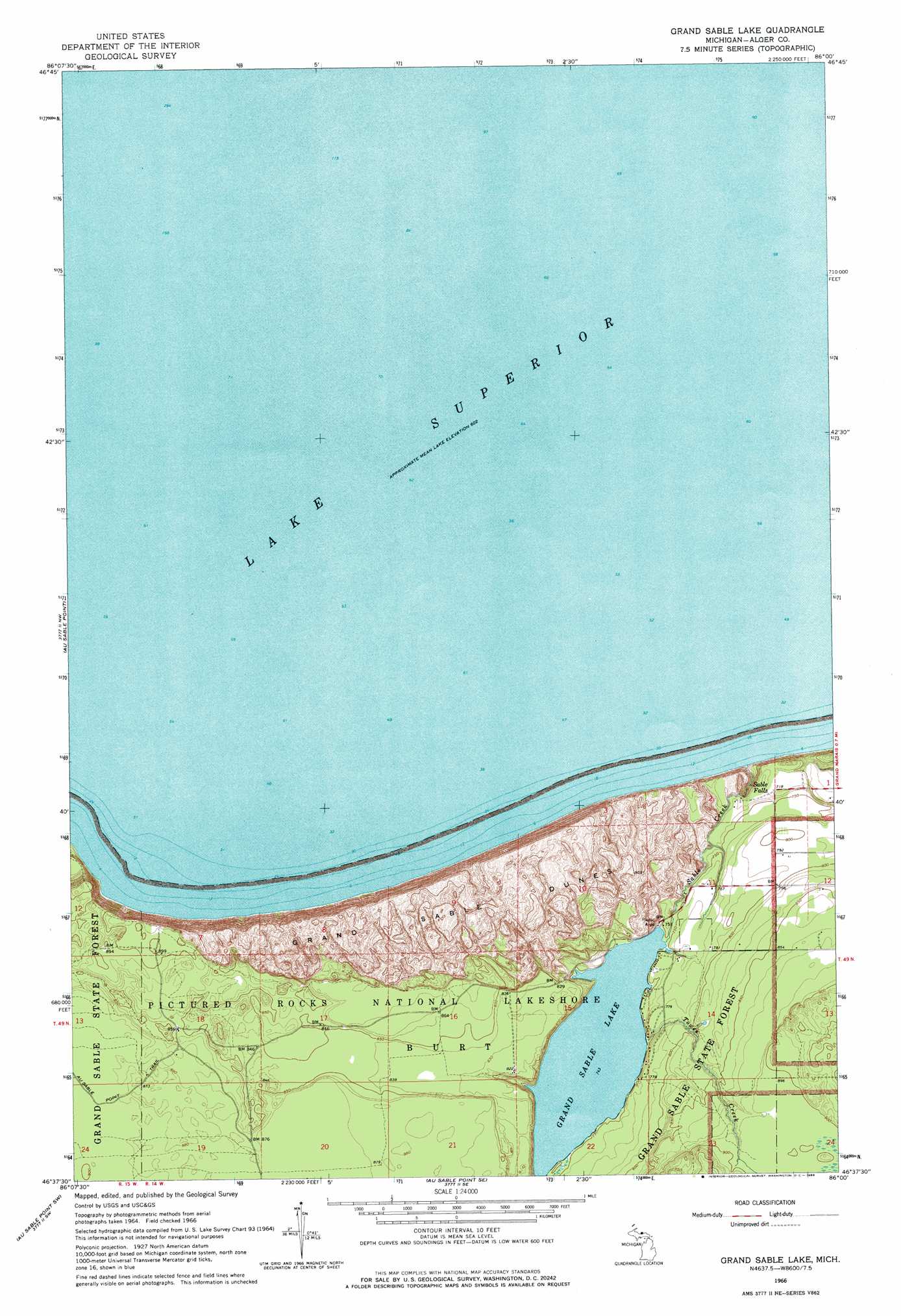
USGS Topo Quad 46086f1 - 1:24,000 scale
| Topo Map Name: | Grand Sable Lake |
| USGS Topo Quad ID: | 46086f1 |
| Print Size: | ca. 21 1/4" wide x 27" high |
| Southeast Coordinates: | 46.625° N latitude / 86° W longitude |
| Map Center Coordinates: | 46.6875° N latitude / 86.0625° W longitude |
| U.S. State: | MI |
| Filename: | o46086f1.jpg |
| Download Map JPG Image: | Grand Sable Lake topo map 1:24,000 scale |
| Map Type: | Topographic |
| Topo Series: | 7.5´ |
| Map Scale: | 1:24,000 |
| Source of Map Images: | United States Geological Survey (USGS) |
| Alternate Map Versions: |
Grand Sable Lake MI 1966, updated 1968 Download PDF Buy paper map Grand Sable Lake MI 2011 Download PDF Buy paper map Grand Sable Lake MI 2014 Download PDF Buy paper map Grand Sable Lake MI 2017 Download PDF Buy paper map |
1:24,000 Topo Quads surrounding Grand Sable Lake
Au Sable Point |
Grand Sable Lake |
Grand Marais |
Grand Marais Ne |
|
Trappers Lake |
Au Sable Point Sw |
Au Sable Point Se |
Nawakwa Lake |
Grand Marais Se |
Cusino |
Driggs Lake |
Sunken Lake |
Seney Nw |
Tahquamenon Lakes |
> Back to 46086e1 at 1:100,000 scale
> Back to 46086a1 at 1:250,000 scale
> Back to U.S. Topo Maps home
Grand Sable Lake topo map: Gazetteer
Grand Sable Lake: Falls
Sable Falls elevation 194m 636′Grand Sable Lake: Lakes
Grand Sable Lake elevation 226m 741′Grand Sable Lake: Streams
Sable Creek elevation 184m 603′Towes Creek elevation 226m 741′
Grand Sable Lake: Summits
Grand Sable Dunes elevation 273m 895′Grand Sable Lake digital topo map on disk
Buy this Grand Sable Lake topo map showing relief, roads, GPS coordinates and other geographical features, as a high-resolution digital map file on DVD: