Rock Se Topo Map Michigan
To zoom in, hover over the map of Rock Se
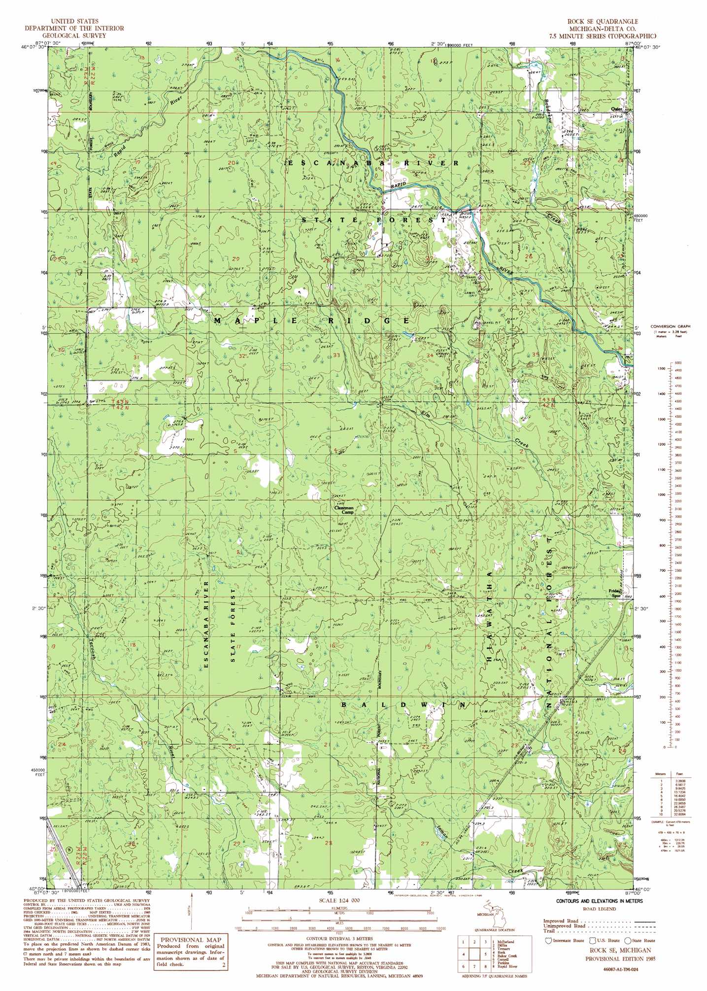
USGS Topo Quad 46087a1 - 1:24,000 scale
| Topo Map Name: | Rock Se |
| USGS Topo Quad ID: | 46087a1 |
| Print Size: | ca. 21 1/4" wide x 27" high |
| Southeast Coordinates: | 46° N latitude / 87° W longitude |
| Map Center Coordinates: | 46.0625° N latitude / 87.0625° W longitude |
| U.S. State: | MI |
| Filename: | o46087a1.jpg |
| Download Map JPG Image: | Rock Se topo map 1:24,000 scale |
| Map Type: | Topographic |
| Topo Series: | 7.5´ |
| Map Scale: | 1:24,000 |
| Source of Map Images: | United States Geological Survey (USGS) |
| Alternate Map Versions: |
Rock SE MI 1985, updated 1985 Download PDF Buy paper map Rock SE MI 2011 Download PDF Buy paper map Rock SE MI 2014 Download PDF Buy paper map Rock SE MI 2017 Download PDF Buy paper map |
| FStopo: | US Forest Service topo Rock SE is available: Download FStopo PDF Download FStopo TIF |
1:24,000 Topo Quads surrounding Rock Se
Little Lake |
Carlshend |
Ladoga |
Chatham |
Forest Lake |
Helena |
Mcfarland |
Diffin |
Trenary |
Lake Stella |
Swimming Hole Creek |
Rock |
Rock Se |
Baker Creek |
Poplar Lake |
Woodlawn |
Cornell |
Perkins |
Rapid River |
Ensign |
Schaffer |
Chandler |
Gladstone |
Maywood |
Ogontz |
> Back to 46087a1 at 1:100,000 scale
> Back to 46086a1 at 1:250,000 scale
> Back to U.S. Topo Maps home
Rock Se topo map: Gazetteer
Rock Se: Populated Places
Osier (historical) elevation 258m 846′Rock Se: Post Offices
Osier Post Office (historical) elevation 258m 846′Rock Se: Streams
Boudreau Creek elevation 243m 797′Deadhorse Creek elevation 274m 898′
Rock Se digital topo map on disk
Buy this Rock Se topo map showing relief, roads, GPS coordinates and other geographical features, as a high-resolution digital map file on DVD: