Northland Ne Topo Map Michigan
To zoom in, hover over the map of Northland Ne
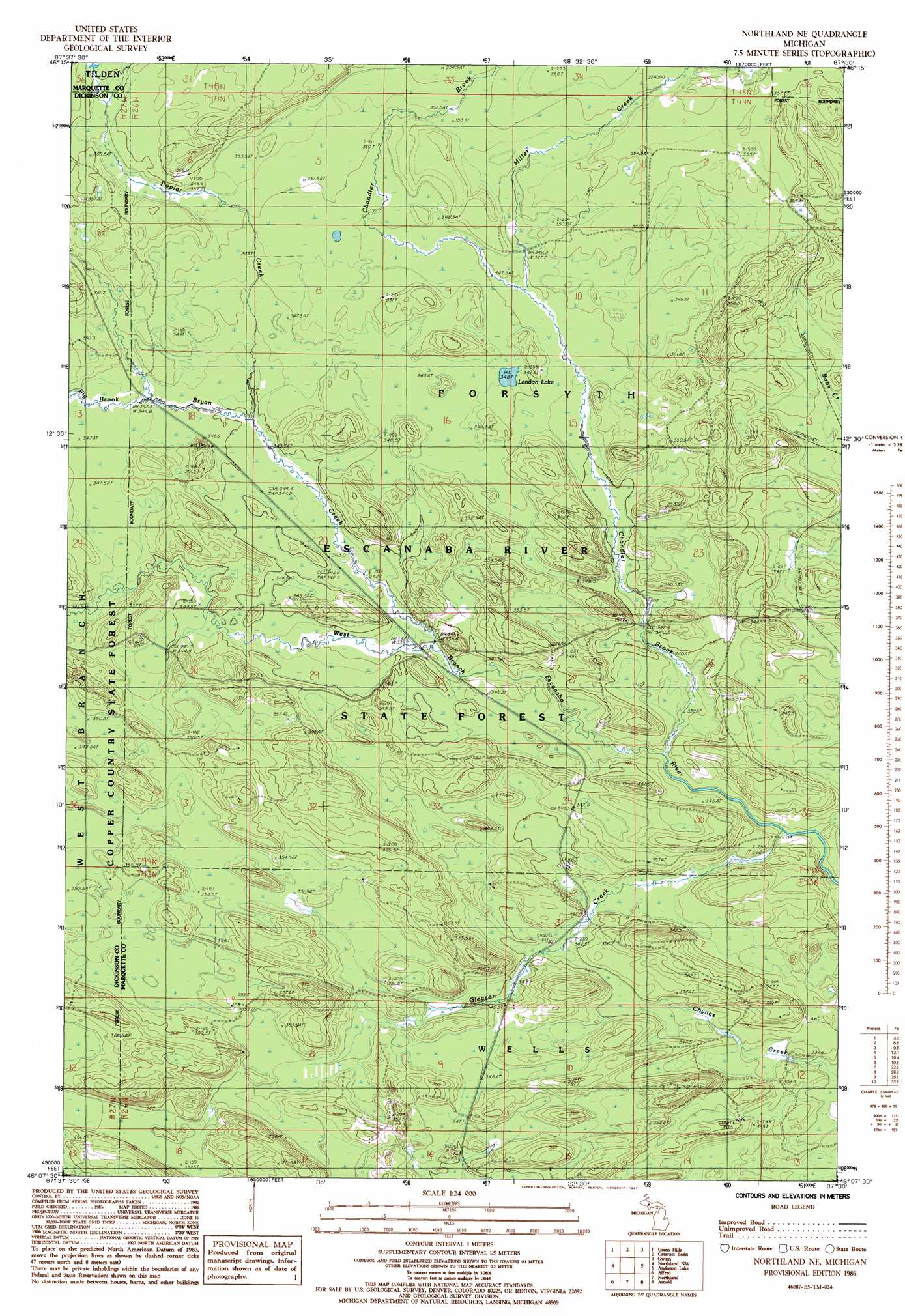
USGS Topo Quad 46087b5 - 1:24,000 scale
| Topo Map Name: | Northland Ne |
| USGS Topo Quad ID: | 46087b5 |
| Print Size: | ca. 21 1/4" wide x 27" high |
| Southeast Coordinates: | 46.125° N latitude / 87.5° W longitude |
| Map Center Coordinates: | 46.1875° N latitude / 87.5625° W longitude |
| U.S. State: | MI |
| Filename: | o46087b5.jpg |
| Download Map JPG Image: | Northland Ne topo map 1:24,000 scale |
| Map Type: | Topographic |
| Topo Series: | 7.5´ |
| Map Scale: | 1:24,000 |
| Source of Map Images: | United States Geological Survey (USGS) |
| Alternate Map Versions: |
Northland NE MI 1986, updated 1987 Download PDF Buy paper map Northland NE MI 2011 Download PDF Buy paper map Northland NE MI 2014 Download PDF Buy paper map Northland NE MI 2017 Download PDF Buy paper map |
1:24,000 Topo Quads surrounding Northland Ne
Greenwood |
Ishpeming |
Palmer |
Sands |
Harvey |
Chabeneau Lake |
Green Hills |
Cataract Basin |
Gwinn |
Little Lake |
Ralph Ne |
Northland Nw |
Northland Ne |
Anderson Lake |
Helena |
Ralph |
Alfred |
Northland |
Arnold |
Swimming Hole Creek |
Felch |
Foster City |
Helps |
La Branche |
Woodlawn |
> Back to 46087a1 at 1:100,000 scale
> Back to 46086a1 at 1:250,000 scale
> Back to U.S. Topo Maps home
Northland Ne topo map: Gazetteer
Northland Ne: Lakes
Landon Lake elevation 349m 1145′Northland Ne: Streams
Big Brook elevation 345m 1131′Bryan Creek elevation 342m 1122′
Chandler Brook elevation 338m 1108′
Gleason Creek elevation 335m 1099′
Miller Creek elevation 348m 1141′
Poplar Creek elevation 345m 1131′
Northland Ne digital topo map on disk
Buy this Northland Ne topo map showing relief, roads, GPS coordinates and other geographical features, as a high-resolution digital map file on DVD: