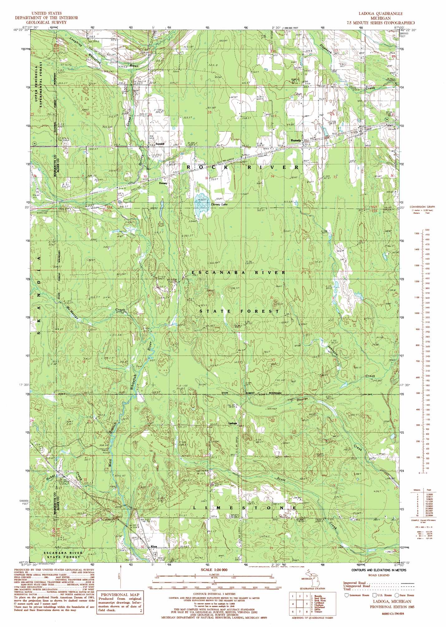
Ladoga Topo Map Michigan
To zoom in, hover over the map of Ladoga
USGS Topo Quad 46087c1 - 1:24,000 scale
| Topo Map Name: | Ladoga |
| USGS Topo Quad ID: | 46087c1 |
| Print Size: | ca. 21 1/4" wide x 27" high |
| Southeast Coordinates: | 46.25° N latitude / 87° W longitude |
| Map Center Coordinates: | 46.3125° N latitude / 87.0625° W longitude |
| U.S. State: | MI |
| Filename: | o46087c1.jpg |
| Download Map JPG Image: | Ladoga topo map 1:24,000 scale |
| Map Type: | Topographic |
| Topo Series: | 7.5´ |
| Map Scale: | 1:24,000 |
| Source of Map Images: | United States Geological Survey (USGS) |
| Alternate Map Versions: |
Ladoga MI 1985, updated 1985 Download PDF Buy paper map Ladoga MI 2011 Download PDF Buy paper map Ladoga MI 2014 Download PDF Buy paper map Ladoga MI 2017 Download PDF Buy paper map |
| FStopo: | US Forest Service topo Ladoga is available: Download FStopo PDF Download FStopo TIF |
1:24,000 Topo Quads surrounding Ladoga
Shot Point |
Laughing Fish Point |
|||
Harvey |
Skandia |
Sand River |
Rock River |
Au Train |
Little Lake |
Carlshend |
Ladoga |
Chatham |
Forest Lake |
Helena |
Mcfarland |
Diffin |
Trenary |
Lake Stella |
Swimming Hole Creek |
Rock |
Rock Se |
Baker Creek |
Poplar Lake |
> Back to 46087a1 at 1:100,000 scale
> Back to 46086a1 at 1:250,000 scale
> Back to U.S. Topo Maps home
Ladoga topo map: Gazetteer
Ladoga: Forests
Escanaba River State Forest elevation 323m 1059′Ladoga: Lakes
Dorsey Lake elevation 323m 1059′Ladoga: Populated Places
Dorsey elevation 316m 1036′Kiva elevation 308m 1010′
Ladoga elevation 307m 1007′
Rumely elevation 322m 1056′
Sundell elevation 322m 1056′
Ladoga: Post Offices
Kiva Post Office (historical) elevation 308m 1010′Rumely Post Office (historical) elevation 322m 1056′
Sundell Post Office (historical) elevation 322m 1056′
Ladoga: Streams
Dorsey Creek elevation 300m 984′Huber Creek elevation 306m 1003′
McMaster Creek elevation 311m 1020′
Ladoga digital topo map on disk
Buy this Ladoga topo map showing relief, roads, GPS coordinates and other geographical features, as a high-resolution digital map file on DVD: