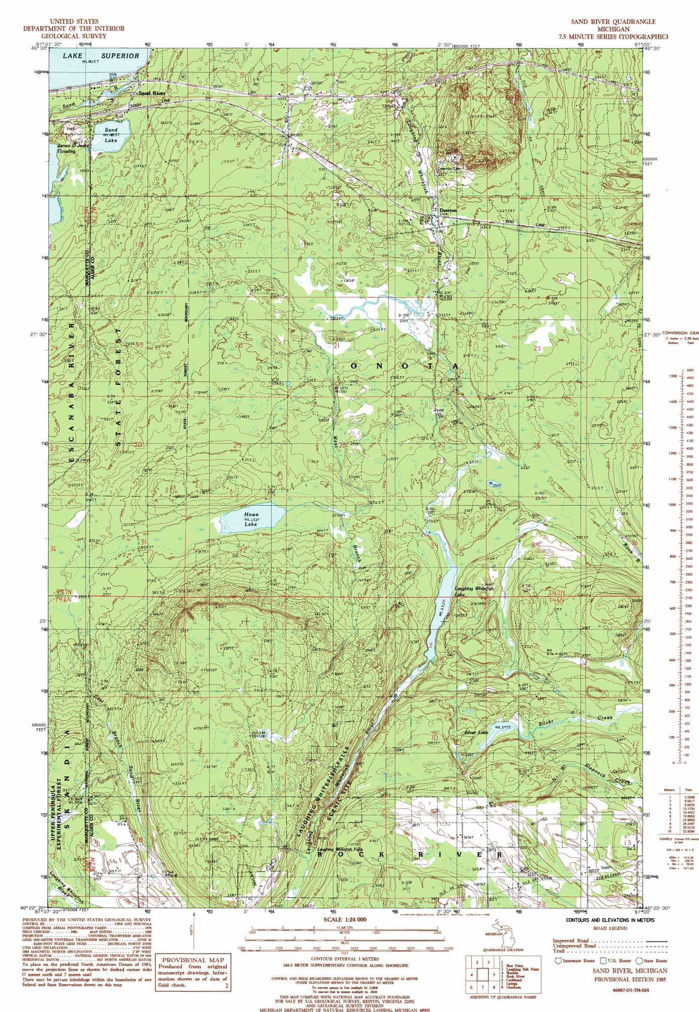
Sand River Topo Map Michigan
To zoom in, hover over the map of Sand River
USGS Topo Quad 46087d1 - 1:24,000 scale
| Topo Map Name: | Sand River |
| USGS Topo Quad ID: | 46087d1 |
| Print Size: | ca. 21 1/4" wide x 27" high |
| Southeast Coordinates: | 46.375° N latitude / 87° W longitude |
| Map Center Coordinates: | 46.4375° N latitude / 87.0625° W longitude |
| U.S. State: | MI |
| Filename: | o46087d1.jpg |
| Download Map JPG Image: | Sand River topo map 1:24,000 scale |
| Map Type: | Topographic |
| Topo Series: | 7.5´ |
| Map Scale: | 1:24,000 |
| Source of Map Images: | United States Geological Survey (USGS) |
| Alternate Map Versions: |
Sand River MI 1985, updated 1985 Download PDF Buy paper map Sand River MI 2011 Download PDF Buy paper map Sand River MI 2014 Download PDF Buy paper map Sand River MI 2017 Download PDF Buy paper map |
| FStopo: | US Forest Service topo Sand River is available: Download FStopo PDF Download FStopo TIF |
1:24,000 Topo Quads surrounding Sand River
Shot Point |
Laughing Fish Point |
|||
Harvey |
Skandia |
Sand River |
Rock River |
Au Train |
Little Lake |
Carlshend |
Ladoga |
Chatham |
Forest Lake |
Helena |
Mcfarland |
Diffin |
Trenary |
Lake Stella |
> Back to 46087a1 at 1:100,000 scale
> Back to 46086a1 at 1:250,000 scale
> Back to U.S. Topo Maps home
Sand River topo map: Gazetteer
Sand River: Falls
Laughing Whitefish Falls elevation 295m 967′Sand River: Lakes
Howe Lake elevation 253m 830′Laughing Whitefish Lake elevation 253m 830′
Sand Lake elevation 189m 620′
Silver Lake elevation 277m 908′
Sand River: Populated Places
Deerton elevation 222m 728′Sand River elevation 192m 629′
Sand River: Post Offices
Deerton Post Office elevation 222m 728′Sand River Post Office (historical) elevation 192m 629′
Sand River Post Office (historical) elevation 192m 629′
Tyoga Post Office (historical) elevation 210m 688′
Sand River: Reservoirs
James D Jeske Flooding elevation 186m 610′James D Jeske Flooding elevation 186m 610′
Sand River: Streams
Sand River elevation 184m 603′West Branch Laughing Whitefish River elevation 230m 754′
Sand River digital topo map on disk
Buy this Sand River topo map showing relief, roads, GPS coordinates and other geographical features, as a high-resolution digital map file on DVD: