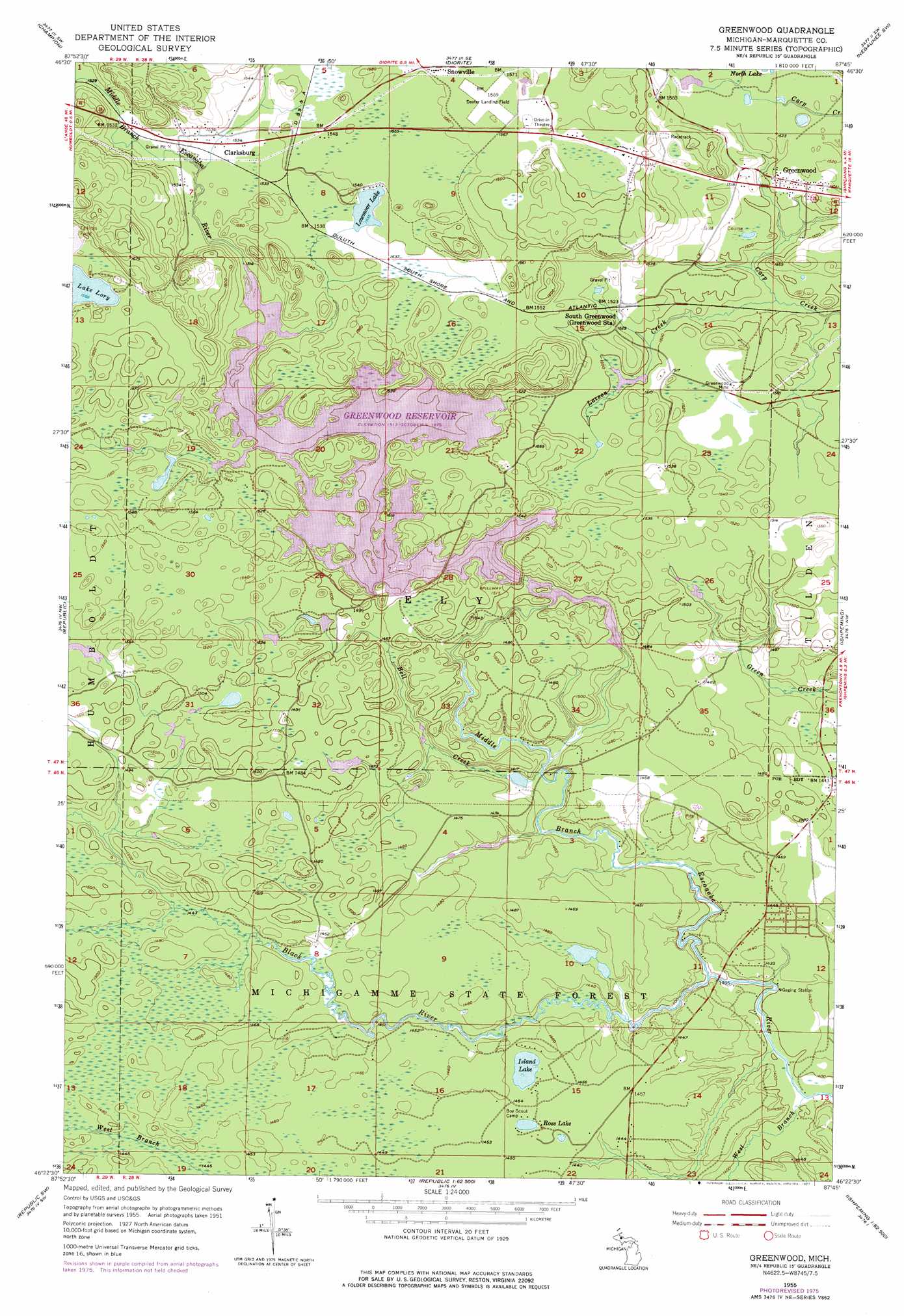
Greenwood Topo Map Michigan
To zoom in, hover over the map of Greenwood
USGS Topo Quad 46087d7 - 1:24,000 scale
| Topo Map Name: | Greenwood |
| USGS Topo Quad ID: | 46087d7 |
| Print Size: | ca. 21 1/4" wide x 27" high |
| Southeast Coordinates: | 46.375° N latitude / 87.75° W longitude |
| Map Center Coordinates: | 46.4375° N latitude / 87.8125° W longitude |
| U.S. State: | MI |
| Filename: | o46087d7.jpg |
| Download Map JPG Image: | Greenwood topo map 1:24,000 scale |
| Map Type: | Topographic |
| Topo Series: | 7.5´ |
| Map Scale: | 1:24,000 |
| Source of Map Images: | United States Geological Survey (USGS) |
| Alternate Map Versions: |
Greenwood MI 1955, updated 1956 Download PDF Buy paper map Greenwood MI 1955, updated 1973 Download PDF Buy paper map Greenwood MI 1955, updated 1977 Download PDF Buy paper map Greenwood MI 2011 Download PDF Buy paper map Greenwood MI 2014 Download PDF Buy paper map Greenwood MI 2017 Download PDF Buy paper map |
1:24,000 Topo Quads surrounding Greenwood
Summit Lake |
Bulldog Lake |
Silver Lake Basin |
Negaunee Nw |
Buckroe |
Michigamme |
Champion |
Diorite |
Negaunee Sw |
Negaunee |
Witch Lake Ne |
Republic |
Greenwood |
Ishpeming |
Palmer |
Witch Lake |
Republic Sw |
Chabeneau Lake |
Green Hills |
Cataract Basin |
Channing |
Ralph Nw |
Ralph Ne |
Northland Nw |
Northland Ne |
> Back to 46087a1 at 1:100,000 scale
> Back to 46086a1 at 1:250,000 scale
> Back to U.S. Topo Maps home
Greenwood topo map: Gazetteer
Greenwood: Falls
Black River Falls elevation 427m 1400′Greenwood: Lakes
Island Lake elevation 442m 1450′Lake Unky elevation 442m 1450′
Lowmoor Lake elevation 468m 1535′
Greenwood: Populated Places
Clarksburg elevation 468m 1535′Greenwood elevation 463m 1519′
Snowville elevation 477m 1564′
South Greenwood elevation 463m 1519′
Greenwood: Post Offices
Clarksburg Post Office (historical) elevation 468m 1535′Greenwood: Reservoirs
Greenwood Reservoir elevation 462m 1515′Greenwood: Streams
Bell Creek elevation 431m 1414′Black River elevation 424m 1391′
Larson Creek elevation 448m 1469′
West Branch Middle Branch Escanaba River elevation 423m 1387′
Greenwood digital topo map on disk
Buy this Greenwood topo map showing relief, roads, GPS coordinates and other geographical features, as a high-resolution digital map file on DVD: