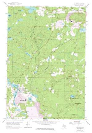
Republic Topo Map Michigan
To zoom in, hover over the map of Republic
USGS Topo Quad 46087d8 - 1:24,000 scale
| Topo Map Name: | Republic |
| USGS Topo Quad ID: | 46087d8 |
| Print Size: | ca. 21 1/4" wide x 27" high |
| Southeast Coordinates: | 46.375° N latitude / 87.875° W longitude |
| Map Center Coordinates: | 46.4375° N latitude / 87.9375° W longitude |
| U.S. State: | MI |
| Filename: | o46087d8.jpg |
| Download Map JPG Image: | Republic topo map 1:24,000 scale |
| Map Type: | Topographic |
| Topo Series: | 7.5´ |
| Map Scale: | 1:24,000 |
| Source of Map Images: | United States Geological Survey (USGS) |
| Alternate Map Versions: |
Republic MI 1955, updated 1957 Download PDF Buy paper map Republic MI 1955, updated 1977 Download PDF Buy paper map Republic MI 2011 Download PDF Buy paper map Republic MI 2014 Download PDF Buy paper map Republic MI 2017 Download PDF Buy paper map |
1:24,000 Topo Quads surrounding Republic
> Back to 46087a1 at 1:100,000 scale
> Back to 46086a1 at 1:250,000 scale
> Back to U.S. Topo Maps home
Republic topo map: Gazetteer
Republic: Bays
White Horse Bay elevation 451m 1479′Republic: Forests
Michigamme State Forest elevation 458m 1502′Republic: Lakes
Autio Lake elevation 480m 1574′Birch Lake elevation 453m 1486′
Buto Lake elevation 480m 1574′
Egg Lake elevation 496m 1627′
Fish Lake elevation 488m 1601′
Granite Lake elevation 480m 1574′
Horseshoe Lake elevation 504m 1653′
Kirk Lake elevation 479m 1571′
Lake Lory elevation 475m 1558′
Michigamme Basin elevation 457m 1499′
Milwaukee Lake elevation 468m 1535′
Mud Lake elevation 493m 1617′
Mud Lake elevation 485m 1591′
Perch Lake elevation 468m 1535′
Perch Lake elevation 488m 1601′
The Basin elevation 457m 1499′
Tower Lake elevation 463m 1519′
Twin Lake elevation 488m 1601′
Republic: Mines
Republic Mine elevation 497m 1630′Republic: Populated Places
Humboldt elevation 470m 1541′Humboldt Mine elevation 487m 1597′
Republic elevation 464m 1522′
Republic: Post Offices
Humboldt Post Office (historical) elevation 470m 1541′Republic Post Office elevation 462m 1515′
Republic: Streams
Bruce Creek elevation 456m 1496′Trout Falls Creek elevation 448m 1469′
Republic digital topo map on disk
Buy this Republic topo map showing relief, roads, GPS coordinates and other geographical features, as a high-resolution digital map file on DVD:


