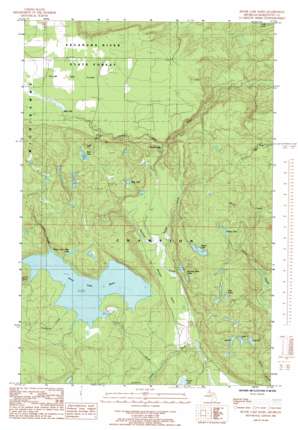
Silver Lake Basin Topo Map Michigan
To zoom in, hover over the map of Silver Lake Basin
USGS Topo Quad 46087f7 - 1:24,000 scale
| Topo Map Name: | Silver Lake Basin |
| USGS Topo Quad ID: | 46087f7 |
| Print Size: | ca. 21 1/4" wide x 27" high |
| Southeast Coordinates: | 46.625° N latitude / 87.75° W longitude |
| Map Center Coordinates: | 46.6875° N latitude / 87.8125° W longitude |
| U.S. State: | MI |
| Filename: | o46087f7.jpg |
| Download Map JPG Image: | Silver Lake Basin topo map 1:24,000 scale |
| Map Type: | Topographic |
| Topo Series: | 7.5´ |
| Map Scale: | 1:24,000 |
| Source of Map Images: | United States Geological Survey (USGS) |
| Alternate Map Versions: |
Silver Lake Basin MI 1985, updated 1985 Download PDF Buy paper map Silver Lake Basin MI 1996, updated 1999 Download PDF Buy paper map Silver Lake Basin MI 2011 Download PDF Buy paper map Silver Lake Basin MI 2014 Download PDF Buy paper map Silver Lake Basin MI 2017 Download PDF Buy paper map |
1:24,000 Topo Quads surrounding Silver Lake Basin
> Back to 46087e1 at 1:100,000 scale
> Back to 46086a1 at 1:250,000 scale
> Back to U.S. Topo Maps home
Silver Lake Basin topo map: Gazetteer
Silver Lake Basin: Falls
Mulligan Falls elevation 429m 1407′Pinnacle Falls elevation 376m 1233′
Wylie Falls elevation 430m 1410′
Silver Lake Basin: Flats
Mulligan Plains elevation 423m 1387′Yellow Dog Plains elevation 440m 1443′
Silver Lake Basin: Lakes
2 Lake elevation 497m 1630′3 Lake elevation 491m 1610′
8 Lake elevation 509m 1669′
Bob Lake elevation 510m 1673′
Hills Lakes elevation 521m 1709′
Island Lake elevation 524m 1719′
Penny Lake elevation 520m 1706′
Rocking Chair Lakes elevation 463m 1519′
Silver Lead Mine Lake elevation 483m 1584′
Stag Lake elevation 497m 1630′
Silver Lake Basin: Reservoirs
Silver Lake Basin elevation 453m 1486′Silver Lake Basin: Streams
Bob Creek elevation 414m 1358′Coles Creek elevation 453m 1486′
Connors Creek elevation 418m 1371′
Mulligan Creek elevation 410m 1345′
Outlet Creek elevation 422m 1384′
Voelkers Creek elevation 458m 1502′
Silver Lake Basin digital topo map on disk
Buy this Silver Lake Basin topo map showing relief, roads, GPS coordinates and other geographical features, as a high-resolution digital map file on DVD:


