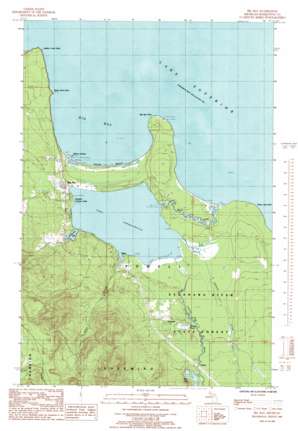
Big Bay Topo Map Michigan
To zoom in, hover over the map of Big Bay
USGS Topo Quad 46087g6 - 1:24,000 scale
| Topo Map Name: | Big Bay |
| USGS Topo Quad ID: | 46087g6 |
| Print Size: | ca. 21 1/4" wide x 27" high |
| Southeast Coordinates: | 46.75° N latitude / 87.625° W longitude |
| Map Center Coordinates: | 46.8125° N latitude / 87.6875° W longitude |
| U.S. State: | MI |
| Filename: | o46087g6.jpg |
| Download Map JPG Image: | Big Bay topo map 1:24,000 scale |
| Map Type: | Topographic |
| Topo Series: | 7.5´ |
| Map Scale: | 1:24,000 |
| Source of Map Images: | United States Geological Survey (USGS) |
| Alternate Map Versions: |
Big Bay MI 1985, updated 1985 Download PDF Buy paper map Big Bay MI 2011 Download PDF Buy paper map Big Bay MI 2014 Download PDF Buy paper map Big Bay MI 2017 Download PDF Buy paper map |
1:24,000 Topo Quads surrounding Big Bay
Howe Lake |
Huron Mountain |
|||
Mountain Lake |
Ives Hill |
Big Bay |
Granite Point |
|
Bulldog Lake |
Silver Lake Basin |
Negaunee Nw |
Buckroe |
Marquette Nw |
Champion |
Diorite |
Negaunee Sw |
Negaunee |
Marquette |
> Back to 46087e1 at 1:100,000 scale
> Back to 46086a1 at 1:250,000 scale
> Back to U.S. Topo Maps home
Big Bay topo map: Gazetteer
Big Bay: Bays
Big Bay elevation 183m 600′Big Bay: Beaches
Squaw Beach elevation 185m 606′Big Bay: Capes
Big Bay Point elevation 189m 620′Black Rock Cape elevation 184m 603′
Salmon Trout Point elevation 209m 685′
Yellow Dog Point elevation 187m 613′
Big Bay: Falls
Alder Falls elevation 240m 787′Big Bay: Lakes
Bear Lake elevation 206m 675′Brandts Pond elevation 198m 649′
McKenzie Bay elevation 194m 636′
Big Bay: Parks
Perkins County Park elevation 195m 639′Big Bay: Populated Places
Alder elevation 199m 652′Antlers elevation 208m 682′
Big Bay elevation 208m 682′
Burns Landing elevation 187m 613′
Homeier elevation 205m 672′
Big Bay: Post Offices
Big Bay Post Office elevation 214m 702′Big Bay: Reservoirs
Lake Independence elevation 190m 623′Big Bay: Streams
Alder Creek elevation 195m 639′Iron River elevation 183m 600′
Johnson Creek elevation 193m 633′
Yellow Dog River elevation 194m 636′
Big Bay digital topo map on disk
Buy this Big Bay topo map showing relief, roads, GPS coordinates and other geographical features, as a high-resolution digital map file on DVD:


