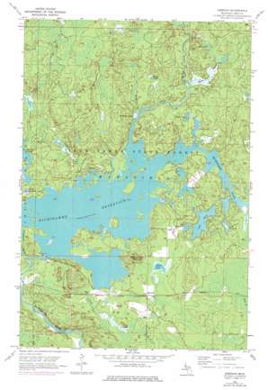
Kiernan Topo Map Michigan
To zoom in, hover over the map of Kiernan
USGS Topo Quad 46088b2 - 1:24,000 scale
| Topo Map Name: | Kiernan |
| USGS Topo Quad ID: | 46088b2 |
| Print Size: | ca. 21 1/4" wide x 27" high |
| Southeast Coordinates: | 46.125° N latitude / 88.125° W longitude |
| Map Center Coordinates: | 46.1875° N latitude / 88.1875° W longitude |
| U.S. State: | MI |
| Filename: | o46088b2.jpg |
| Download Map JPG Image: | Kiernan topo map 1:24,000 scale |
| Map Type: | Topographic |
| Topo Series: | 7.5´ |
| Map Scale: | 1:24,000 |
| Source of Map Images: | United States Geological Survey (USGS) |
| Alternate Map Versions: |
Kiernan MI 1947, updated 1947 Download PDF Buy paper map Kiernan MI 1956, updated 1957 Download PDF Buy paper map Kiernan MI 1956, updated 1977 Download PDF Buy paper map Kiernan MI 1956, updated 1977 Download PDF Buy paper map Kiernan MI 2011 Download PDF Buy paper map Kiernan MI 2014 Download PDF Buy paper map Kiernan MI 2017 Download PDF Buy paper map |
1:24,000 Topo Quads surrounding Kiernan
> Back to 46088a1 at 1:100,000 scale
> Back to 46088a1 at 1:250,000 scale
> Back to U.S. Topo Maps home
Kiernan topo map: Gazetteer
Kiernan: Airports
Huber Airport elevation 429m 1407′Kiernan: Dams
Hemlock Falls Dam elevation 404m 1325′Way Dam elevation 417m 1368′
Kiernan: Falls
Margeson Falls elevation 446m 1463′Kiernan: Lakes
Beaver Lake elevation 432m 1417′Butler Lake elevation 431m 1414′
Corbett Lake elevation 418m 1371′
Crotch Lake elevation 419m 1374′
Lake Ellen elevation 423m 1387′
Lake Wallace elevation 421m 1381′
Little Lake Ellen elevation 425m 1394′
Moccasin Lake elevation 418m 1371′
North Deerskin Lake elevation 417m 1368′
Shiner Lake elevation 427m 1400′
Spot Lake elevation 433m 1420′
Kiernan: Populated Places
Kiernan elevation 427m 1400′Kiernan: Post Offices
Maywood Post Office (historical) elevation 427m 1400′Kiernan: Reservoirs
Michigamme Reservoir elevation 417m 1368′Kiernan: Streams
Clarks Creek elevation 409m 1341′Fence River elevation 418m 1371′
Margeson Creek elevation 421m 1381′
McMillan Creek elevation 418m 1371′
Michigamme Slough elevation 408m 1338′
Noyes Creek elevation 418m 1371′
Threemile Creek elevation 425m 1394′
Kiernan: Summits
Michigamme Mountain elevation 476m 1561′Kiernan digital topo map on disk
Buy this Kiernan topo map showing relief, roads, GPS coordinates and other geographical features, as a high-resolution digital map file on DVD:


