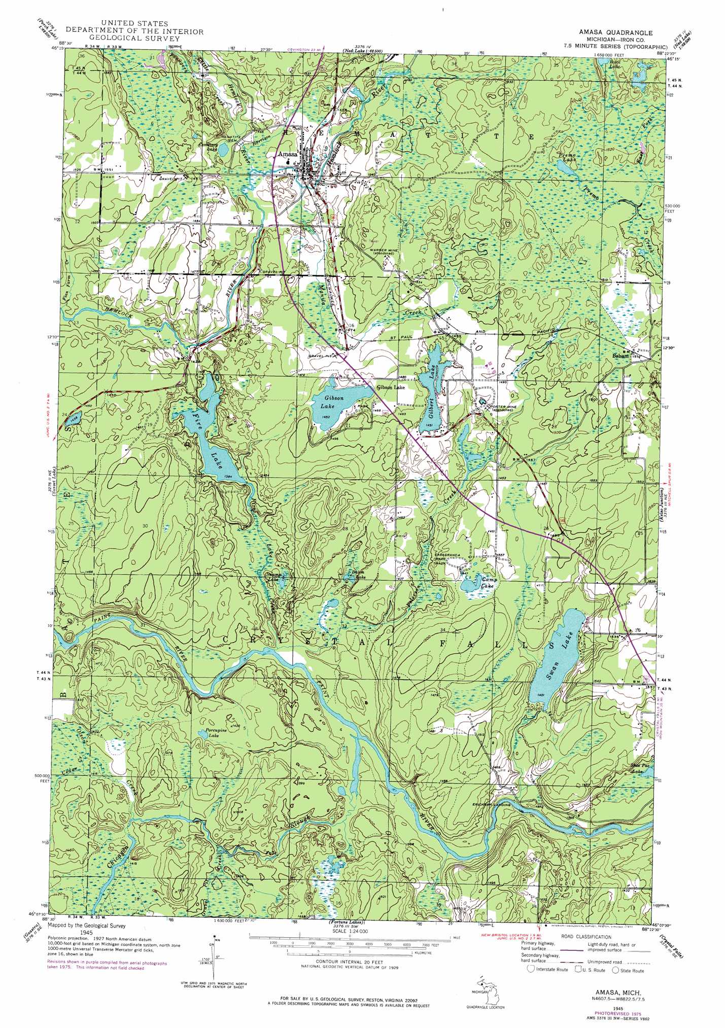
Amasa Topo Map Michigan
To zoom in, hover over the map of Amasa
USGS Topo Quad 46088b4 - 1:24,000 scale
| Topo Map Name: | Amasa |
| USGS Topo Quad ID: | 46088b4 |
| Print Size: | ca. 21 1/4" wide x 27" high |
| Southeast Coordinates: | 46.125° N latitude / 88.375° W longitude |
| Map Center Coordinates: | 46.1875° N latitude / 88.4375° W longitude |
| U.S. State: | MI |
| Filename: | o46088b4.jpg |
| Download Map JPG Image: | Amasa topo map 1:24,000 scale |
| Map Type: | Topographic |
| Topo Series: | 7.5´ |
| Map Scale: | 1:24,000 |
| Source of Map Images: | United States Geological Survey (USGS) |
| Alternate Map Versions: |
Amasa MI 1945, updated 1970 Download PDF Buy paper map Amasa MI 1945, updated 1977 Download PDF Buy paper map Amasa MI 1947 Download PDF Buy paper map Amasa MI 2011 Download PDF Buy paper map Amasa MI 2014 Download PDF Buy paper map Amasa MI 2016 Download PDF Buy paper map |
1:24,000 Topo Quads surrounding Amasa
Marten Lake |
Tunis |
Drummond Lake |
Ned Lake |
Nelson Lake |
Perch Lake |
Porter Lake |
Triangle Ranch |
Neo Lake Se |
Hickman Lake |
Gibbs City |
Sunset Lake |
Amasa |
Kelso Junction |
Kiernan |
Iron River |
Gaastra |
Fortune Lakes |
Crystal Falls |
Lake Mary |
Tipler |
Long Lake Ne |
Naults |
Florence West |
Florence East |
> Back to 46088a1 at 1:100,000 scale
> Back to 46088a1 at 1:250,000 scale
> Back to U.S. Topo Maps home
Amasa topo map: Gazetteer
Amasa: Falls
Chicagon Falls elevation 421m 1381′Amasa: Lakes
Camp Lake elevation 442m 1450′Cemetery Lake elevation 439m 1440′
Dahm Lake elevation 421m 1381′
Fire Lake elevation 422m 1384′
Gibson Lake elevation 442m 1450′
Gilbert Lake elevation 442m 1450′
Porcupine Lake elevation 433m 1420′
Premo Lake elevation 460m 1509′
Shoe Pac Lake elevation 420m 1377′
Swamp Lake elevation 421m 1381′
Swan Lake elevation 427m 1400′
Amasa: Mines
Porter Mine elevation 448m 1469′Warner Mine elevation 475m 1558′
Amasa: Parks
Gibson Lake Park elevation 445m 1459′Amasa: Populated Places
Amasa elevation 439m 1440′Balsam elevation 463m 1519′
Erickson Landing elevation 409m 1341′
Gibson Lake elevation 451m 1479′
Amasa: Post Offices
Amasa Post Office elevation 439m 1440′Balsam Post Office (historical) elevation 463m 1519′
Amasa: Streams
Cedar Creek elevation 433m 1420′Chicagon Slough elevation 415m 1361′
East Fork Premo Creek elevation 457m 1499′
Fire Lake Creek elevation 415m 1361′
Gravel Pit Creek elevation 421m 1381′
Harrison Creek elevation 439m 1440′
Little Hemlock River elevation 439m 1440′
Manila Creek elevation 439m 1440′
Olson Creek elevation 433m 1420′
Peterson Creek elevation 415m 1361′
Railroad Creek elevation 451m 1479′
Youngers Creek elevation 439m 1440′
Amasa digital topo map on disk
Buy this Amasa topo map showing relief, roads, GPS coordinates and other geographical features, as a high-resolution digital map file on DVD: