Tunis Topo Map Michigan
To zoom in, hover over the map of Tunis
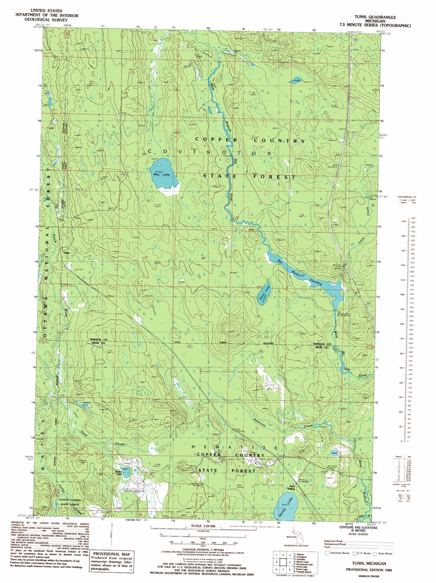
USGS Topo Quad 46088d5 - 1:24,000 scale
| Topo Map Name: | Tunis |
| USGS Topo Quad ID: | 46088d5 |
| Print Size: | ca. 21 1/4" wide x 27" high |
| Southeast Coordinates: | 46.375° N latitude / 88.5° W longitude |
| Map Center Coordinates: | 46.4375° N latitude / 88.5625° W longitude |
| U.S. State: | MI |
| Filename: | o46088d5.jpg |
| Download Map JPG Image: | Tunis topo map 1:24,000 scale |
| Map Type: | Topographic |
| Topo Series: | 7.5´ |
| Map Scale: | 1:24,000 |
| Source of Map Images: | United States Geological Survey (USGS) |
| Alternate Map Versions: |
Tunis MI 1985, updated 1986 Download PDF Buy paper map Tunis MI 2011 Download PDF Buy paper map Tunis MI 2014 Download PDF Buy paper map Tunis MI 2016 Download PDF Buy paper map |
| FStopo: | US Forest Service topo Tunis is available: Download FStopo PDF Download FStopo TIF |
1:24,000 Topo Quads surrounding Tunis
Vista Falls |
Prickett Lake |
Baraga Plains |
Alberta |
Herman |
Echo Lake |
Sidnaw |
Covington |
Vermilac |
Nestoria |
Glitter Lake |
Marten Lake |
Tunis |
Drummond Lake |
Ned Lake |
Winslow Lake |
Perch Lake |
Porter Lake |
Triangle Ranch |
Neo Lake Se |
Beechwood |
Gibbs City |
Sunset Lake |
Amasa |
Kelso Junction |
> Back to 46088a1 at 1:100,000 scale
> Back to 46088a1 at 1:250,000 scale
> Back to U.S. Topo Maps home
Tunis topo map: Gazetteer
Tunis: Lakes
Herbs Lake elevation 461m 1512′May Lake elevation 486m 1594′
Saine Lake elevation 469m 1538′
Spring Lake elevation 461m 1512′
Tunis: Populated Places
Tunis elevation 455m 1492′Tunis: Post Offices
Net River Post Office (historical) elevation 463m 1519′Tunis: Reservoirs
Net River Flooding elevation 469m 1538′Tunis: Streams
Dead Slough elevation 455m 1492′Dead Stream elevation 455m 1492′
East Branch Net River elevation 447m 1466′
Goblin Creek elevation 455m 1492′
Reservoir Creek elevation 450m 1476′
Tracy Creek elevation 469m 1538′
West Branch Net River elevation 447m 1466′
Tunis digital topo map on disk
Buy this Tunis topo map showing relief, roads, GPS coordinates and other geographical features, as a high-resolution digital map file on DVD: