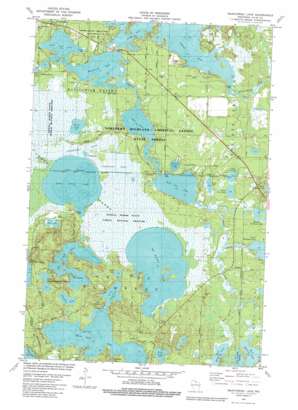
Manitowish Lake Topo Map Wisconsin
To zoom in, hover over the map of Manitowish Lake
USGS Topo Quad 46089a7 - 1:24,000 scale
| Topo Map Name: | Manitowish Lake |
| USGS Topo Quad ID: | 46089a7 |
| Print Size: | ca. 21 1/4" wide x 27" high |
| Southeast Coordinates: | 46° N latitude / 89.75° W longitude |
| Map Center Coordinates: | 46.0625° N latitude / 89.8125° W longitude |
| U.S. State: | WI |
| Filename: | o46089a7.jpg |
| Download Map JPG Image: | Manitowish Lake topo map 1:24,000 scale |
| Map Type: | Topographic |
| Topo Series: | 7.5´ |
| Map Scale: | 1:24,000 |
| Source of Map Images: | United States Geological Survey (USGS) |
| Alternate Map Versions: |
Manitowish Lake WI 1981, updated 1982 Download PDF Buy paper map Manitowish Lake WI 2010 Download PDF Buy paper map Manitowish Lake WI 2013 Download PDF Buy paper map Manitowish Lake WI 2015 Download PDF Buy paper map |
1:24,000 Topo Quads surrounding Manitowish Lake
> Back to 46089a1 at 1:100,000 scale
> Back to 46088a1 at 1:250,000 scale
> Back to U.S. Topo Maps home
Manitowish Lake topo map: Gazetteer
Manitowish Lake: Capes
Catfish Point elevation 491m 1610′Manitowish Lake: Lakes
Alder Lake elevation 488m 1601′Big Crooked Lake elevation 492m 1614′
Bolin Lake elevation 490m 1607′
Eagle Lake elevation 493m 1617′
East Ellerson Lake elevation 492m 1614′
Elsie Lake elevation 493m 1617′
Great Corn Lake elevation 492m 1614′
Ike Walton Lake elevation 493m 1617′
Island Lake elevation 488m 1601′
Little Corn Lake elevation 493m 1617′
Little Sand Lake elevation 491m 1610′
Little Star Lake elevation 488m 1601′
Little Sugarbush Lake elevation 491m 1610′
Little Trout Lake elevation 490m 1607′
Lower Gresham Lake elevation 489m 1604′
Manitowish Lake elevation 488m 1601′
Middle Ellerson Lake elevation 493m 1617′
Middle Gresham Lake elevation 488m 1601′
Nelson Lake elevation 489m 1604′
Snort Lake elevation 490m 1607′
Spider Lake elevation 488m 1601′
Sunfish Lake elevation 492m 1614′
West Ellerson Lake elevation 490m 1607′
White Sand Lake elevation 491m 1610′
Wild Rice Lake elevation 488m 1601′
Zee Lake elevation 492m 1614′
Manitowish Lake: Streams
Gresham Creek elevation 491m 1610′Mud Creek elevation 491m 1610′
Trout River elevation 488m 1601′
Manitowish Lake digital topo map on disk
Buy this Manitowish Lake topo map showing relief, roads, GPS coordinates and other geographical features, as a high-resolution digital map file on DVD:


