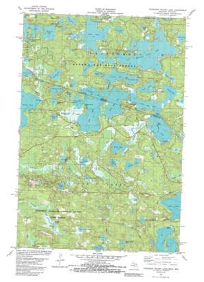
Thousand Island Lake Topo Map Wisconsin
To zoom in, hover over the map of Thousand Island Lake
USGS Topo Quad 46089b4 - 1:24,000 scale
| Topo Map Name: | Thousand Island Lake |
| USGS Topo Quad ID: | 46089b4 |
| Print Size: | ca. 21 1/4" wide x 27" high |
| Southeast Coordinates: | 46.125° N latitude / 89.375° W longitude |
| Map Center Coordinates: | 46.1875° N latitude / 89.4375° W longitude |
| U.S. States: | WI, MI |
| Filename: | o46089b4.jpg |
| Download Map JPG Image: | Thousand Island Lake topo map 1:24,000 scale |
| Map Type: | Topographic |
| Topo Series: | 7.5´ |
| Map Scale: | 1:24,000 |
| Source of Map Images: | United States Geological Survey (USGS) |
| Alternate Map Versions: |
Thousand Island Lake MI 1981, updated 1982 Download PDF Buy paper map Thousand Island Lake MI 1981, updated 1989 Download PDF Buy paper map Thousand Island Lake MI 1999, updated 2005 Download PDF Buy paper map Thousand Island Lake MI 2011 Download PDF Buy paper map Thousand Island Lake MI 2014 Download PDF Buy paper map Thousand Island Lake MI 2017 Download PDF Buy paper map |
| FStopo: | US Forest Service topo Thousand Island Lake is available: Download FStopo PDF Download FStopo TIF |
1:24,000 Topo Quads surrounding Thousand Island Lake
> Back to 46089a1 at 1:100,000 scale
> Back to 46088a1 at 1:250,000 scale
> Back to U.S. Topo Maps home
Thousand Island Lake topo map: Gazetteer
Thousand Island Lake: Bays
Palmer Bay elevation 513m 1683′Thousand Island Lake: Capes
Indian Point elevation 523m 1715′Meadowwoods Point elevation 513m 1683′
Thousand Island Lake: Islands
Belle Island elevation 513m 1683′Thousand Island Lake: Lakes
Balsam Lake elevation 519m 1702′Bay Lake elevation 514m 1686′
Benny Lake elevation 517m 1696′
Big Lake elevation 513m 1683′
Big Mosquito Lake elevation 520m 1706′
Brown Lake elevation 504m 1653′
Cedar Lake elevation 521m 1709′
Cisco Lake elevation 513m 1683′
Cleveland Lake elevation 521m 1709′
Coffee Lake elevation 504m 1653′
Cox Lake elevation 514m 1686′
Crampton Lake elevation 510m 1673′
Dalzell Lake elevation 512m 1679′
Deadwood Lake elevation 512m 1679′
Deerpath Lake elevation 513m 1683′
Dream Lake elevation 514m 1686′
Dumbbell Lake elevation 529m 1735′
Dutch Lake elevation 515m 1689′
East Bay Lake elevation 513m 1683′
Emeline Lake elevation 514m 1686′
Erwin Lake elevation 518m 1699′
Fishhawk Lake elevation 513m 1683′
Forest Lake elevation 521m 1709′
Gilbert Lake elevation 518m 1699′
Grace Lake elevation 521m 1709′
Gray Lake elevation 518m 1699′
Guides Lake elevation 514m 1686′
Hardin Lake elevation 521m 1709′
Helen Lake elevation 513m 1683′
Indian Lake elevation 513m 1683′
Jane Lake elevation 518m 1699′
Kickapoo Lake elevation 504m 1653′
Lac du Lune elevation 524m 1719′
Lake of the Woods elevation 528m 1732′
Lindsley Lake elevation 513m 1683′
Little Mosquito Lake elevation 522m 1712′
Mamie Lake elevation 513m 1683′
Mamie Lake elevation 513m 1683′
McCullough Lake elevation 519m 1702′
Michigan Bay elevation 513m 1683′
Midget Lake elevation 519m 1702′
Morley Lake elevation 513m 1683′
Mule Lake elevation 518m 1699′
Perry Lake elevation 513m 1683′
Poor Lake elevation 513m 1683′
Thousand Island Lake elevation 513m 1683′
Tower Lake elevation 520m 1706′
West Bay Lake elevation 513m 1683′
West Bay Lake elevation 513m 1683′
White Spruce Lake elevation 528m 1732′
Thousand Island Lake: Springs
Garland Springs elevation 507m 1663′Thousand Island Lake: Streams
Helen Creek elevation 520m 1706′Plum Creek elevation 504m 1653′
Spring Creek elevation 518m 1699′
Whitefish Creek elevation 514m 1686′
Thousand Island Lake digital topo map on disk
Buy this Thousand Island Lake topo map showing relief, roads, GPS coordinates and other geographical features, as a high-resolution digital map file on DVD:


