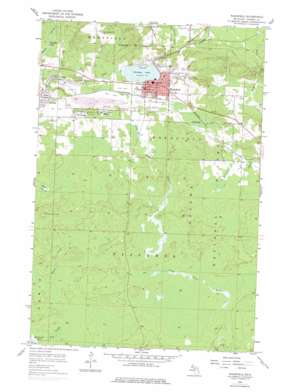
Wakefield Topo Map Michigan
To zoom in, hover over the map of Wakefield
USGS Topo Quad 46089d8 - 1:24,000 scale
| Topo Map Name: | Wakefield |
| USGS Topo Quad ID: | 46089d8 |
| Print Size: | ca. 21 1/4" wide x 27" high |
| Southeast Coordinates: | 46.375° N latitude / 89.875° W longitude |
| Map Center Coordinates: | 46.4375° N latitude / 89.9375° W longitude |
| U.S. State: | MI |
| Filename: | o46089d8.jpg |
| Download Map JPG Image: | Wakefield topo map 1:24,000 scale |
| Map Type: | Topographic |
| Topo Series: | 7.5´ |
| Map Scale: | 1:24,000 |
| Source of Map Images: | United States Geological Survey (USGS) |
| Alternate Map Versions: |
Wakefield MI 1955, updated 1957 Download PDF Buy paper map Wakefield MI 1955, updated 1977 Download PDF Buy paper map Wakefield MI 1999, updated 2004 Download PDF Buy paper map Wakefield MI 2011 Download PDF Buy paper map Wakefield MI 2014 Download PDF Buy paper map Wakefield MI 2017 Download PDF Buy paper map |
| FStopo: | US Forest Service topo Wakefield is available: Download FStopo PDF Download FStopo TIF |
1:24,000 Topo Quads surrounding Wakefield
> Back to 46089a1 at 1:100,000 scale
> Back to 46088a1 at 1:250,000 scale
> Back to U.S. Topo Maps home
Wakefield topo map: Gazetteer
Wakefield: Falls
Neepikon Falls elevation 399m 1309′Neepikon Falls elevation 401m 1315′
Wakefield: Mines
Plymouth Mine elevation 462m 1515′Sunday Lake Mine elevation 475m 1558′
Wakefield: Parks
Eddy Park elevation 465m 1525′Wakefield: Populated Places
Plymouth elevation 494m 1620′Ramsay elevation 447m 1466′
Verona elevation 468m 1535′
Wakefield elevation 469m 1538′
Wico elevation 502m 1646′
Wakefield: Post Offices
Ramsay Post Office elevation 449m 1473′Verona Post Office (historical) elevation 468m 1535′
Wakefield Post Office elevation 470m 1541′
Wakefield: Reservoirs
Sunday Lake elevation 464m 1522′Wakefield: Streams
Alward Creek elevation 429m 1407′Bice Creek elevation 473m 1551′
Cim Creek elevation 478m 1568′
Little Black River elevation 406m 1332′
Wakefield digital topo map on disk
Buy this Wakefield topo map showing relief, roads, GPS coordinates and other geographical features, as a high-resolution digital map file on DVD:


