Matchwood Nw Topo Map Michigan
To zoom in, hover over the map of Matchwood Nw
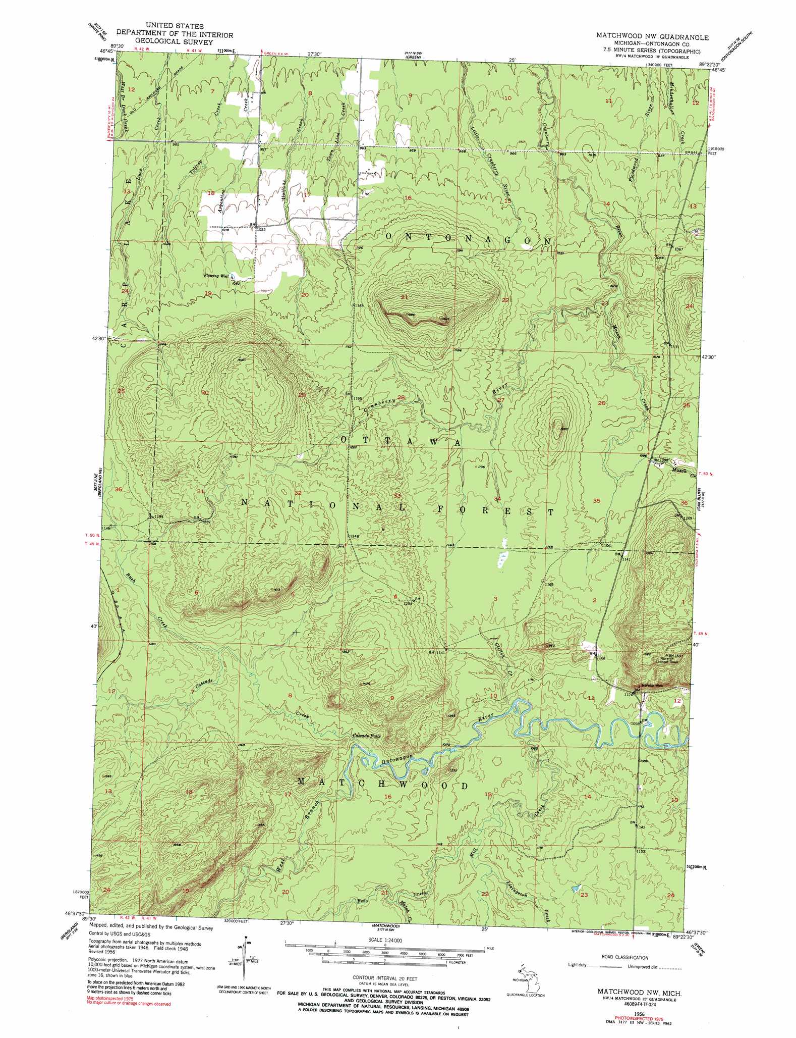
USGS Topo Quad 46089f4 - 1:24,000 scale
| Topo Map Name: | Matchwood Nw |
| USGS Topo Quad ID: | 46089f4 |
| Print Size: | ca. 21 1/4" wide x 27" high |
| Southeast Coordinates: | 46.625° N latitude / 89.375° W longitude |
| Map Center Coordinates: | 46.6875° N latitude / 89.4375° W longitude |
| U.S. State: | MI |
| Filename: | o46089f4.jpg |
| Download Map JPG Image: | Matchwood Nw topo map 1:24,000 scale |
| Map Type: | Topographic |
| Topo Series: | 7.5´ |
| Map Scale: | 1:24,000 |
| Source of Map Images: | United States Geological Survey (USGS) |
| Alternate Map Versions: |
Matchwood NW MI 1949, updated 1949 Download PDF Buy paper map Matchwood NW MI 1956, updated 1958 Download PDF Buy paper map Matchwood NW MI 1956, updated 1990 Download PDF Buy paper map Matchwood NW MI 2011 Download PDF Buy paper map Matchwood NW MI 2014 Download PDF Buy paper map Matchwood NW MI 2017 Download PDF Buy paper map |
| FStopo: | US Forest Service topo Matchwood NW is available: Download FStopo PDF Download FStopo TIF |
1:24,000 Topo Quads surrounding Matchwood Nw
Ontonagon North |
Tenmile Point |
|||
Government Peak |
White Pine |
Green |
Ontonagon South |
Firesteel |
Aldridge Creek |
Bergland Ne |
Matchwood Nw |
Oak Bluff |
Rockland |
Merriweather |
Bergland |
Matchwood |
Ewen |
Bruce Crossing |
Marenisco |
Marshall Creek |
Cup Lake |
Choate |
Paulding |
> Back to 46089e1 at 1:100,000 scale
> Back to 46088a1 at 1:250,000 scale
> Back to U.S. Topo Maps home
Matchwood Nw topo map: Gazetteer
Matchwood Nw: Falls
Cascade Falls elevation 330m 1082′Matchwood Nw: Mines
Norwich Mine elevation 387m 1269′Matchwood Nw: Streams
Bebo Creek elevation 326m 1069′Bush Creek elevation 340m 1115′
Cascade Creek elevation 326m 1069′
Clifton Creek elevation 320m 1049′
Livingston Creek elevation 327m 1072′
Mason Creek elevation 296m 971′
Match Creek elevation 335m 1099′
Mill Creek elevation 320m 1049′
Woodpecker Creek elevation 315m 1033′
Matchwood Nw digital topo map on disk
Buy this Matchwood Nw topo map showing relief, roads, GPS coordinates and other geographical features, as a high-resolution digital map file on DVD: