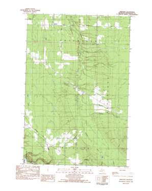
Firesteel Topo Map Michigan
To zoom in, hover over the map of Firesteel
USGS Topo Quad 46089g2 - 1:25,000 scale
| Topo Map Name: | Firesteel |
| USGS Topo Quad ID: | 46089g2 |
| Print Size: | ca. 21 1/4" wide x 27" high |
| Southeast Coordinates: | 46.75° N latitude / 89.125° W longitude |
| Map Center Coordinates: | 46.8125° N latitude / 89.1875° W longitude |
| U.S. State: | MI |
| Filename: | l46089g2.jpg |
| Download Map JPG Image: | Firesteel topo map 1:25,000 scale |
| Map Type: | Topographic |
| Topo Series: | 7.5´ |
| Map Scale: | 1:25,000 |
| Source of Map Images: | United States Geological Survey (USGS) |
| Alternate Map Versions: |
Firesteel MI 1982, updated 1983 Download PDF Buy paper map |
| FStopo: | US Forest Service topo Firesteel is available: Download FStopo PDF Download FStopo TIF |
1:24,000 Topo Quads surrounding Firesteel
> Back to 46089e1 at 1:100,000 scale
> Back to 46088a1 at 1:250,000 scale
> Back to U.S. Topo Maps home
Firesteel topo map: Gazetteer
Firesteel: Populated Places
Firesteel elevation 223m 731′Firesteel: Streams
Caledonia Creek elevation 229m 751′Greentown Creek elevation 210m 688′
McGuire Creek elevation 204m 669′
Monehan Creek elevation 199m 652′
Firesteel digital topo map on disk
Buy this Firesteel topo map showing relief, roads, GPS coordinates and other geographical features, as a high-resolution digital map file on DVD:


