Government Peak Topo Map Michigan
To zoom in, hover over the map of Government Peak
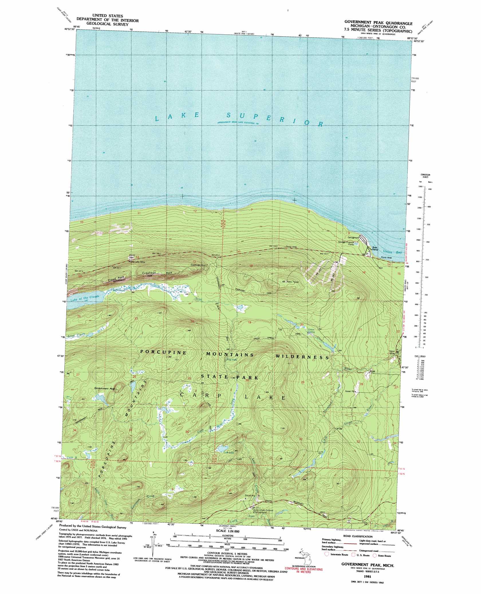
USGS Topo Quad 46089g6 - 1:24,000 scale
| Topo Map Name: | Government Peak |
| USGS Topo Quad ID: | 46089g6 |
| Print Size: | ca. 21 1/4" wide x 27" high |
| Southeast Coordinates: | 46.75° N latitude / 89.625° W longitude |
| Map Center Coordinates: | 46.8125° N latitude / 89.6875° W longitude |
| U.S. State: | MI |
| Filename: | o46089g6.jpg |
| Download Map JPG Image: | Government Peak topo map 1:24,000 scale |
| Map Type: | Topographic |
| Topo Series: | 7.5´ |
| Map Scale: | 1:24,000 |
| Source of Map Images: | United States Geological Survey (USGS) |
| Alternate Map Versions: |
Government Peak MI 1981, updated 1981 Download PDF Buy paper map Government Peak MI 1981, updated 1981 Download PDF Buy paper map Government Peak MI 1998, updated 2001 Download PDF Buy paper map Government Peak MI 2011 Download PDF Buy paper map Government Peak MI 2014 Download PDF Buy paper map Government Peak MI 2017 Download PDF Buy paper map |
1:24,000 Topo Quads surrounding Government Peak
Carp River East |
Government Peak |
White Pine |
Green |
|
Underwood Hill |
Aldridge Creek |
Bergland Ne |
Matchwood Nw |
|
Tula |
Merriweather |
Bergland |
Matchwood |
> Back to 46089e1 at 1:100,000 scale
> Back to 46088a1 at 1:250,000 scale
> Back to U.S. Topo Maps home
Government Peak topo map: Gazetteer
Government Peak: Falls
Trap Falls elevation 400m 1312′Government Peak: Lakes
Lost Lake elevation 468m 1535′Government Peak: Mines
Carp Lake Mine elevation 395m 1295′Cuyahoga Mine elevation 353m 1158′
Union Mine elevation 271m 889′
Government Peak: Parks
Porcupine Mountains Historical Marker elevation 301m 987′Porcupine Mountains Wilderness State Park elevation 442m 1450′
Government Peak: Populated Places
Carp Lake Landing elevation 193m 633′Government Peak: Springs
Union Spring elevation 325m 1066′Government Peak: Streams
Carp River Inlet elevation 328m 1076′Cleveland Creek elevation 310m 1017′
Lost Creek elevation 336m 1102′
Government Peak: Summits
Cloud Peak elevation 459m 1505′Cuyahoga Peak elevation 480m 1574′
Government Peak elevation 559m 1833′
Government Peak digital topo map on disk
Buy this Government Peak topo map showing relief, roads, GPS coordinates and other geographical features, as a high-resolution digital map file on DVD: