Four Corners Topo Map Michigan
To zoom in, hover over the map of Four Corners
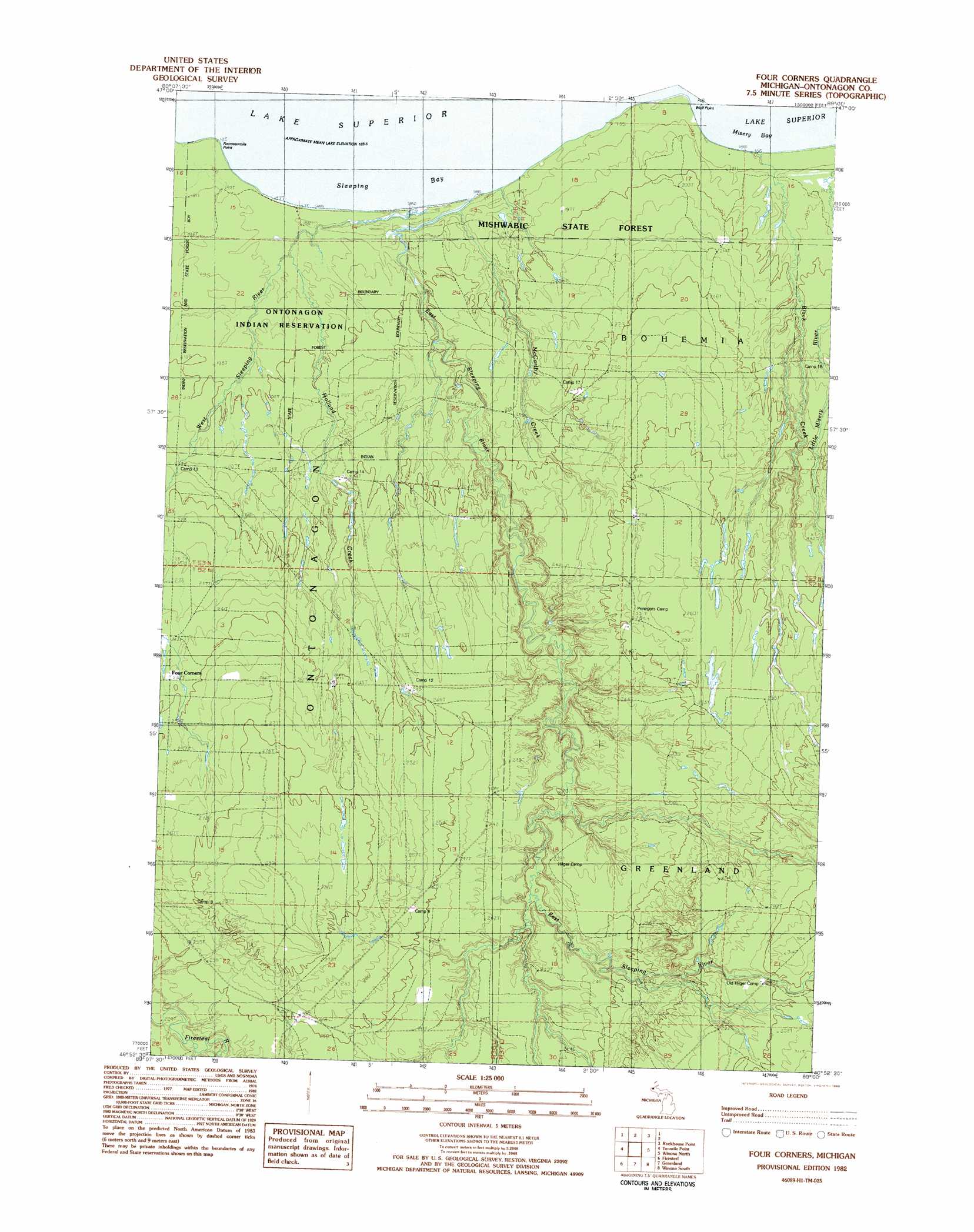
USGS Topo Quad 46089h1 - 1:25,000 scale
| Topo Map Name: | Four Corners |
| USGS Topo Quad ID: | 46089h1 |
| Print Size: | ca. 21 1/4" wide x 27" high |
| Southeast Coordinates: | 46.875° N latitude / 89° W longitude |
| Map Center Coordinates: | 46.9375° N latitude / 89.0625° W longitude |
| U.S. State: | MI |
| Filename: | l46089h1.jpg |
| Download Map JPG Image: | Four Corners topo map 1:25,000 scale |
| Map Type: | Topographic |
| Topo Series: | 7.5´ |
| Map Scale: | 1:25,000 |
| Source of Map Images: | United States Geological Survey (USGS) |
| Alternate Map Versions: |
Four Corners MI 1982, updated 1983 Download PDF Buy paper map |
1:24,000 Topo Quads surrounding Four Corners
Beacon Hill |
||||
Rockhouse Point |
Graveraet River |
|||
Ontonagon North |
Tenmile Point |
Four Corners |
Winona North |
Donken |
Ontonagon South |
Firesteel |
Greenland |
Winona South |
Nisula |
Oak Bluff |
Rockland |
Mckeever |
Rousseau |
Vista Falls |
> Back to 46089e1 at 1:100,000 scale
> Back to 46088a1 at 1:250,000 scale
> Back to U.S. Topo Maps home
Four Corners topo map: Gazetteer
Four Corners: Bays
Sleeping Bay elevation 183m 600′Four Corners: Capes
Fourteen Mile Point elevation 185m 606′Four Corners: Streams
Black Creek elevation 184m 603′East Sleeping River elevation 184m 603′
Holland Creek elevation 186m 610′
McCarthy Creek elevation 185m 606′
West Sleeping River elevation 184m 603′
Four Corners digital topo map on disk
Buy this Four Corners topo map showing relief, roads, GPS coordinates and other geographical features, as a high-resolution digital map file on DVD: