Wilson Lake Topo Map Wisconsin
To zoom in, hover over the map of Wilson Lake
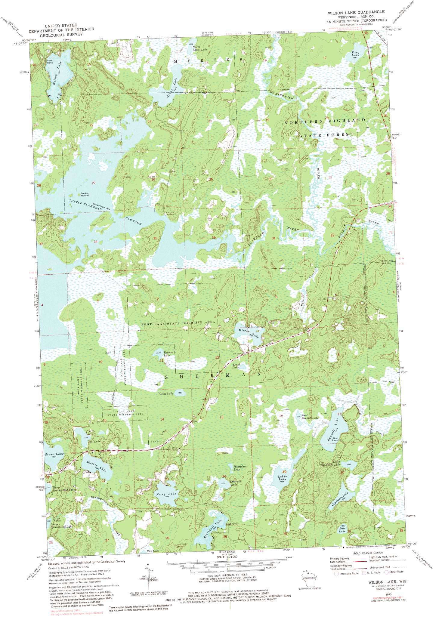
USGS Topo Quad 46090a1 - 1:24,000 scale
| Topo Map Name: | Wilson Lake |
| USGS Topo Quad ID: | 46090a1 |
| Print Size: | ca. 21 1/4" wide x 27" high |
| Southeast Coordinates: | 46° N latitude / 90° W longitude |
| Map Center Coordinates: | 46.0625° N latitude / 90.0625° W longitude |
| U.S. State: | WI |
| Filename: | o46090a1.jpg |
| Download Map JPG Image: | Wilson Lake topo map 1:24,000 scale |
| Map Type: | Topographic |
| Topo Series: | 7.5´ |
| Map Scale: | 1:24,000 |
| Source of Map Images: | United States Geological Survey (USGS) |
| Alternate Map Versions: |
Wilson Lake WI 1973, updated 1976 Download PDF Buy paper map Wilson Lake WI 1973, updated 1984 Download PDF Buy paper map Wilson Lake WI 2010 Download PDF Buy paper map Wilson Lake WI 2013 Download PDF Buy paper map Wilson Lake WI 2015 Download PDF Buy paper map |
1:24,000 Topo Quads surrounding Wilson Lake
Turntable Creek |
Pine Lake |
Lake Evelyn |
Chaney Lake |
Harris Lake |
Lake Six |
Lake Of The Falls |
Mercer |
Winchester |
Papoose Lake |
Hay Creek Flowage |
Turtle-Flambeau Flowage |
Wilson Lake |
Powell |
Manitowish Lake |
Blockhouse Lake |
Pike Lake Nw |
Pike Lake |
Lac Du Flambeau |
Fence Lake |
Gates Lake |
Pike Lake Sw |
Pike Lake Se |
Lac Du Flambeau Sw |
Mercer Lake |
> Back to 46090a1 at 1:100,000 scale
> Back to 46090a1 at 1:250,000 scale
> Back to U.S. Topo Maps home
Wilson Lake topo map: Gazetteer
Wilson Lake: Islands
Bonies Mound elevation 482m 1581′Wilson Lake: Lakes
Bass Lake elevation 485m 1591′Bearskull Lake elevation 482m 1581′
Cap Henry Lake elevation 485m 1591′
Emerson Lake elevation 485m 1591′
Ferry Lake elevation 485m 1591′
Frog Lake elevation 482m 1581′
Goose Lake elevation 482m 1581′
Grant Lake elevation 479m 1571′
Hall Lake elevation 487m 1597′
Hourglass Lake elevation 487m 1597′
Leach Lake elevation 486m 1594′
Lehto Lake elevation 482m 1581′
Little Cap Henry Lake elevation 485m 1591′
Mirror Lake elevation 485m 1591′
Muskie Lake elevation 482m 1581′
North Grant Lake elevation 479m 1571′
Randall Lake elevation 480m 1574′
Reimer Lake elevation 479m 1571′
Stone Lake elevation 485m 1591′
Teal Lake elevation 482m 1581′
West Randall Lake elevation 482m 1581′
Wilson Lake elevation 479m 1571′
Wilson Lake: Parks
Boot Lake State Wildlife Area elevation 485m 1591′Frog Lake and Pines State Natural Area elevation 485m 1591′
Springstead Muskeg State Natural Area elevation 488m 1601′
Wilson Lake: Streams
Bear River elevation 480m 1574′Little Bear Creek elevation 480m 1574′
Manitowish River elevation 480m 1574′
Reimer Creek elevation 480m 1574′
Wilson Lake digital topo map on disk
Buy this Wilson Lake topo map showing relief, roads, GPS coordinates and other geographical features, as a high-resolution digital map file on DVD: