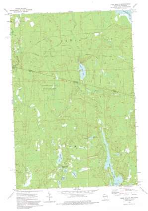
Lake Evelyn Topo Map Wisconsin
To zoom in, hover over the map of Lake Evelyn
USGS Topo Quad 46090c1 - 1:24,000 scale
| Topo Map Name: | Lake Evelyn |
| USGS Topo Quad ID: | 46090c1 |
| Print Size: | ca. 21 1/4" wide x 27" high |
| Southeast Coordinates: | 46.25° N latitude / 90° W longitude |
| Map Center Coordinates: | 46.3125° N latitude / 90.0625° W longitude |
| U.S. States: | WI, MI |
| Filename: | o46090c1.jpg |
| Download Map JPG Image: | Lake Evelyn topo map 1:24,000 scale |
| Map Type: | Topographic |
| Topo Series: | 7.5´ |
| Map Scale: | 1:24,000 |
| Source of Map Images: | United States Geological Survey (USGS) |
| Alternate Map Versions: |
Lake Evelyn WI 1973, updated 1976 Download PDF Buy paper map Lake Evelyn WI 2011 Download PDF Buy paper map Lake Evelyn WI 2013 Download PDF Buy paper map Lake Evelyn WI 2015 Download PDF Buy paper map |
1:24,000 Topo Quads surrounding Lake Evelyn
> Back to 46090a1 at 1:100,000 scale
> Back to 46090a1 at 1:250,000 scale
> Back to U.S. Topo Maps home
Lake Evelyn topo map: Gazetteer
Lake Evelyn: Islands
Horseshoe Island elevation 491m 1610′Lake Evelyn: Lakes
American Lake elevation 488m 1601′Barrel Spring Lake elevation 510m 1673′
Bass Lake elevation 510m 1673′
Beaver Lake elevation 504m 1653′
Black River Lake elevation 468m 1535′
Lake Barbara elevation 504m 1653′
Lake Dorothy elevation 510m 1673′
Lake Evelyn elevation 513m 1683′
Lake Ten elevation 504m 1653′
Long Lake elevation 488m 1601′
Lake Evelyn: Parks
Lake Evelyn State Natural Area elevation 515m 1689′Underwood State Wildlife Area elevation 506m 1660′
Lake Evelyn: Streams
Laymans Creek elevation 471m 1545′South Fork Black River elevation 474m 1555′
Underwood Creek elevation 459m 1505′
Virgin Creek elevation 489m 1604′
Wester Creek elevation 459m 1505′
Lake Evelyn digital topo map on disk
Buy this Lake Evelyn topo map showing relief, roads, GPS coordinates and other geographical features, as a high-resolution digital map file on DVD:


