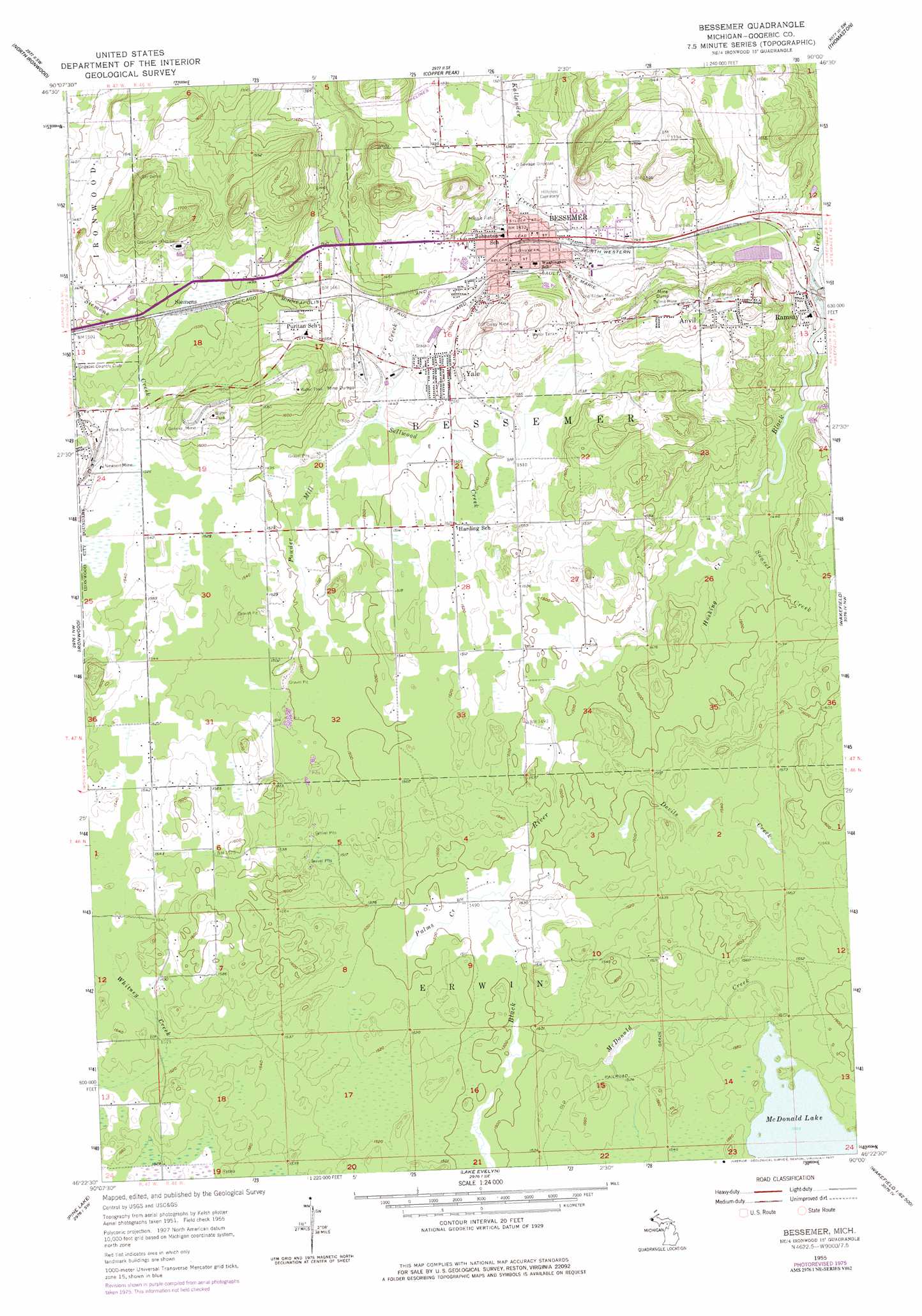
Bessemer Topo Map Michigan
To zoom in, hover over the map of Bessemer
USGS Topo Quad 46090d1 - 1:24,000 scale
| Topo Map Name: | Bessemer |
| USGS Topo Quad ID: | 46090d1 |
| Print Size: | ca. 21 1/4" wide x 27" high |
| Southeast Coordinates: | 46.375° N latitude / 90° W longitude |
| Map Center Coordinates: | 46.4375° N latitude / 90.0625° W longitude |
| U.S. State: | MI |
| Filename: | o46090d1.jpg |
| Download Map JPG Image: | Bessemer topo map 1:24,000 scale |
| Map Type: | Topographic |
| Topo Series: | 7.5´ |
| Map Scale: | 1:24,000 |
| Source of Map Images: | United States Geological Survey (USGS) |
| Alternate Map Versions: |
Bessemer MI 1955, updated 1957 Download PDF Buy paper map Bessemer MI 1955, updated 1977 Download PDF Buy paper map Bessemer MI 2011 Download PDF Buy paper map Bessemer MI 2014 Download PDF Buy paper map Bessemer MI 2017 Download PDF Buy paper map |
1:24,000 Topo Quads surrounding Bessemer
Black River Harbor |
Underwood Hill |
|||
Little Girls Point |
Copper Peak |
Tula |
||
Iron Belt |
Ironwood |
Bessemer |
Wakefield |
Wakefield Ne |
Turntable Creek |
Pine Lake |
Lake Evelyn |
Chaney Lake |
Harris Lake |
Lake Six |
Lake Of The Falls |
Mercer |
Winchester |
Papoose Lake |
> Back to 46090a1 at 1:100,000 scale
> Back to 46090a1 at 1:250,000 scale
> Back to U.S. Topo Maps home
Bessemer topo map: Gazetteer
Bessemer: Falls
Granite Falls elevation 446m 1463′Bessemer: Lakes
McDonald Lake elevation 472m 1548′Bessemer: Mines
Anvil Mine elevation 501m 1643′Geneva Mine elevation 509m 1669′
Newport Mine elevation 485m 1591′
Old Colby Mine elevation 476m 1561′
Old Tilden Mine elevation 455m 1492′
Palms Mine elevation 505m 1656′
Peterson Mine elevation 451m 1479′
Bessemer: Parks
Gogebic Iron Range Historical Marker elevation 444m 1456′Massie Field elevation 430m 1410′
Bessemer: Populated Places
Anvil elevation 488m 1601′Bessemer elevation 434m 1423′
Siemens elevation 457m 1499′
Yale elevation 460m 1509′
Bessemer: Post Offices
Anvil Location Post Office (historical) elevation 489m 1604′Bessemer Post Office elevation 438m 1437′
Puritan Post Office (historical) elevation 477m 1564′
Bessemer: Streams
Devils Creek elevation 451m 1479′Hosking Creek elevation 439m 1440′
McDonald Creek elevation 458m 1502′
Palms Creek elevation 457m 1499′
Sellwood Creek elevation 444m 1456′
Sunset Creek elevation 439m 1440′
Bessemer digital topo map on disk
Buy this Bessemer topo map showing relief, roads, GPS coordinates and other geographical features, as a high-resolution digital map file on DVD: