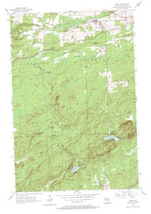
Saxon Topo Map Wisconsin
To zoom in, hover over the map of Saxon
USGS Topo Quad 46090d4 - 1:24,000 scale
| Topo Map Name: | Saxon |
| USGS Topo Quad ID: | 46090d4 |
| Print Size: | ca. 21 1/4" wide x 27" high |
| Southeast Coordinates: | 46.375° N latitude / 90.375° W longitude |
| Map Center Coordinates: | 46.4375° N latitude / 90.4375° W longitude |
| U.S. State: | WI |
| Filename: | o46090d4.jpg |
| Download Map JPG Image: | Saxon topo map 1:24,000 scale |
| Map Type: | Topographic |
| Topo Series: | 7.5´ |
| Map Scale: | 1:24,000 |
| Source of Map Images: | United States Geological Survey (USGS) |
| Alternate Map Versions: |
Saxon WI 1956, updated 1957 Download PDF Buy paper map Saxon WI 1956, updated 1972 Download PDF Buy paper map Saxon WI 2010 Download PDF Buy paper map Saxon WI 2013 Download PDF Buy paper map Saxon WI 2015 Download PDF Buy paper map |
1:24,000 Topo Quads surrounding Saxon
> Back to 46090a1 at 1:100,000 scale
> Back to 46090a1 at 1:250,000 scale
> Back to U.S. Topo Maps home
Saxon topo map: Gazetteer
Saxon: Lakes
Beaver Pond elevation 347m 1138′Upson Lake elevation 410m 1345′
Weber Lake elevation 440m 1443′
Saxon: Parks
Iron County Fairground elevation 353m 1158′Saxon: Populated Places
Saxon elevation 341m 1118′Saxon: Streams
Alder Creek elevation 417m 1368′Chase Creek elevation 348m 1141′
Freburg Creek elevation 330m 1082′
Lawrence Creek elevation 326m 1069′
Mud Creek elevation 335m 1099′
North Branch Lawrence Creek elevation 336m 1102′
Sullivan Creek elevation 400m 1312′
Saxon: Swamps
Blueberry Marsh elevation 357m 1171′Saxon digital topo map on disk
Buy this Saxon topo map showing relief, roads, GPS coordinates and other geographical features, as a high-resolution digital map file on DVD:


