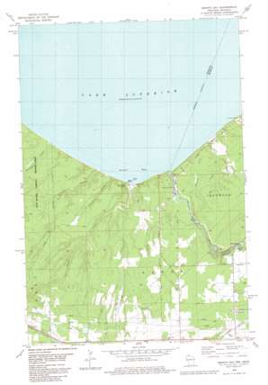
Oronto Bay Topo Map Wisconsin
To zoom in, hover over the map of Oronto Bay
USGS Topo Quad 46090e4 - 1:24,000 scale
| Topo Map Name: | Oronto Bay |
| USGS Topo Quad ID: | 46090e4 |
| Print Size: | ca. 21 1/4" wide x 27" high |
| Southeast Coordinates: | 46.5° N latitude / 90.375° W longitude |
| Map Center Coordinates: | 46.5625° N latitude / 90.4375° W longitude |
| U.S. States: | WI, MI |
| Filename: | o46090e4.jpg |
| Download Map JPG Image: | Oronto Bay topo map 1:24,000 scale |
| Map Type: | Topographic |
| Topo Series: | 7.5´ |
| Map Scale: | 1:24,000 |
| Source of Map Images: | United States Geological Survey (USGS) |
| Alternate Map Versions: |
Oronto Bay WI 1980, updated 1981 Download PDF Buy paper map Oronto Bay WI 2011 Download PDF Buy paper map Oronto Bay WI 2013 Download PDF Buy paper map Oronto Bay WI 2015 Download PDF Buy paper map |
| FStopo: | US Forest Service topo Oronto Bay is available: Download FStopo PDF Download FStopo TIF |
1:24,000 Topo Quads surrounding Oronto Bay
Madeline Island |
Amnicon Point |
|||
Chequamegon Point |
||||
Odanah |
Cedar |
Oronto Bay |
Little Girls Point |
|
High Bridge |
Gurney |
Saxon |
Iron Belt |
Ironwood |
Mellen |
Mount Whittlesey |
Upson |
Turntable Creek |
Pine Lake |
> Back to 46090e1 at 1:100,000 scale
> Back to 46090a1 at 1:250,000 scale
> Back to U.S. Topo Maps home
Oronto Bay topo map: Gazetteer
Oronto Bay: Airports
Saxon Airport elevation 295m 967′Saxon Landing Strip elevation 282m 925′
Oronto Bay: Bays
Oronto Bay elevation 183m 600′Saxon Harbor elevation 183m 600′
Oronto Bay: Falls
Saxon Falls elevation 273m 895′Saxon Falls elevation 268m 879′
Superior Falls elevation 231m 757′
Superior Falls elevation 199m 652′
Oronto Bay: Parks
Legion County Park elevation 219m 718′Saxon Harbor County Park elevation 222m 728′
Oronto Bay: Populated Places
Cedar elevation 330m 1082′Oronto Bay: Streams
Carpenter Creek elevation 183m 600′Flink Creek elevation 184m 603′
Graveyard Creek elevation 188m 616′
Maki Creek elevation 190m 623′
Montreal River elevation 186m 610′
Oronto Creek elevation 183m 600′
Parker Creek elevation 193m 633′
Spoon Creek elevation 200m 656′
Sturgeon Branch elevation 188m 616′
Treasure Creek elevation 197m 646′
Oronto Bay digital topo map on disk
Buy this Oronto Bay topo map showing relief, roads, GPS coordinates and other geographical features, as a high-resolution digital map file on DVD:


