Stockton Island Topo Map Wisconsin
To zoom in, hover over the map of Stockton Island
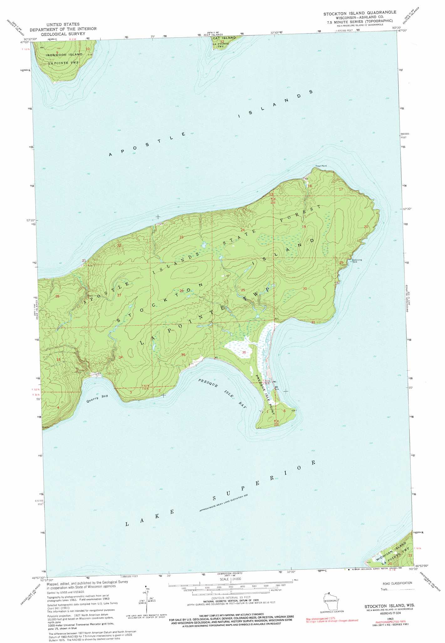
USGS Topo Quad 46090h5 - 1:24,000 scale
| Topo Map Name: | Stockton Island |
| USGS Topo Quad ID: | 46090h5 |
| Print Size: | ca. 21 1/4" wide x 27" high |
| Southeast Coordinates: | 46.875° N latitude / 90.5° W longitude |
| Map Center Coordinates: | 46.9375° N latitude / 90.5625° W longitude |
| U.S. State: | WI |
| Filename: | o46090h5.jpg |
| Download Map JPG Image: | Stockton Island topo map 1:24,000 scale |
| Map Type: | Topographic |
| Topo Series: | 7.5´ |
| Map Scale: | 1:24,000 |
| Source of Map Images: | United States Geological Survey (USGS) |
| Alternate Map Versions: |
Stockton Island WI 1963, updated 1965 Download PDF Buy paper map Stockton Island WI 1963, updated 1992 Download PDF Buy paper map Stockton Island WI 2010 Download PDF Buy paper map Stockton Island WI 2013 Download PDF Buy paper map Stockton Island WI 2015 Download PDF Buy paper map |
1:24,000 Topo Quads surrounding Stockton Island
Bear Island |
Rocky Island |
Cat Island |
Outer Island |
|
York Island |
Oak Island |
Stockton Island |
Michigan Island |
|
Bayfield |
Madeline Island |
Amnicon Point |
||
Long Island |
Chequamegon Point |
> Back to 46090e1 at 1:100,000 scale
> Back to 46090a1 at 1:250,000 scale
> Back to U.S. Topo Maps home
Stockton Island topo map: Gazetteer
Stockton Island: Bays
Presque Isle Bay elevation 184m 603′Quarry Bay elevation 184m 603′
Stockton Island: Capes
Presque Isle Point elevation 185m 606′Trout Point elevation 192m 629′
Stockton Island: Islands
Stockton Island elevation 217m 711′Stockton Island: Pillars
Balancing Rock elevation 184m 603′Stockton Island digital topo map on disk
Buy this Stockton Island topo map showing relief, roads, GPS coordinates and other geographical features, as a high-resolution digital map file on DVD: