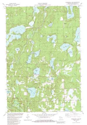
Horseshoe Lake Topo Map Wisconsin
To zoom in, hover over the map of Horseshoe Lake
USGS Topo Quad 46091a8 - 1:24,000 scale
| Topo Map Name: | Horseshoe Lake |
| USGS Topo Quad ID: | 46091a8 |
| Print Size: | ca. 21 1/4" wide x 27" high |
| Southeast Coordinates: | 46° N latitude / 91.875° W longitude |
| Map Center Coordinates: | 46.0625° N latitude / 91.9375° W longitude |
| U.S. State: | WI |
| Filename: | o46091a8.jpg |
| Download Map JPG Image: | Horseshoe Lake topo map 1:24,000 scale |
| Map Type: | Topographic |
| Topo Series: | 7.5´ |
| Map Scale: | 1:24,000 |
| Source of Map Images: | United States Geological Survey (USGS) |
| Alternate Map Versions: |
Horseshoe Lake WI 1982, updated 1982 Download PDF Buy paper map Horseshoe Lake WI 2010 Download PDF Buy paper map Horseshoe Lake WI 2013 Download PDF Buy paper map Horseshoe Lake WI 2015 Download PDF Buy paper map |
1:24,000 Topo Quads surrounding Horseshoe Lake
> Back to 46091a1 at 1:100,000 scale
> Back to 46090a1 at 1:250,000 scale
> Back to U.S. Topo Maps home
Horseshoe Lake topo map: Gazetteer
Horseshoe Lake: Airports
Ben Sutherland Airport elevation 322m 1056′Horseshoe Lake: Channels
Minong Flowage elevation 303m 994′Horseshoe Lake: Dams
Lower Kimball Lake Dam elevation 304m 997′Minong Flowage 2WP252 Dam elevation 305m 1000′
Horseshoe Lake: Lakes
Adventure Lake elevation 302m 990′Banks Lake elevation 293m 961′
Big Bass Lake elevation 308m 1010′
Chicog Lake elevation 302m 990′
Cloverleaf Lake elevation 293m 961′
East Wilcox Lake elevation 311m 1020′
Hoinville Lake elevation 290m 951′
Horseshoe Lake elevation 305m 1000′
Lake Nancy elevation 296m 971′
Little Bass Lake elevation 308m 1010′
Lower Kimball Lake elevation 302m 990′
Mack Lake elevation 318m 1043′
Matthews Lake elevation 302m 990′
McLain Lake elevation 302m 990′
Middle Lake elevation 299m 980′
Mosquito Lake elevation 306m 1003′
North Twin Lake elevation 302m 990′
Sherman Lake elevation 299m 980′
Sleepy Eye Lake elevation 305m 1000′
South Twin Lake elevation 299m 980′
Twin Lakes elevation 299m 980′
West Wilcox Lake elevation 308m 1010′
Horseshoe Lake: Reservoirs
Lower Kimball Lake 6 elevation 304m 997′Minong Flowage 320 elevation 305m 1000′
Horseshoe Lake: Streams
Chicog Creek elevation 293m 961′Little Chicog Creek elevation 311m 1020′
Stuntz Brook elevation 290m 951′
Horseshoe Lake digital topo map on disk
Buy this Horseshoe Lake topo map showing relief, roads, GPS coordinates and other geographical features, as a high-resolution digital map file on DVD:


