Totagatic Lake Topo Map Wisconsin
To zoom in, hover over the map of Totagatic Lake
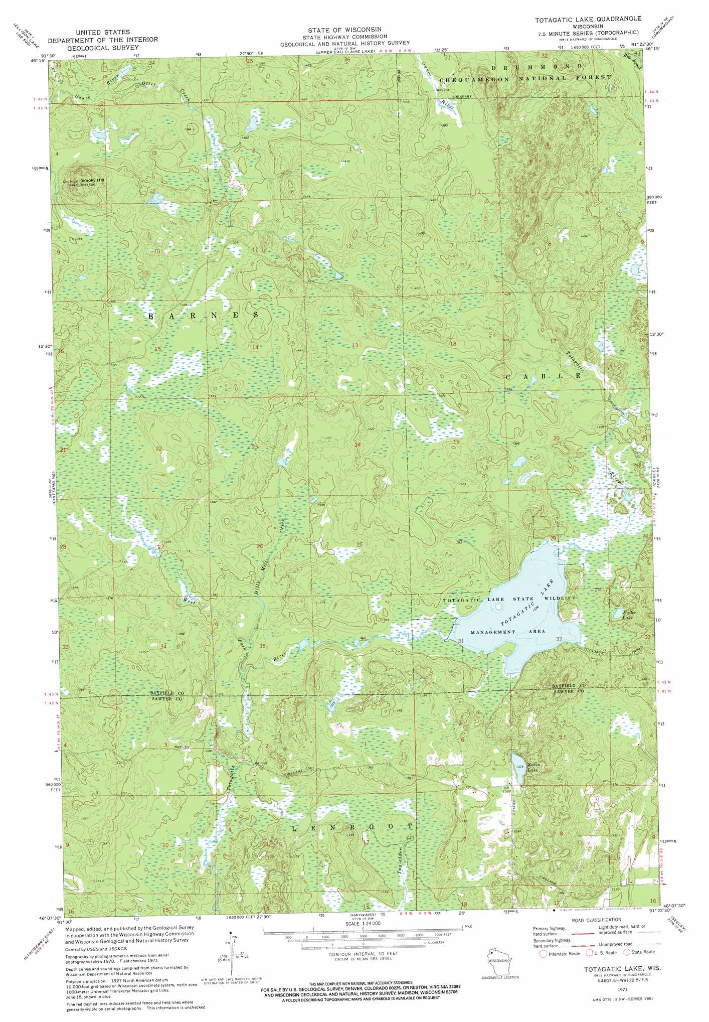
USGS Topo Quad 46091b4 - 1:24,000 scale
| Topo Map Name: | Totagatic Lake |
| USGS Topo Quad ID: | 46091b4 |
| Print Size: | ca. 21 1/4" wide x 27" high |
| Southeast Coordinates: | 46.125° N latitude / 91.375° W longitude |
| Map Center Coordinates: | 46.1875° N latitude / 91.4375° W longitude |
| U.S. State: | WI |
| Filename: | o46091b4.jpg |
| Download Map JPG Image: | Totagatic Lake topo map 1:24,000 scale |
| Map Type: | Topographic |
| Topo Series: | 7.5´ |
| Map Scale: | 1:24,000 |
| Source of Map Images: | United States Geological Survey (USGS) |
| Alternate Map Versions: |
Totagatic Lake WI 1971, updated 1973 Download PDF Buy paper map Totagatic Lake WI 1971, updated 1992 Download PDF Buy paper map Totagatic Lake WI 2005, updated 2006 Download PDF Buy paper map Totagatic Lake WI 2011 Download PDF Buy paper map Totagatic Lake WI 2013 Download PDF Buy paper map Totagatic Lake WI 2015 Download PDF Buy paper map |
| FStopo: | US Forest Service topo Totagatic Lake is available: Download FStopo PDF Download FStopo TIF |
1:24,000 Topo Quads surrounding Totagatic Lake
Lake Minnesuing |
Island Lake |
Drummond Nw |
Delta |
Grandview Nw |
Metzger Lake |
Ellison Lake |
Upper Eau Claire Lake |
Drummond |
Diamond Lake |
Chittamo |
Chittamo Ne |
Totagatic Lake |
Cable |
Lake Tahkodah |
Stanberry West |
Stanberry East |
Hayward |
Seeley |
Spider Lake |
Springbrook |
Bean Lake |
Reserve |
Chief Lake |
New Post |
> Back to 46091a1 at 1:100,000 scale
> Back to 46090a1 at 1:250,000 scale
> Back to U.S. Topo Maps home
Totagatic Lake topo map: Gazetteer
Totagatic Lake: Lakes
Dawn Lake elevation 417m 1368′Fuller Lake elevation 408m 1338′
Sabin Lake elevation 405m 1328′
Totagatic Lake elevation 407m 1335′
Totagatic Lake: Parks
Totagatic Lake State Wildlife Managament Area elevation 407m 1335′Totagatic Lake: Streams
Hills Mill Creek elevation 399m 1309′Otter Creek elevation 392m 1286′
West Fork Totagatic River elevation 396m 1299′
Totagatic Lake: Summits
Smoky Hill elevation 458m 1502′Totagatic Lake digital topo map on disk
Buy this Totagatic Lake topo map showing relief, roads, GPS coordinates and other geographical features, as a high-resolution digital map file on DVD: