Gordon Topo Map Wisconsin
To zoom in, hover over the map of Gordon
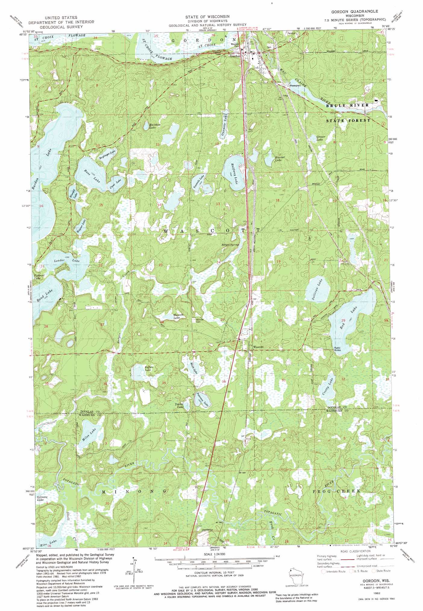
USGS Topo Quad 46091b7 - 1:24,000 scale
| Topo Map Name: | Gordon |
| USGS Topo Quad ID: | 46091b7 |
| Print Size: | ca. 21 1/4" wide x 27" high |
| Southeast Coordinates: | 46.125° N latitude / 91.75° W longitude |
| Map Center Coordinates: | 46.1875° N latitude / 91.8125° W longitude |
| U.S. State: | WI |
| Filename: | o46091b7.jpg |
| Download Map JPG Image: | Gordon topo map 1:24,000 scale |
| Map Type: | Topographic |
| Topo Series: | 7.5´ |
| Map Scale: | 1:24,000 |
| Source of Map Images: | United States Geological Survey (USGS) |
| Alternate Map Versions: |
Gordon WI 1982, updated 1982 Download PDF Buy paper map Gordon WI 2010 Download PDF Buy paper map Gordon WI 2013 Download PDF Buy paper map Gordon WI 2015 Download PDF Buy paper map |
1:24,000 Topo Quads surrounding Gordon
Amnicon Lake |
Lyman Lake |
Bennett |
Lake Minnesuing |
Island Lake |
Empire Swamp |
Buckety Creek |
Solon Springs |
Metzger Lake |
Ellison Lake |
Scovils Lake |
Minong Flowage |
Gordon |
Chittamo |
Chittamo Ne |
Frog Lake |
Horseshoe Lake |
Minong |
Stanberry West |
Stanberry East |
Mckenzie Lake |
Dunn Lake |
Trego |
Springbrook |
Bean Lake |
> Back to 46091a1 at 1:100,000 scale
> Back to 46090a1 at 1:250,000 scale
> Back to U.S. Topo Maps home
Gordon topo map: Gazetteer
Gordon: Dams
Gordon 2WP49 Dam elevation 317m 1040′Gordon: Lakes
Arrowhead Lake elevation 321m 1053′Bardon Lake elevation 314m 1030′
Bass Lake elevation 314m 1030′
Beglinger Lake elevation 314m 1030′
Bluegill Lake elevation 314m 1030′
Bond Lake elevation 311m 1020′
Buffalo Lake elevation 314m 1030′
Clear Lake elevation 314m 1030′
Crotty Lake elevation 325m 1066′
Grover Lake elevation 321m 1053′
Harriet Lake elevation 319m 1046′
Kreide Lake elevation 317m 1040′
Leader Lake elevation 314m 1030′
Miles Lake elevation 308m 1010′
Muck Lake elevation 318m 1043′
One Mile Lake elevation 318m 1043′
Peterson Lake elevation 318m 1043′
Rainbow Lake elevation 315m 1033′
Red Lake elevation 324m 1062′
Rice Lake elevation 305m 1000′
Sullivan Lake elevation 324m 1062′
Two Mile Lake elevation 317m 1040′
Wagner Lake elevation 314m 1030′
Wascott Lake elevation 316m 1036′
Yoekel Lake elevation 320m 1049′
Gordon: Parks
Brule River State Forest Annex elevation 320m 1049′Gordon: Populated Places
Gordon elevation 315m 1033′Wascott elevation 333m 1092′
Gordon: Reservoirs
Eau Claire River Flowage 33 elevation 317m 1040′Gordon: Springs
Bergen Springs elevation 316m 1036′Gordon: Streams
Frog Creek elevation 311m 1020′Shell Creek elevation 305m 1000′
Gordon digital topo map on disk
Buy this Gordon topo map showing relief, roads, GPS coordinates and other geographical features, as a high-resolution digital map file on DVD: