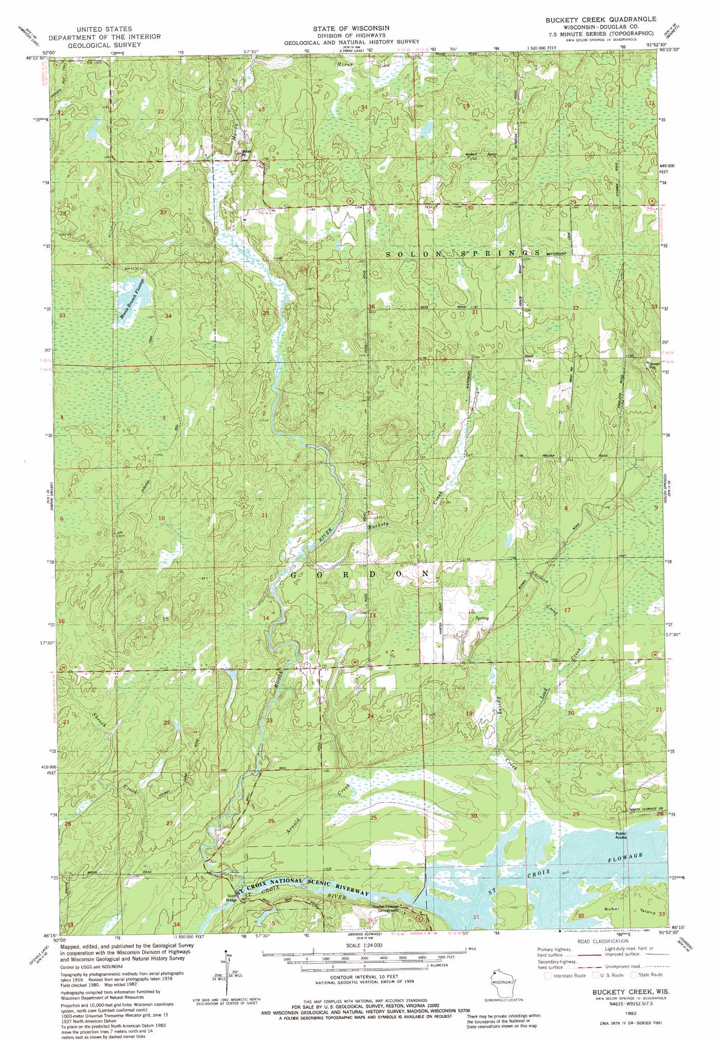
Buckety Creek Topo Map Wisconsin
To zoom in, hover over the map of Buckety Creek
USGS Topo Quad 46091c8 - 1:24,000 scale
| Topo Map Name: | Buckety Creek |
| USGS Topo Quad ID: | 46091c8 |
| Print Size: | ca. 21 1/4" wide x 27" high |
| Southeast Coordinates: | 46.25° N latitude / 91.875° W longitude |
| Map Center Coordinates: | 46.3125° N latitude / 91.9375° W longitude |
| U.S. State: | WI |
| Filename: | o46091c8.jpg |
| Download Map JPG Image: | Buckety Creek topo map 1:24,000 scale |
| Map Type: | Topographic |
| Topo Series: | 7.5´ |
| Map Scale: | 1:24,000 |
| Source of Map Images: | United States Geological Survey (USGS) |
| Alternate Map Versions: |
Buckety Creek WI 1982, updated 1983 Download PDF Buy paper map Buckety Creek WI 2010 Download PDF Buy paper map Buckety Creek WI 2013 Download PDF Buy paper map Buckety Creek WI 2015 Download PDF Buy paper map |
1:24,000 Topo Quads surrounding Buckety Creek
Borea |
Sunnyside |
South Range |
Poplar |
Lake Nebagamon |
Patzau |
Amnicon Lake |
Lyman Lake |
Bennett |
Lake Minnesuing |
Moose Junction |
Empire Swamp |
Buckety Creek |
Solon Springs |
Metzger Lake |
Dairyland |
Scovils Lake |
Minong Flowage |
Gordon |
Chittamo |
Webb Lake |
Frog Lake |
Horseshoe Lake |
Minong |
Stanberry West |
> Back to 46091a1 at 1:100,000 scale
> Back to 46090a1 at 1:250,000 scale
> Back to U.S. Topo Maps home
Buckety Creek topo map: Gazetteer
Buckety Creek: Bridges
Scott Bridge elevation 301m 987′Buckety Creek: Dams
Saint Croix 2WP365 Dam elevation 308m 1010′Buckety Creek: Islands
Bubar Island elevation 311m 1020′Buckety Creek: Reservoirs
Moose Branch Flowage elevation 372m 1220′Saint Croix Flowage elevation 308m 1010′
Saint Croix Flowage 282 elevation 313m 1026′
Buckety Creek: Streams
Arnold Creek elevation 302m 990′Buckety Creek elevation 333m 1092′
Carlson Creek elevation 326m 1069′
Lord Creek elevation 313m 1026′
Moose River elevation 302m 990′
Spring Creek elevation 308m 1010′
Buckety Creek digital topo map on disk
Buy this Buckety Creek topo map showing relief, roads, GPS coordinates and other geographical features, as a high-resolution digital map file on DVD: