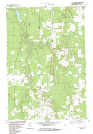
Blaine Creek Topo Map Wisconsin
To zoom in, hover over the map of Blaine Creek
USGS Topo Quad 46091f4 - 1:24,000 scale
| Topo Map Name: | Blaine Creek |
| USGS Topo Quad ID: | 46091f4 |
| Print Size: | ca. 21 1/4" wide x 27" high |
| Southeast Coordinates: | 46.625° N latitude / 91.375° W longitude |
| Map Center Coordinates: | 46.6875° N latitude / 91.4375° W longitude |
| U.S. State: | WI |
| Filename: | o46091f4.jpg |
| Download Map JPG Image: | Blaine Creek topo map 1:24,000 scale |
| Map Type: | Topographic |
| Topo Series: | 7.5´ |
| Map Scale: | 1:24,000 |
| Source of Map Images: | United States Geological Survey (USGS) |
| Alternate Map Versions: |
Blaine Creek WI 1984, updated 1984 Download PDF Buy paper map Blaine Creek WI 2010 Download PDF Buy paper map Blaine Creek WI 2013 Download PDF Buy paper map Blaine Creek WI 2015 Download PDF Buy paper map |
1:24,000 Topo Quads surrounding Blaine Creek
Port Wing |
Herbster |
Bark Bay |
||
Cloverland |
Oulu |
Blaine Creek |
Iron Lake Ne |
Moquah Nw |
Lake Nebagamon |
Brule |
Iron Lake |
Hart Lake |
Ino |
Lake Minnesuing |
Island Lake |
Drummond Nw |
Delta |
Grandview Nw |
> Back to 46091e1 at 1:100,000 scale
> Back to 46090a1 at 1:250,000 scale
> Back to U.S. Topo Maps home
Blaine Creek topo map: Gazetteer
Blaine Creek: Dams
Orienta Dam elevation 196m 643′Port Wing 2WP954 Dam elevation 187m 613′
Blaine Creek: Reservoirs
Orienta Flowage 148 elevation 187m 613′Blaine Creek: Streams
Blaine Creek elevation 220m 721′DeChamps Creek elevation 280m 918′
East Fork Iron River elevation 207m 679′
Hill Creek elevation 255m 836′
Kolin Creek elevation 231m 757′
Middle Creek elevation 263m 862′
Muskeg Creek elevation 247m 810′
Resch Creek elevation 210m 688′
Schacte Creek elevation 258m 846′
Townsend Creek elevation 280m 918′
Blaine Creek digital topo map on disk
Buy this Blaine Creek topo map showing relief, roads, GPS coordinates and other geographical features, as a high-resolution digital map file on DVD:


