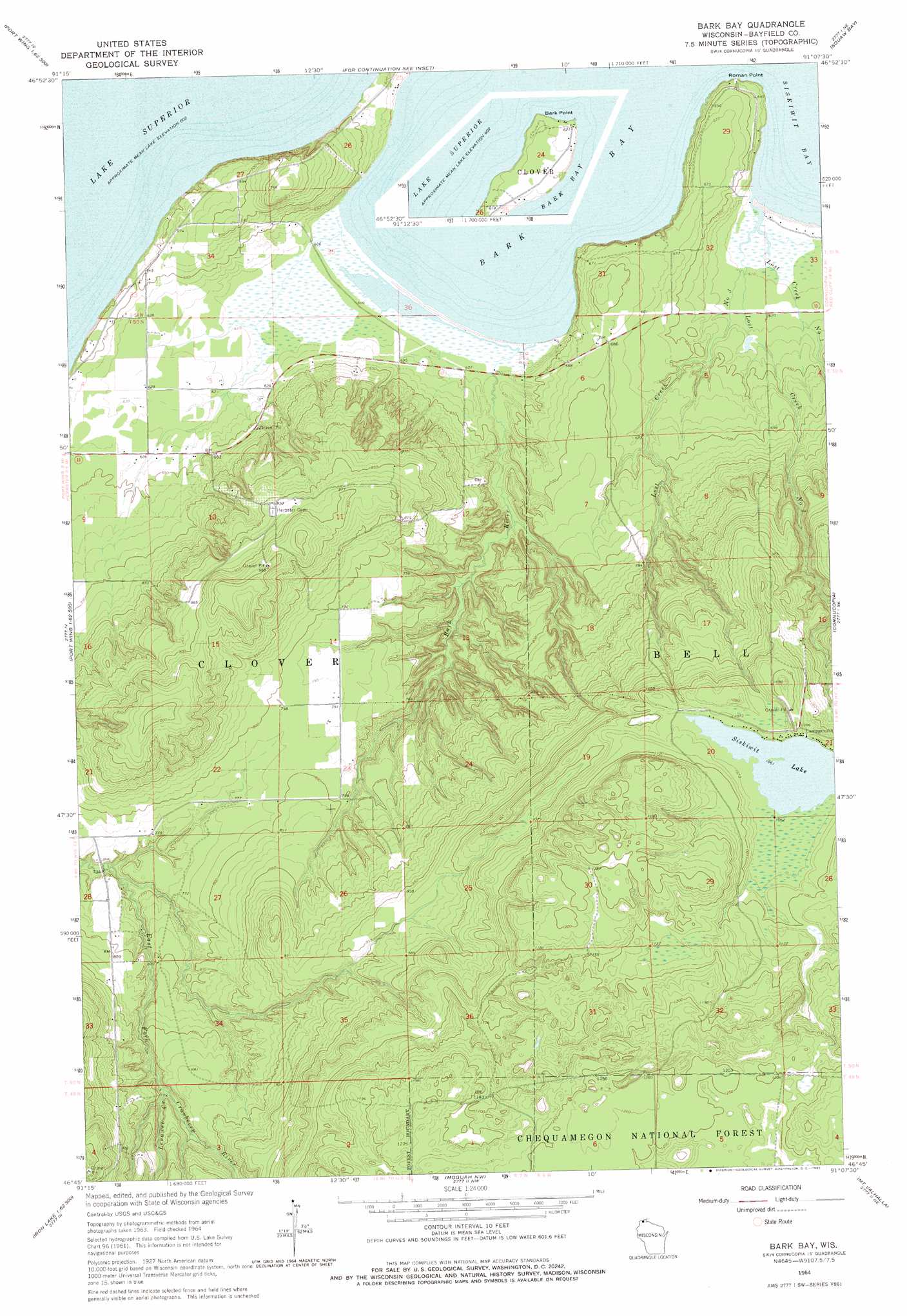
Bark Bay Topo Map Wisconsin
To zoom in, hover over the map of Bark Bay
USGS Topo Quad 46091g2 - 1:24,000 scale
| Topo Map Name: | Bark Bay |
| USGS Topo Quad ID: | 46091g2 |
| Print Size: | ca. 21 1/4" wide x 27" high |
| Southeast Coordinates: | 46.75° N latitude / 91.125° W longitude |
| Map Center Coordinates: | 46.8125° N latitude / 91.1875° W longitude |
| U.S. State: | WI |
| Filename: | o46091g2.jpg |
| Download Map JPG Image: | Bark Bay topo map 1:24,000 scale |
| Map Type: | Topographic |
| Topo Series: | 7.5´ |
| Map Scale: | 1:24,000 |
| Source of Map Images: | United States Geological Survey (USGS) |
| Alternate Map Versions: |
Bark Bay WI 1964, updated 1965 Download PDF Buy paper map Bark Bay WI 1964, updated 1965 Download PDF Buy paper map Bark Bay WI 2005, updated 2006 Download PDF Buy paper map Bark Bay WI 2011 Download PDF Buy paper map Bark Bay WI 2013 Download PDF Buy paper map Bark Bay WI 2015 Download PDF Buy paper map |
| FStopo: | US Forest Service topo Bark Bay is available: Download FStopo PDF Download FStopo TIF |
1:24,000 Topo Quads surrounding Bark Bay
Squaw Bay |
Sand Island |
|||
Port Wing |
Herbster |
Bark Bay |
Cornucopia |
Mount Ashwabay |
Blaine Creek |
Iron Lake Ne |
Moquah Nw |
Mount Valhalla |
Washburn |
Iron Lake |
Hart Lake |
Ino |
Moquah |
Ashland West |
> Back to 46091e1 at 1:100,000 scale
> Back to 46090a1 at 1:250,000 scale
> Back to U.S. Topo Maps home
Bark Bay topo map: Gazetteer
Bark Bay: Airports
Vietmeier Airport elevation 241m 790′Bark Bay: Bays
Bark Bay elevation 184m 603′Bark Bay: Capes
Roman Point elevation 198m 649′Bark Bay: Lakes
Siskiwit Lake elevation 323m 1059′Bark Bay: Parks
Bark Bay Slough State Natural Area elevation 184m 603′Lost Creek Bog State Natural Area elevation 185m 606′
Bark Bay: Streams
Bark River elevation 186m 610′Lenawee Creek elevation 250m 820′
Lost Creek Number One elevation 184m 603′
Lost Creek Number Three elevation 186m 610′
Lost Creek Number Two elevation 184m 603′
Bark Bay digital topo map on disk
Buy this Bark Bay topo map showing relief, roads, GPS coordinates and other geographical features, as a high-resolution digital map file on DVD: