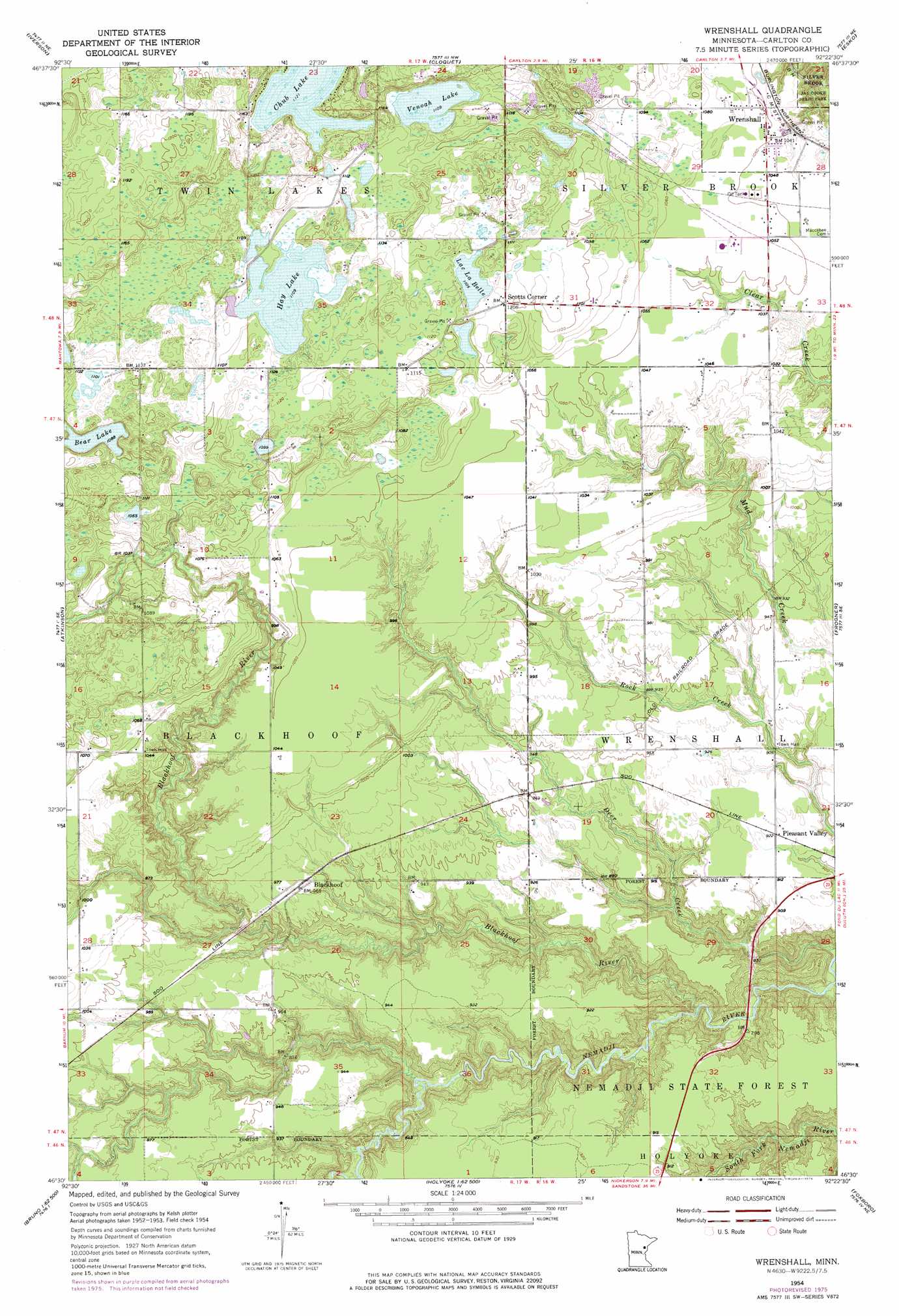
Wrenshall Topo Map Minnesota
To zoom in, hover over the map of Wrenshall
USGS Topo Quad 46092e4 - 1:24,000 scale
| Topo Map Name: | Wrenshall |
| USGS Topo Quad ID: | 46092e4 |
| Print Size: | ca. 21 1/4" wide x 27" high |
| Southeast Coordinates: | 46.5° N latitude / 92.375° W longitude |
| Map Center Coordinates: | 46.5625° N latitude / 92.4375° W longitude |
| U.S. State: | MN |
| Filename: | o46092e4.jpg |
| Download Map JPG Image: | Wrenshall topo map 1:24,000 scale |
| Map Type: | Topographic |
| Topo Series: | 7.5´ |
| Map Scale: | 1:24,000 |
| Source of Map Images: | United States Geological Survey (USGS) |
| Alternate Map Versions: |
Wrenshall MN 1954, updated 1955 Download PDF Buy paper map Wrenshall MN 1954, updated 1966 Download PDF Buy paper map Wrenshall MN 1954, updated 1974 Download PDF Buy paper map Wrenshall MN 1954, updated 1976 Download PDF Buy paper map Wrenshall MN 2010 Download PDF Buy paper map Wrenshall MN 2013 Download PDF Buy paper map Wrenshall MN 2016 Download PDF Buy paper map |
1:24,000 Topo Quads surrounding Wrenshall
Martin Lake |
Brookston |
Saginaw |
Adolph |
Duluth Heights |
Sawyer |
Iverson |
Cloquet |
Esko |
West Duluth |
Barnum |
Atkinson |
Wrenshall |
Frogner |
Borea |
Hanging Horn Lake |
Nickerson |
Holyoke |
Foxboro |
Patzau |
Bruno |
Kerrick |
Holyoke Sw |
Black Lake |
Moose Junction |
> Back to 46092e1 at 1:100,000 scale
> Back to 46092a1 at 1:250,000 scale
> Back to U.S. Topo Maps home
Wrenshall topo map: Gazetteer
Wrenshall: Dams
Moehrke SCS Dam elevation 303m 994′Walter Hackensmith Fishpond Dam elevation 272m 892′
Wrenshall: Lakes
Bear Lake elevation 332m 1089′Chub Lake elevation 342m 1122′
Hay Lake elevation 338m 1108′
Lac La Belle elevation 337m 1105′
Venoah Lake elevation 338m 1108′
Wrenshall: Populated Places
Bandle's Mobile Home Park elevation 315m 1033′Blackhoof elevation 295m 967′
Pioneer Park Mobile Home Park elevation 315m 1033′
Pleasant Valley elevation 280m 918′
Scotts Corner elevation 337m 1105′
Wrenshall elevation 317m 1040′
Wrenshall: Post Offices
Blackhoof Post Office (historical) elevation 295m 967′Wrenshall Post Office elevation 320m 1049′
Wrenshall: Reservoirs
Moehrke Pond elevation 303m 994′Wrenshall: Streams
Blackhoof River elevation 236m 774′Wrenshall digital topo map on disk
Buy this Wrenshall topo map showing relief, roads, GPS coordinates and other geographical features, as a high-resolution digital map file on DVD: